Azalea Creek Trail
- 0.5 mi
- round trip
- 186 ft
- climb
- 383 ft
- high point
- Out and back
- route
- Feb–May, Oct–Nov
- best months
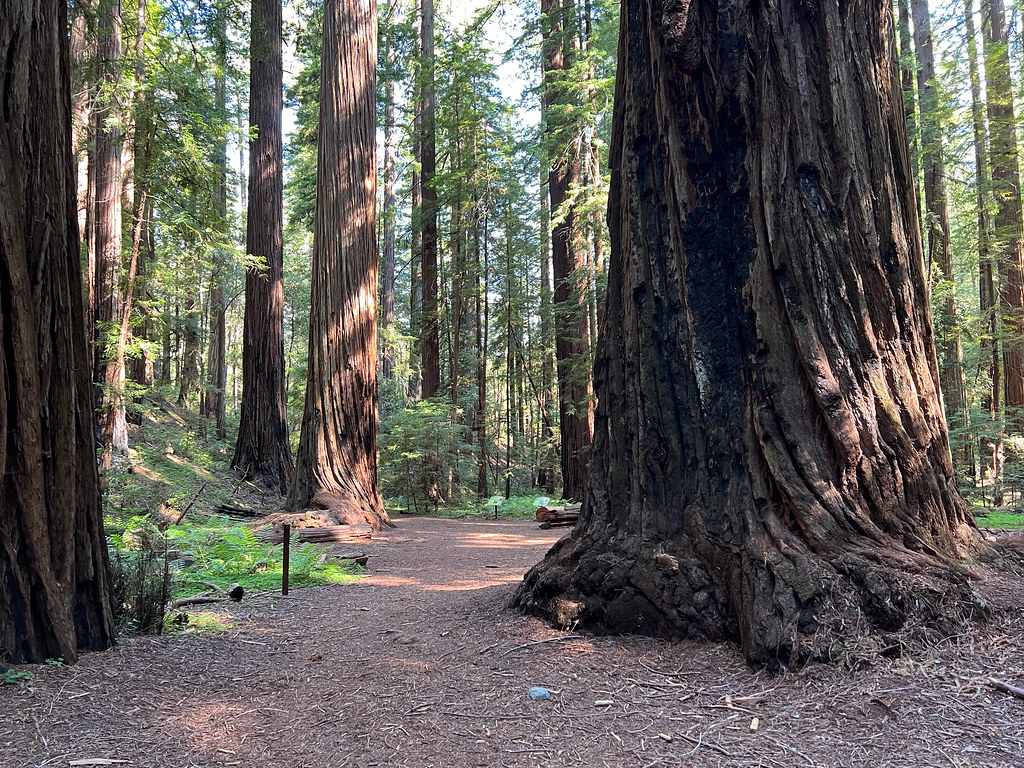
Azalea Creek Trail is a short, easy out-and-back hike in Hendy Woods State Park in California, managed by State Park and Recreation. The trail is about 0.45 miles long, and the round trip covers roughly 0.9 miles with a total elevation gain of 186 feet. The high point is about 383 feet, and the low point is about 293 feet, so the climb is gentle and the route is well suited to a quick stop. Spring and fall are the most comfortable times to go. Typical averages from a nearby weather station in Ukiah show April highs around 69°F and October highs around 79°F, while July and August average highs near 94°F. The trail is close to several other routes. Hermit Hut Trail is about 0.1 mile away, and Eagle Trail and Little Hendy Trail are each about 0.3 mile away. For time on the water, the Navarro River is about a mile off.
- Hermit Hut TrailHiking0.1 mi
- Eagle TrailHiking0.3 mi
- Little Hendy TrailHiking0.3 mi
- Meadow TrailHiking0.6 mi
 Navarro RiverCanoeingPhoto: Clinton Steeds from Los Angeles, USA, CC BY 2.0 (via Wikimedia Commons)1 mi
- Indian CreekCanoeing5.3 mi
- North Fork Indian CreekCanoeing6.7 mi
- Anderson CreekCanoeing7.8 mi
Source: Roamze catalog (indexable pages within 10 miles, PostGIS distance)
 Montgomery TrailHiking · ~20 min drivePhoto: daveynin, CC BY 2.0 (via Flickr)
 Trail 9 - Red Mountain (Blue/Blue/Green/Green)Hiking · ~35 min drivePhoto: blmcalifornia, Public domain (via Wikimedia Commons)
- Sheep TrailHiking · ~18 min drive
 Davis Wetlands TrailHiking · ~23 min drivePhoto: MarcNijdam, CC BY 2.0 (via Flickr)
- Valley View TrailHiking · ~35 min drive
- Trail 8 - Miners Ridge (Black/Black/Blue)Hiking · ~35 min drive
 Fern Canyon TrailHiking · ~33 min drivePhoto: Jason Sturner, CC BY 2.0 (via Wikimedia Commons)
- Big Tree TrailHiking · ~35 min drive
- Fern Canyon TrailHiking · ~33 min drivePhoto: Jason Sturner, CC BY 2.0 (via Wikimedia Commons)
- Trail 14 - Panther Ridge (Blue/Black)Hiking · ~36 min drive
Also worth it near here
Best time to visit Azalea Creek Trail
Best months: February–May and October–November. Best months have typical highs of 55–85 °F, lows of 30 °F or warmer (32 °F where the station doesn't record snow), at most one snowy day and no more than 12 wet days.
Jan
58° / 37°
14 wet
Feb
61° / 39°
11 wet
Mar
65° / 41°
12 wet
Apr
69° / 43°
8 wet
May
78° / 48°
4 wet
Jun
86° / 52°
2 wet
Jul
94° / 56°
1 wet
Aug
94° / 55°
0 wet
Sep
89° / 51°
2 wet
Oct
79° / 45°
6 wet
Nov
65° / 40°
11 wet
Dec
57° / 36°
15 wet
Typical high / low (°F) and days with rain or snow, 1991–2020. Measured at Ukiah Muni Ap, CA, 15.3 mi away at 601 ft. This station doesn't record snowfall. Source: NOAA NCEI U.S. Climate Normals 1991–2020.
Map and trail data © OpenStreetMap contributors
