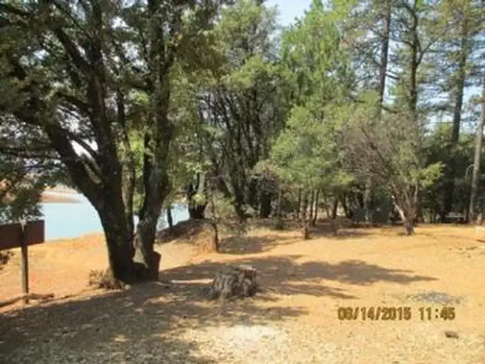
Hirz Bay
- Apr–May, Oct–Nov
- best months
Is Hirz Bay open right now?
Closure in the area
There's a closure order in Shasta-Trinity National Forest. It doesn't name Hirz Bay, so check the source for the area it covers (2 listed).
Mud and Ash Creek Area and Road Closure
Agency closure covering Shasta-Trinity National Forest · Order 14-26-13 · USFS · Shasta-Trinity National Forest
Road Closure on Wild Mad Road
Agency closure covering Shasta-Trinity National Forest · Order 14-25-09 · USFS · Shasta-Trinity National Forest
Trout Creek Bridge Closure Order
Agency alert covering Shasta-Trinity National Forest · Order 14-26-02 · USFS · Shasta-Trinity National Forest
South Fork Suspension Bridge Closure
Agency alert covering Shasta-Trinity National Forest · Order 14-25-30 · USFS · Shasta-Trinity National Forest
Ah-Di-Na Area Closure
Agency alert covering Shasta-Trinity National Forest · Order 14-25-10 · USFS · Shasta-Trinity National Forest
As of · Source: USFS · Shasta-Trinity National Forest. Agencies don't list every closure — check before you go.
Overview Hirz Bay Campground is nestled among Manzanita and oak trees on a hilltop overlooking the McCloud Arm of Shasta Lake. The scenic location offers a variety of recreational activities, including a nearby boat ramp for water sports and a hiking trail.Recreation The nearest boat launch is about 1 mile away at Hirz Bay. Resorts on the lake have watercraft rentals and marinas with fuel. Popular water activities include power and non-motorized boating, fishing and water skiing. Lake Shasta offers excellent fishing for trout, catfish, Chinook salmon, crappie, bluegill, white sturgeon, brown bullhead and bass. Hikers can access the 2-mile Hirz Bay Trail from the campground.Facilities Each campsite contains a paved parking spur, a table, a bear-proof food locker and one fire ring. This campground has a pay phone, drinking water, flush toilets and an overflow parking area.Natural Features Shasta-Trinity is the largest national forest in California with a diverse landscape encompassing five wilderness areas, hundreds of mountain lakes and 6,278 miles of streams and rivers. Lake Shasta sits at an elevation of 1,067 feet, with 365 miles of shoreline punctuated by steep mountains blanketed in manzanita and evergreens. A snow-capped Mount Shasta, the second-tallest mountain in the Cascade Range, looms in the distance. Nearby Attractions Lake Shasta Caverns are also located on the McCloud Arm of Shasta Lake in an area know as the Grey Rocks. Tours are given daily at this privately owned facility. The nearby Hirz Mountain Lookout offers panoramic views of Mt. Shasta, Mt. Lassen and the surrounding area at an elevation of 3,500 feet.
Local outfitters
- Headwaters Adventure Co21 mi away
Not on Roamze yet. Their page has how to reach them.
- Hirz Bay Group 2Camping0.1 mi
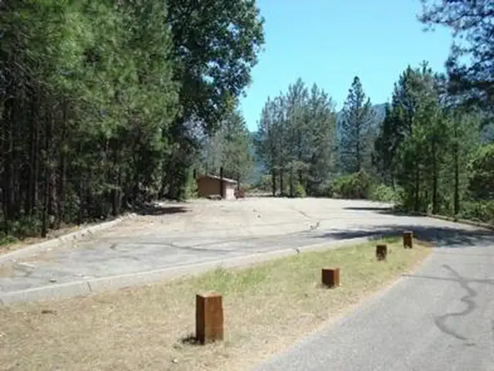 Hirz Bay Group 1CampingPhoto: Recreation.gov (RIDB) / public domain0.1 mi
- Hirz Bay (#1) Cg-GCamping0.1 mi
- DekkasHiking1.9 mi
- Top of the Hill TrailHiking2.7 mi
- Samwell CaveHiking3.9 mi
- Nosoni CreekCanoeing5 mi
- Shasta Lake AreaLake fishing5.5 mi
Source: Roamze catalog (indexable pages within 10 miles, PostGIS distance)
- Dekkas RockSaltwater fishing · ~2 min drive
- Grouse LakeLake fishing · ~35 min drive
- McCloud Area RecreationRiver fishing · ~1h 4m drive
- Pit River CampgroundPier fishing · ~1h 8m drive
- Peltier Bridge Primitive CampgroundSaltwater fishing · ~43 min drive
- Blue LakeLake fishing · ~43 min drive
- Sheep Camp Primitive CampgroundSaltwater fishing · ~44 min drive
- Mt. Shasta AreaLake fishing · ~45 min drive
- Minersville CampgroundSaltwater fishing · ~50 min drive
- Trinity Unit - National Recreation AreaLake fishing · ~48 min drive
Best time to visit Hirz Bay
Best months: April–May and October–November. Best months have typical highs of 55–85 °F, lows of 30 °F or warmer (32 °F where the station doesn't record snow), at most one snowy day and no more than 12 wet days.
Jan
55° / 40°
14 wet
Feb
59° / 42°
13 wet
Mar
63° / 44°
13 wet
Apr
70° / 48°
10 wet
May
79° / 55°
8 wet
Jun
88° / 63°
3 wet
Jul
97° / 69°
1 wet
Aug
96° / 68°
1 wet
Sep
90° / 63°
2 wet
Oct
78° / 55°
5 wet
Nov
62° / 46°
10 wet
Dec
54° / 41°
13 wet
Typical high / low (°F) and days with rain or snow, 1991–2020. Measured at Shasta Dam, CA, 13.6 mi away at 1,075 ft. This station doesn't record snowfall. Source: NOAA NCEI U.S. Climate Normals 1991–2020.