Mt. Pacifico
Campground
Campground · < 0.1 mi from the trail
Alert in the area
The Forest Service lists 7 alerts for Angeles National Forest.
Rincon-Redbox Road (2N24) Closure
Agency alert covering Angeles National Forest · Order 05-01-26-13 · USFS · Angeles National Forest
Fire Danger Level Elevated to "Very High"
Agency alert covering Angeles National Forest · USFS · Angeles National Forest
San Gabriel Canyon OHV Area Prohibitions
Agency alert covering Angeles National Forest · Order 05-01-26-09 · USFS · Angeles National Forest
San Dimas Experimental Forest Closure
Agency alert covering Angeles National Forest · USFS · Angeles National Forest
Eaton Fire Area Closure
Agency alert covering Angeles National Forest · Order 05-01-26-04 · USFS · Angeles National Forest
As of · Source: USFS · Angeles National Forest. Agencies don't list every closure — check before you go.
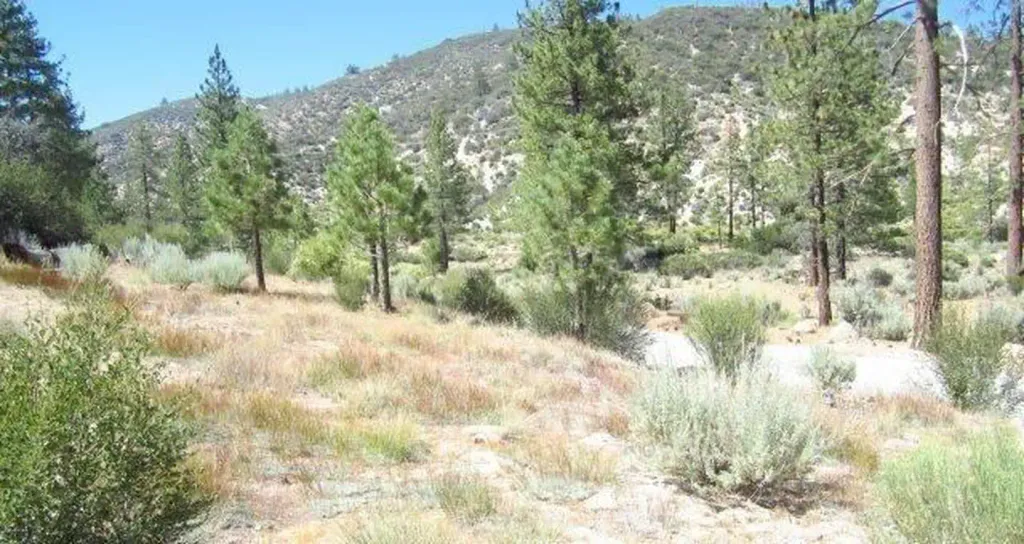
Mt. Pacifico Campground sits at about 7,100 feet on the western edge of the San Gabriel Mountains National Monument, within the San Gabriel Mountains National Monument Ranger District of Angeles National Forest. The Forest Service manages the land, and the site is accessed by driving the 3N17 FS road from the Mill Creek Summit side. That road and the access road to the campground are open to both street-legal and off-highway vehicles, while the 3N90, or Roundtop Road, is street-legal only. The campground is a first-come, first-served site with 10 tent-only sites. Vault toilets are the only facility. Vehicles parked here need an Interagency Pass or Adventure Pass. It is not RV accessible, and the Pacific Crest Trail passes about half a mile north downslope. Spring and fall are the most comfortable times to visit. Typical averages from a nearby weather station at Mt. Wilson, which sits roughly 1,400 feet lower, show May highs around 70°F and October highs around 72°F, with only a few wet days in each month. Summer runs hotter, with July and August highs in the mid-80s. Nearby, the Top Rope Wall climbing area is about 2.6 miles away, and the Monte Cristo Trail is about 2.8 miles off. Bandido Group Campground and the Mt. Hillyer hike are each about 3.1 miles away.
Mt. Pacifico
Campground
Familia Barrios Taco Grill
Restaurant
 If it rainsThomas Ormston from Darmstadt, Germany, CC BY 2.0 · Wikimedia Commons
Aviation museum in Palmdale, California, United States
Places © OpenStreetMap contributors · Photos: Thomas Ormston from Darmstadt, Germany, CC BY 2.0 (commons)
More in Acton Mt. HillyerHikingPhoto: stevelyon, CC BY-SA 2.0 (via Flickr)3.1 mi
 Meadow Group CampgroundCampingPhoto: Recreation.gov (RIDB) / public domain4.1 mi
Source: Roamze catalog (indexable pages within 10 miles, PostGIS distance)
Also worth it near here
Mt. HillyerHiking · ~5 min drivePhoto: stevelyon, CC BY-SA 2.0 (via Flickr) Strawberry PeakSummit · ~14 min drivePhoto: Justin, CC BY-SA 2.0 (via Wikimedia Commons)
 PCT Dawson SaddleMountain biking · ~14 min drivePhoto: Ian D. Keating, CC BY 2.0 (via Wikimedia Commons)
 Stream WallRock climbing · ~15 min drivePhoto: RuggyBearLA, CC BY 2.0 (via Flickr)
Best months: Year-round. Best months have typical highs of 55–85 °F, lows of 30 °F or warmer (32 °F where the station doesn't record snow), at most one snowy day and no more than 12 wet days.
Jan
56° / 38°
7 wet
Feb
55° / 37°
8 wet
Mar
59° / 39°
7 wet
Apr
63° / 42°
4 wet
May
70° / 48°
3 wet
Jun
79° / 58°
1 wet
Jul
84° / 64°
1 wet
Aug
85° / 64°
1 wet
Sep
81° / 59°
1 wet
Oct
72° / 51°
3 wet
Nov
63° / 43°
4 wet
Dec
55° / 37°
7 wet
Typical high / low (°F) and days with rain or snow, 1991–2020. Measured at Mt Wilson Cbs, CA, 10.7 mi away at 5,710 ft. The station sits about 1,400 ft lower than this place, so expect it a little cooler here. This station doesn't record snowfall. Source: NOAA NCEI U.S. Climate Normals 1991–2020.
