Horse Flats
Campground
Campground · < 0.1 mi from the trail
Alert in the area
The Forest Service lists 7 alerts for Angeles National Forest.
Rincon-Redbox Road (2N24) Closure
Agency alert covering Angeles National Forest · Order 05-01-26-13 · USFS · Angeles National Forest
Fire Danger Level Elevated to "Very High"
Agency alert covering Angeles National Forest · USFS · Angeles National Forest
San Gabriel Canyon OHV Area Prohibitions
Agency alert covering Angeles National Forest · Order 05-01-26-09 · USFS · Angeles National Forest
San Dimas Experimental Forest Closure
Agency alert covering Angeles National Forest · USFS · Angeles National Forest
Eaton Fire Area Closure
Agency alert covering Angeles National Forest · Order 05-01-26-04 · USFS · Angeles National Forest
As of · Source: USFS · Angeles National Forest. Agencies don't list every closure — check before you go.
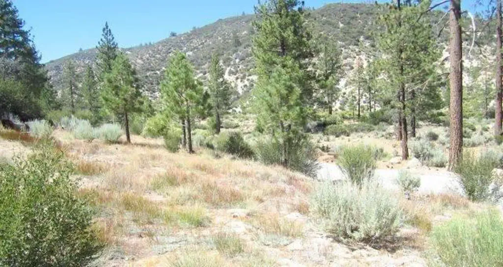
Elevation:5600-Foot ElevationAmenities:26Campsites- Picnic tables and campfire rings, vault toilets, no piped water available. Bouldering: Rock climbing is a 1-mile hike to the top of MT. Hillyer. Hiking: The Silver Moccasin Trail is just a short walk away located at the southwest side of the campground. Horse Corrals: There are (4) horse corrals and several hitching posts located at the west side of the campground. Fees: Camping - $12 per night per site, $5 for extra vehicle. Campsites are first come-first served. No reserving of campsites allowed. Day use -Same as the camping fee. Adventure Pass required for vehicles parked outside the campground RV 's: Maximum RV length is 20feet - no hookups Horse Flats Campground offers 26 campsites with plentiful shade options at a lofty 5000-foot elevation. It also has accessible hiking opportunities such as the Silver Moccasin National Recreation Trail, some excellent areas for mountain bikers, and, as the name implies, equestrian resources that include four corrals and several more hitching posts.
Horse Flats
Campground
 If it rainsBoothsift, CC BY-SA 4.0 · Wikimedia Commons
Places © OpenStreetMap contributors · Photos: Boothsift, CC BY-SA 4.0 (commons)
More in Acton Mt. HillyerHikingPhoto: stevelyon, CC BY-SA 2.0 (via Flickr)0.1 mi
 CreeksideHikingPhoto: feverblue, CC BY-SA 2.0 (via Flickr)1.1 mi
 Meadow Group CampgroundCampingPhoto: Recreation.gov (RIDB) / public domain1.4 mi
 West Fork San Gabriel RiverCanoeingPhoto: Eeekster, CC BY 3.0 (via Wikimedia Commons)7.3 mi
Source: Roamze catalog (indexable pages within 10 miles, PostGIS distance)
Also worth it near here
Mt. HillyerHiking · Next doorPhoto: stevelyon, CC BY-SA 2.0 (via Flickr) PCT Dawson SaddleMountain biking · ~12 min drivePhoto: Ian D. Keating, CC BY 2.0 (via Wikimedia Commons)West Fork San Gabriel RiverCanoeing · ~12 min drivePhoto: Eeekster, CC BY 3.0 (via Wikimedia Commons)
 Strawberry PeakSummit · ~13 min drivePhoto: Justin, CC BY-SA 2.0 (via Wikimedia Commons)
Best months: Year-round. Best months have typical highs of 55–85 °F, lows of 30 °F or warmer (32 °F where the station doesn't record snow), at most one snowy day and no more than 12 wet days.
Jan
56° / 38°
7 wet
Feb
55° / 37°
8 wet
Mar
59° / 39°
7 wet
Apr
63° / 42°
4 wet
May
70° / 48°
3 wet
Jun
79° / 58°
1 wet
Jul
84° / 64°
1 wet
Aug
85° / 64°
1 wet
Sep
81° / 59°
1 wet
Oct
72° / 51°
3 wet
Nov
63° / 43°
4 wet
Dec
55° / 37°
7 wet
Typical high / low (°F) and days with rain or snow, 1991–2020. Measured at Mt Wilson Cbs, CA, 8.5 mi away at 5,710 ft. This station doesn't record snowfall. Source: NOAA NCEI U.S. Climate Normals 1991–2020.
