Ellery Cg
Campground
Campground · < 0.1 mi from the trail
Alert in the area
The Forest Service lists 3 alerts for Inyo National Forest.
Help Halt Golden Mussel Invasion
Agency alert covering Inyo National Forest · USFS · Inyo National Forest
Ansel Adams and John Muir Wilderness Campfire Restrictions
Agency alert covering Inyo National Forest · Order 05-04-50-25-04 · USFS · Inyo National Forest
Golden Trout and Hoover Wilderness Campfire Restrictions
Agency alert covering Inyo National Forest · Order 05-04-50-25-05 · USFS · Inyo National Forest
As of · Source: USFS · Inyo National Forest. Agencies don't list every closure — check before you go.
Ellery Campground sits at 9,500 feet on the east side of Tioga Pass, the east entrance to Yosemite National Park, within the Mono Lake Ranger District of Inyo National Forest. The Forest Service manages the land, and the campground is set at Ellery Lake, about 14 miles from the park's west side. The site has 12 campsites, and some can accommodate vehicles up to 28 feet. Many sites don't have room for a second vehicle. Each campsite has a locker for food storage, and the 14-day stay limit applies. This is bear country, so food must be stored properly and bears must not be fed. Summer is the most comfortable time to visit. Typical averages from a nearby weather station at Tuolumne Meadows show July highs around 71°F with lows near 38°F, while winter highs stay in the low 40s. The Bennetville Loop Trail and Junction Campground are both about 0.4 miles away, and the Nunatak Tioga Tarns Trail is about 0.5 miles off. Climbers can find the Girls On Fire - Panderer Cliff Area about 0.7 miles away.
Ellery Cg
Campground
Epic Cafe
Restaurant
 If it rainsEeekster, CC BY 3.0 · Wikimedia Commons
Sierra Point
Viewpoint
Point in Yosemite National Park at the eastern end of the valley
Places © OpenStreetMap contributors · Photos: Eeekster, CC BY 3.0 (commons)
More in Yosemite ValleyNot on Roamze yet. Their page has how to reach them.
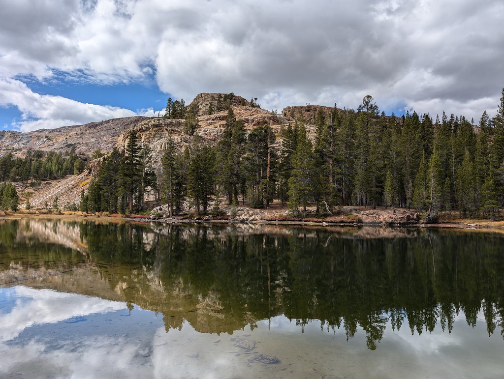 Bennetville Loop TrailHikingPhoto: RuggyBearLA, CC BY 2.0 (via Flickr)0.4 mi
 Nunatak Tioga Tarns TrailHikingPhoto: RuggyBearLA, CC BY 2.0 (via Flickr)0.5 mi
 Girls On Fire - Panderer Cliff AreaRock climbingPhoto: Lukáš Lalinský, CC BY-SA 2.0 (via Flickr)0.7 mi
 Ellery Dam Spillway CragRock climbingPhoto: Seth Tisue, CC BY-SA 2.0 (via Flickr)0.9 miDemonology Cliff BandRock climbingPhoto: Seth Tisue, CC BY-SA 2.0 (via Flickr)0.9 mi
 Tioga Lake CgCampingPhoto: waterarchives — CC BY-SA 2.0 (via Flickr)0.9 mi
 Rush CreekCanoeingPhoto: Greg Reis, CC BY-SA 3.0 (via Wikimedia Commons)9.5 mi
Source: Roamze catalog (indexable pages within 10 miles, PostGIS distance)
Tioga Lake CgCamping · ~2 min drivePhoto: waterarchives — CC BY-SA 2.0 (via Flickr) Trailhead Group Campground (AT SADDLEBAG LAKE)Camping · ~4 min drivePhoto: Chris Mayer — CC BY 2.0 (via Flickr)
 Glen Aulin High Sierra CampCamping · ~17 min drivePhoto: Lela Getzler, CC BY 2.0 (via Wikimedia Commons)
 Vogelsang High Sierra CampCamping · ~19 min drivePhoto: Diarrhea, CC BY 3.0 (via Wikimedia Commons)
 Silver Lake CampgroundCamping · ~21 min drivePhoto: docentjoyce — CC BY 2.0 (via Flickr)
Also worth it near here
Bennetville Loop TrailHiking · Next doorPhoto: RuggyBearLA, CC BY 2.0 (via Flickr)Girls On Fire - Panderer Cliff AreaRock climbing · ~1 min drivePhoto: Lukáš Lalinský, CC BY-SA 2.0 (via Flickr) Tioga PeakSummit · ~1 min drivePhoto: C N, CC BY-SA 2.0 (via Wikimedia Commons)
Best months: June–September. Best months have typical highs of 55–85 °F, lows of 30 °F or warmer (32 °F where the station doesn't record snow), at most one snowy day and no more than 12 wet days.
Jan
41° / 13°
Feb
38° / 12°
Mar
42° / 15°
Apr
45° / 22°
May
54° / 27°
Jun
65° / 33°
Jul
71° / 38°
Aug
70° / 36°
Sep
65° / 32°
Oct
57° / 26°
Nov
47° / 20°
Dec
40° / 12°
Typical high / low (°F) and days with rain or snow, 1991–2020. Measured at Tuolumne Meadows Rs, CA, 6.9 mi away at 8,694 ft. The station sits about 800 ft lower than this place, so expect it a little cooler here. This station doesn't record snowfall. Source: NOAA NCEI U.S. Climate Normals 1991–2020.
