Crystal Springs Campground
Campground
Campground · < 0.1 mi from the trail
Closure in the area
There's a closure order in Humboldt-Toiyabe National Forest. It doesn't name Crystal Springs Campground, so check the source for the area it covers.
Elephant Fire Closure
Agency closure covering Humboldt-Toiyabe National Forest · Order 04-17-26-01-04 · USFS · Humboldt-Toiyabe National Forest
Floriston Fire Closure
Agency alert covering Carson Ranger District · Order 17-26-24 · USFS · Carson Ranger District
Power line construction along SR 88, Alpine County, California (Carson Ranger District)
Agency alert covering Carson Ranger District · USFS · Carson Ranger District
Over-Snow Vehicle Closure (Carson Ranger District)
Agency alert covering Carson Ranger District · Order 04-17-25-12 · USFS · Carson Ranger District
Area, Road, and Trail Closures (Spring Mountains National Recreation Area)
Agency alert covering Humboldt-Toiyabe National Forest · Order 04-17-25-04 · USFS · Humboldt-Toiyabe National Forest
As of · Source: USFS · Humboldt-Toiyabe National Forest. Agencies don't list every closure — check before you go.
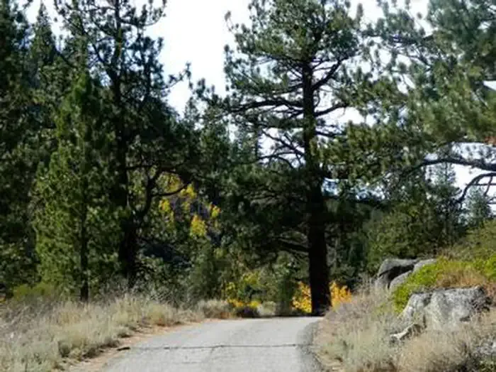
Crystal Springs Campground is a Forest Service campground in California's Humboldt-Toiyabe National Forest, within the Carson Ranger District. It is managed by the Forest Service and sits among several climbing areas and short trails, making it a base for both camping and rock. Vault toilets are the only amenities on site. A fee is charged for visits. Summer is the most comfortable time to go. Typical July and August highs run around 80°F with lows in the low 40s, and those months see only about two wet days each, according to averages from a nearby weather station at South Lake Tahoe. Winters are cold, with typical January highs near 43°F and lows around 18°F. Crystal Springs Canyon and The Steeple, both climbing areas, and the 4-Second Climbing Trail lie within about a quarter mile. Kit Carson Campground is roughly 2.8 miles away.
Crystal Springs Campground
Campground
Alpine County Museum
Museum
Places © OpenStreetMap contributors, Places © Overture Maps Foundation
More in Bear Valley 4-Second Climbing TrailHikingPhoto: simonov, CC BY-SA 2.0 (via Flickr)0.2 mi
 HorsethiefHikingPhoto: UncleVinny, CC BY 3.0 (via Wikimedia Commons)2.3 mi
 Kit Carson CampgroundCampingPhoto: Recreation.gov (RIDB) / public domain2.8 mi
 West Fork Carson RiverCanoeingPhoto: Skooiman at English Wikipedia, Public domain (via Wikimedia Commons)3.3 mi
Source: Roamze catalog (indexable pages within 10 miles, PostGIS distance)
Also worth it near here
4-Second Climbing TrailHiking · Next doorPhoto: simonov, CC BY-SA 2.0 (via Flickr) MuralsRock climbing · ~3 min drivePhoto: Ken Lund, CC BY-SA 2.0 (via Flickr)West Fork Carson RiverCanoeing · ~6 min drivePhoto: Skooiman at English Wikipedia, Public domain (via Wikimedia Commons)
Best months: May–September. Best months have typical highs of 55–85 °F, lows of 30 °F or warmer (32 °F where the station doesn't record snow), at most one snowy day and no more than 12 wet days.
Jan
43° / 18°
9 wet
Feb
43° / 19°
9 wet
Mar
48° / 24°
10 wet
Apr
53° / 28°
8 wet
May
62° / 33°
7 wet
Jun
72° / 38°
3 wet
Jul
80° / 43°
2 wet
Aug
80° / 41°
2 wet
Sep
73° / 35°
3 wet
Oct
62° / 29°
5 wet
Nov
51° / 23°
7 wet
Dec
43° / 18°
10 wet
Typical high / low (°F) and days with rain or snow, 1991–2020. Measured at South Lake Tahoe Ap, CA, 12.3 mi away at 6,314 ft. This station doesn't record snowfall. Source: NOAA NCEI U.S. Climate Normals 1991–2020.
