Bailey Cove Cg-F
- from $28
- fee
- Apr–May, Oct–Nov
- best months
Is Bailey Cove Cg-F open right now?
Closure in the area
There's a closure order in Shasta-Trinity National Forest. It doesn't name Bailey Cove Cg-F, so check the source for the area it covers (2 listed).
Mud and Ash Creek Area and Road Closure
Agency closure covering Shasta-Trinity National Forest · Order 14-26-13 · USFS · Shasta-Trinity National Forest
Road Closure on Wild Mad Road
Agency closure covering Shasta-Trinity National Forest · Order 14-25-09 · USFS · Shasta-Trinity National Forest
Bailey Cove Road Closure Order
Agency alert covering Shasta-Trinity National Forest · Order 14-25-11 · USFS · Shasta-Trinity National Forest
Trout Creek Bridge Closure Order
Agency alert covering Shasta-Trinity National Forest · Order 14-26-02 · USFS · Shasta-Trinity National Forest
South Fork Suspension Bridge Closure
Agency alert covering Shasta-Trinity National Forest · Order 14-25-30 · USFS · Shasta-Trinity National Forest
As of · Source: USFS · Shasta-Trinity National Forest. Agencies don't list every closure — check before you go.
- At 1,100 ft
- Shasta Lake Ranger DistrictShasta-Trinity National Forest
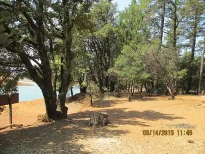
Bailey Cove Campground is a Forest Service campground in the Shasta Lake Ranger District of Shasta-Trinity National Forest in California. It sits within the national forest's boundaries, and the nearest town is Shasta Dam, about 8 miles away. The site has flush toilets, and a fee is charged for stays. The most comfortable months for a visit are typically May and October, when typical averages from the nearby Shasta Dam weather station run from highs around 79°F with lows near 55°F in May to highs around 78°F with lows near 55°F in October. July and August are the hottest, with typical highs in the mid-90s. Waters Gulch Trail and Overlook Trail are both within about 2 miles. Bailey Cove campground is about 2 miles away, and Nelson Point campground is about 3.6 miles away.
 Waters Gulch TrailHikingPhoto: AB87, CC BY 3.0 (via Wikimedia Commons)1.5 mi
- Overlook TrailHikingPhoto: AB87, CC BY 3.0 (via Wikimedia Commons)1.7 mi
- Bailey CoveCamping2 mi
- Nelson PointCamping3.6 mi
- Hirz BaySaltwater fishing5.7 mi
 Dekkas RockSaltwater fishingPhoto: Recreation.gov (RIDB) / public domain6.7 mi
- Creek SlabRock climbing8.8 mi
- Mary Fork BouldersRock climbing8.8 mi
Source: Roamze catalog (indexable pages within 10 miles, PostGIS distance)
- Hirz BayCamping · ~10 min drive
- Hirz Bay Cabin RentalHut camping · ~10 min drive
- Hirz Bay Group 1Camping · ~10 min drive
- Holiday Harbor RV CampgroundCamping · Next door
- ObrienCamping · ~1 min drive
- Lower Salt Creek Shoreline CampgroundCamping · ~6 min drive
- Upper Salt Creek Cg-G_ClosedCamping · ~6 min drive
- Nelson PointCamping · ~6 min drive
- Greens Creek CampgroundCamping · ~6 min drive
- Nelson Point Cg-FCamping · ~6 min drive
Best time to visit Bailey Cove Cg-F
Best months: April–May and October–November. Best months have typical highs of 55–85 °F, lows of 30 °F or warmer (32 °F where the station doesn't record snow), at most one snowy day and no more than 12 wet days.
Jan
55° / 40°
14 wet
Feb
59° / 42°
13 wet
Mar
63° / 44°
13 wet
Apr
70° / 48°
10 wet
May
79° / 55°
8 wet
Jun
88° / 63°
3 wet
Jul
97° / 69°
1 wet
Aug
96° / 68°
1 wet
Sep
90° / 63°
2 wet
Oct
78° / 55°
5 wet
Nov
62° / 46°
10 wet
Dec
54° / 41°
13 wet
Typical high / low (°F) and days with rain or snow, 1991–2020. Measured at Shasta Dam, CA, 7.8 mi away at 1,075 ft. This station doesn't record snowfall. Source: NOAA NCEI U.S. Climate Normals 1991–2020.
