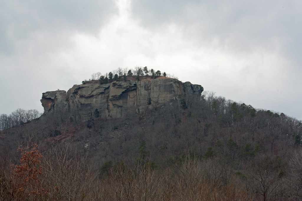
Bean Point
 Photo: Ken Lund from Reno, Nevada, USA, CC BY-SA 2.0 (via Wikimedia Commons)
- 705 ft
- summit
- Mar–May, Sep–Nov
- best months
Bean Point is a summit of 705 feet in the Greers Ferry Recreation Area in Arkansas, about 6.6 miles from the town of Quitman. It sits within the recreation area's network of climbing and paddling spots, and its elevation makes it a natural anchor for exploring the surrounding rock and water. Spring and fall are the most comfortable times to visit. Typical averages from the nearby Greers Ferry Dam weather station show October highs around 73°F with lows near 49°F, and April is similar at about 72°F by day and 47°F at night. July and August average highs of 91°F, and winter lows dip into the upper 20s. Climbers will find The Cellar about 1.7 miles away and SCR House and The Gasfields (Proper) each about 2.1 miles off. Paddlers can head to Cadron Creek, roughly 2.6 miles from the summit.
Conditions and forecast
Daily highs and lows, wind and the chance of precipitation at the summit for the next 7 days, from the Open-Meteo model.
- Summit elevation
- 705 ft
Elevation from USGS 3D Elevation Program terrain data (about 10 m resolution).
We don't know of a mapped trail or route to the summit of Bean Point. Plan the approach with local maps, a guidebook or a local guide, and check conditions before you go.
Questions about Bean Point
How tall is Bean Point?
705 ft (215 m).
Is there a trail to the top of Bean Point?
We don't know of a mapped trail or route to the summit. Plan the approach with local maps, a guidebook or a local guide.
- Kincannon Mountain1,543 ft · Arkansas2 routes36 mi away
- High Mountain1,488 ft · Arkansas1 route55 mi away
- Chinquapin Mountain1,204 ft · Arkansas1 route56 mi away
- Wahzhazhe Summit2,564 ft · Arkansas2 routes80 mi away
- North Mountain1,131 ft · Arkansas1 route82 mi away
- Hot Springs Mountain1,042 ft · Arkansas1 route83 mi away
- The CellarRock climbing1.7 mi
- SCR HouseRock climbing2.1 mi
- The Gasfields (Proper)Rock climbing2.1 mi
- Cadron CreekCanoeing2.6 mi
 Wildlife TrailHikingPhoto: kdwood2, CC BY-SA 2.0 (via Flickr)9.1 mi
- Clear CreekCanoeing9.4 mi
- Summit TrailHikingPhoto: kdwood2, CC BY-SA 2.0 (via Flickr)9.6 mi
 Tonawanda Base TrailHikingPhoto: kdwood2, CC BY-SA 2.0 (via Flickr)9.6 mi
Source: Roamze catalog (indexable pages within 10 miles, PostGIS distance)
Best time to visit Bean Point
Best months: March–May and September–November. Best months have typical highs of 55–85 °F, lows of 30 °F or warmer (32 °F where the station doesn't record snow), at most one snowy day and no more than 12 wet days.
Jan
48° / 28°
8 wet
Feb
54° / 31°
8 wet
Mar
62° / 38°
9 wet
Apr
72° / 47°
9 wet
May
79° / 57°
10 wet
Jun
87° / 66°
8 wet
Jul
91° / 69°
8 wet
Aug
91° / 68°
8 wet
Sep
84° / 61°
7 wet
Oct
73° / 49°
8 wet
Nov
61° / 39°
8 wet
Dec
51° / 31°
9 wet
Typical high / low (°F) and days with rain or snow, 1991–2020. Measured at Greers Ferry Dam, AR, 9.5 mi away at 527 ft. Source: NOAA NCEI U.S. Climate Normals 1991–2020.

