Hobbs State Park / Conservation Management Area
- State Park and Recreation
- managed by
- Mar–Jun, Sep–Nov
- best months
Clear today
Weather is good · OpenWeather · checked 10 h ago
Hobbs State Park / Conservation Management Area is a 12,157-acre state park in Arkansas, about 7 miles from the town of Prairie Creek. It is managed by the state park agency, and two trails run within its boundaries. Spring and fall are the most comfortable times to visit. Typical averages from a nearby weather station in Bentonville show October highs around 71°F with lows near 46°F, and April highs around 69°F. Midsummer highs typically reach the high 80s. Several trails start close by. The Hidden Diversity Multi-Use Trail is about 0.4 miles away, and the Pigeon Roost Trail - Dry Creek Loop is about 0.7 miles away. For an overnight stay, Rocky Branch Campground is about 3.7 miles away and Horseshoe Bend is about 4 miles away.
Park size
12,157 acres
Inside this park
- Hidden Diversity Multi-Use TrailHiking0.4 mi
 Pigeon Roost Trail - Dry Creek LoopHikingPhoto: Doug Wertman from Rogers, AR, USA, CC BY 2.0 (via Wikimedia Commons)0.7 mi
- Pigeon Roost TrailHikingPhoto: Doug Wertman from Rogers, AR, USA, CC BY 2.0 (via Wikimedia Commons)1.4 mi
 Rocky Branch CampgroundCampingPhoto: Recreation.gov (RIDB) / public domain3.7 mi
 Horseshoe BendCampingPhoto: Recreation.gov (RIDB) / public domain4 mi
 Hickory Creek Park (AR)CampingPhoto: Recreation.gov (RIDB) / public domain5.7 mi
 War Eagle CampgroundCampingPhoto: Recreation.gov (RIDB) / public domain5.8 mi
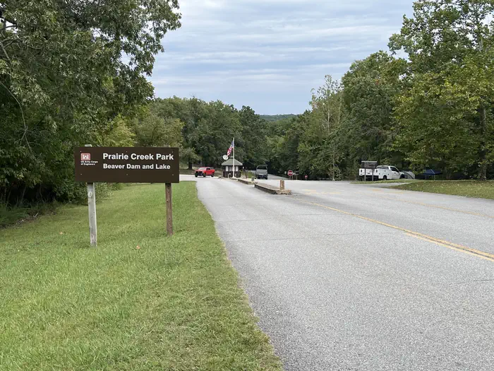 Prairie CreekRiver fishing7.6 mi
Source: Roamze catalog (indexable pages within 10 miles, PostGIS distance)
 Roaring River State ParkState park · ~38 min drivePhoto: dfellow, CC BY 2.0 (via Wikimedia Commons)
 Prairie Grove Battlefield State ParkState park · ~49 min drivePhoto: OzarkerRazorback, CC BY-SA 4.0 (via Wikimedia Commons)
 Big Sugar Creek State ParkState park · ~51 min drivePhoto: mostateparks, Public domain (via Wikimedia Commons)
 Devil's Den State ParkState park · ~1h 5m drivePhoto: jaystout, CC BY 2.0 (via Wikimedia Commons)
 Natural Falls State ParkState park · ~1h 10m drivePhoto: Doug Wertman from Rogers, AR, USA, CC BY 2.0 (via Wikimedia Commons)
 Table Rock State ParkState park · ~1h 11m drivePhoto: KTrimble, CC BY-SA 3.0 (via Wikimedia Commons)
- Withrow Springs State ParkState park · ~25 min drive
- Lake Fort Smith State ParkState park · ~1h 11m drive
Best time to visit Hobbs State Park / Conservation Management Area
Best months: March–June and September–November. Best months have typical highs of 55–85 °F, lows of 30 °F or warmer (32 °F where the station doesn't record snow), at most one snowy day and no more than 12 wet days.
Jan
46° / 24°
6 wet · 1 snow
Feb
51° / 27°
6 wet · 1 snow
Mar
60° / 36°
8 wet
Apr
69° / 44°
9 wet
May
77° / 54°
10 wet
Jun
85° / 63°
9 wet
Jul
89° / 66°
7 wet
Aug
90° / 65°
6 wet
Sep
82° / 57°
6 wet
Oct
71° / 46°
7 wet
Nov
59° / 36°
7 wet
Dec
49° / 27°
6 wet · 1 snow
Typical high / low (°F) and days with rain or snow, 1991–2020. Measured at Bentonville 4 S, AR, 15.2 mi away at 1,220 ft. We don't have this place's elevation, so higher spots nearby can run cooler. Source: NOAA NCEI U.S. Climate Normals 1991–2020.
