Thumb Butte
Campground
Campground · 0.4 mi from the trail
Closure in the area
There's a closure order in Prescott National Forest. It doesn't name Thumb Butte, so check the source for the area it covers (5 listed).
Prescott National Forest Pile Burning Planned Through October
Agency closure covering Prescott National Forest · USFS · Prescott National Forest
Prescott National Forest Pile Burning through August
Agency closure covering Prescott National Forest · USFS · Prescott National Forest
NFS Road 354 Closure Order #03-07-26-02
Agency closure covering Prescott National Forest · Order 03-07-26-02 · USFS · Prescott National Forest
Juniper Fire (BLM)
Agency closure covering Prescott National Forest · USFS · Prescott National Forest
Orchard Fire
Agency closure covering Prescott National Forest · USFS · Prescott National Forest
As of · Source: USFS · Prescott National Forest. Agencies don't list every closure — check before you go.
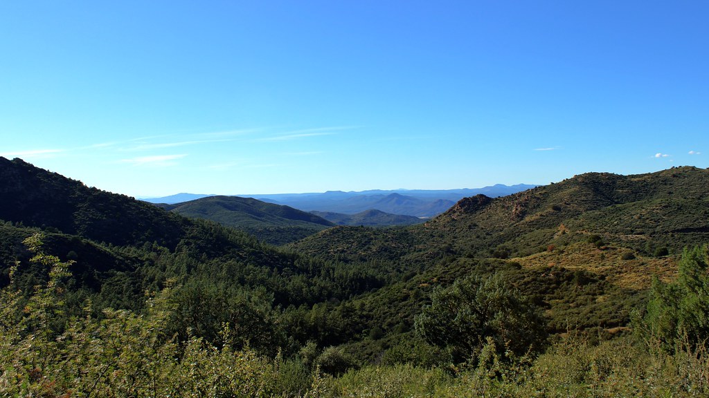
Thumb Butte is a climbing area in the Bradshaw Ranger District of Prescott National Forest in Arizona, managed by the Forest Service. It sits among a cluster of climbing spots, with the Mecca Area (Northeast Face) about 0.1 mile away and Outfrumunders about 0.2 mile away, so it works well as a base for exploring the surrounding crags. Spring and fall are the most comfortable times to visit. Typical averages from a nearby weather station in Prescott show May highs around 76°F and October highs around 73°F, while July and August average about 90°F with more wet days. The area has three routes, two of which are trad and one is bouldering. Hotdog in a Bun is a 5.7, and Dances on Air is a 5.10a, with a first ascent by Rusty Ballie and Greg Hill in 1991. The Thumb Butte Bypass hike starts about 0.3 mile away, and the Fdr 373-Thumb Butte Loop Designated Disp. campground is about 1.7 miles off.
Thumb Butte
Campground
Casa Sanchez
Restaurant
 If it rainsDoncram, CC BY-SA 3.0 · Wikimedia Commons
An open-air museum located in Prescott, Arizona
Places © OpenStreetMap contributors · Photos: Doncram, CC BY-SA 3.0 (commons)
More in PrescottBest months: March–May and September–October. Best months have typical highs of 55–85 °F, lows of 30 °F or warmer (32 °F where the station doesn't record snow), at most one snowy day and no more than 12 wet days.
Jan
53° / 24°
5 wet
Feb
55° / 26°
6 wet
Mar
61° / 32°
5 wet
Apr
68° / 37°
3 wet
May
76° / 45°
3 wet
Jun
87° / 54°
3 wet
Jul
90° / 61°
9 wet
Aug
87° / 60°
10 wet
Sep
82° / 52°
6 wet
Oct
73° / 40°
4 wet
Nov
62° / 30°
4 wet
Dec
52° / 24°
5 wet
Typical high / low (°F) and days with rain or snow, 1991–2020. Measured at Prescott, AZ, 5.2 mi away at 5,205 ft. The station sits about 1,100 ft lower than this place, so expect it a little cooler here. This station doesn't record snowfall. Source: NOAA NCEI U.S. Climate Normals 1991–2020.
 Photo: Alan Stark from Goodyear, AZ, United States, CC BY-SA 2.0 (via Wikimedia Commons)
Brush Monkey Boulders
~8 min drive
Brush Monkey Boulders in Arizona has 8 bouldering routes ranging from v3 to v10.
 Photo: Chris English, CC BY-SA 3.0 (via Wikimedia Commons)
Southeast Face
~8 min drive
Southeast Face in Arizona has 5 climbing routes with 5 distinct difficulty grades.
Photo: Chris English, CC BY-SA 3.0 (via Wikimedia Commons)Waves of Rock
~8 min drive
Waves of Rock in Arizona offers 5 climbing routes with mixed and traditional styles.
Photo: Chris English, CC BY-SA 3.0 (via Wikimedia Commons)Boulderland
~8 min drive
Boulderland in Arizona has 7 climbing routes across 4 grades, featuring top-rope and trad styles.
Photo: Chris English, CC BY-SA 3.0 (via Wikimedia Commons)Granite Basin Crags
~9 min drive
11 routes at Granite Basin Crags in Arizona range across 9 grades and include sport and trad climbing.
Photo: Chris English, CC BY-SA 3.0 (via Wikimedia Commons)Granite Mountain
~10 min drive
Granite Mountain in Arizona has 8 trad climbing routes.
Photo: Chris English, CC BY-SA 3.0 (via Wikimedia Commons)Right Section
~11 min drive
Right Section in Arizona has 25 routes across 19 grades, offering bouldering, sport, and trad climbing.
 Photo: Sean Foster, CC BY 3.0 (via Wikimedia Commons)
Pavilion Wall
~11 min drive
Pavilion Wall in Arizona has 10 trad climbing routes across 8 difficulty grades.
Photo: Sean Foster, CC BY 3.0 (via Wikimedia Commons)Thor's Chasm
~11 min drive
Thor's Chasm in Arizona has 9 climbing routes across 6 grades.
Photo: Sean Foster, CC BY 3.0 (via Wikimedia Commons)West Shore
~11 min drive
West Shore in Arizona has 2 trad climbing routes.