Explorer Trail
- 0.4 mi
- round trip
- 179 ft
- climb
- Singletrack
- surface
- Out and back
- route
- Nov–Apr
- best months
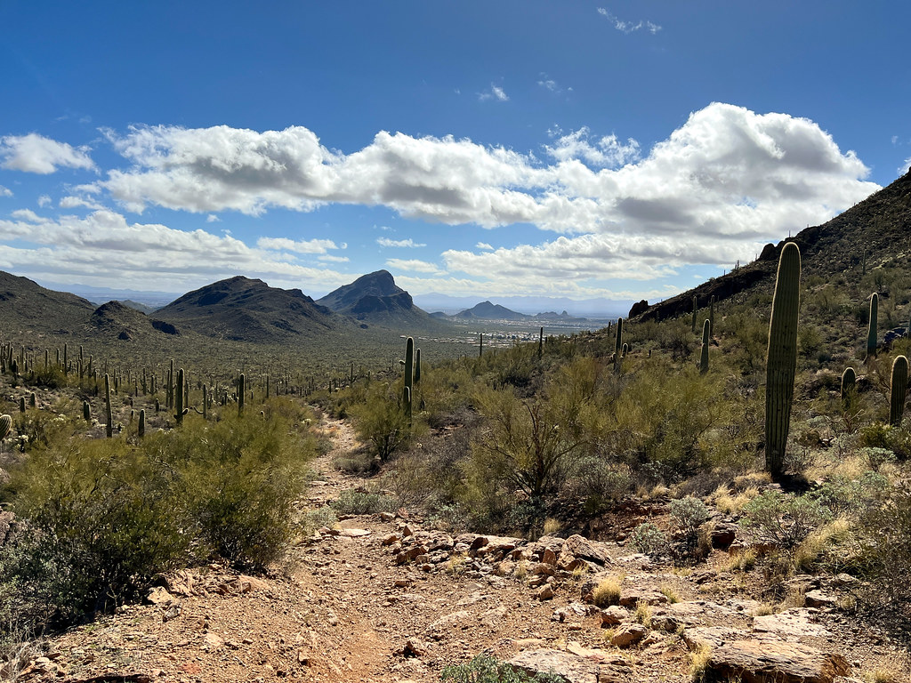
Explorer Trail is a short out-and-back mountain biking route in Tucson Mountain Park, on county land in Arizona. The trail is about 0.4 miles long and rises about 150 feet from its starting point at roughly 2,756 feet to a high of about 2,921 feet, with the steepest stretch near the start at about 15 percent grade. Spring and fall are the most comfortable times to ride. Typical averages from a nearby weather station run from highs around 75°F in March to about 86°F in October. Summer highs there reach 100°F in June, and the station sits a few hundred feet lower than the trail's high point, so expect it to run a little cooler up top. The Starr Pass Cutoff, a mountain biking route, lies about 0.2 miles away, and the Starr Pass Trail hike is about 0.3 miles off. Rock Wren Trail and Little Cat Tral, both mountain biking routes, are each about 0.7 miles away.
Local outfitters
- Caballo Loco Ranch & RV Park24 mi away
Not on Roamze yet. Their page has how to reach them.
- Starr Pass CutoffMountain biking0.2 mi
- Starr Pass TrailHiking0.3 mi
- Sarasota TrailHiking0.6 mi
- Rock Wren TrailMountain biking0.7 mi
- Little Cat TralMountain biking0.7 mi
 The "Gimme Some" DomeRock climbingPhoto: «Gaurav», CC BY-SA 2.0 (via Flickr)2.5 mi
- Tucson MountainsRock climbing2.6 mi
 Gate's PassRock climbingPhoto: Daniel Ramirez from Honolulu, USA, CC BY 2.0 (via Wikimedia Commons)2.6 mi
Source: Roamze catalog (indexable pages within 10 miles, PostGIS distance)
- Starr Pass CutoffMountain biking · Next door
- Explorer TrailMountain biking · Next door
- Rock Wren TrailMountain biking · ~1 min drive
- Starr Pass TrailMountain biking · Next door
- Little Cat TralMountain biking · ~1 min drive
- Rift TrailMountain biking · ~4 min drive
- Explorer TrailMountain biking · Next door
- Golden Gate TrailMountain biking · ~5 min drive
- El Grupo LoopMountain biking · ~4 min drive
- Starr Pass TrailMountain biking · ~2 min drive
Also worth it near here
Best time to visit Explorer Trail
Best months: November–April. Best months have typical highs of 55–85 °F, lows of 30 °F or warmer (32 °F where the station doesn't record snow), at most one snowy day and no more than 12 wet days.
Jan
66° / 41°
6 wet
Feb
68° / 42°
5 wet
Mar
75° / 47°
4 wet
Apr
82° / 52°
3 wet
May
91° / 60°
1 wet
Jun
100° / 70°
2 wet
Jul
99° / 75°
10 wet
Aug
98° / 73°
10 wet
Sep
94° / 69°
6 wet
Oct
86° / 58°
4 wet
Nov
74° / 48°
3 wet
Dec
65° / 40°
6 wet
Typical high / low (°F) and days with rain or snow, 1991–2020. Measured at Tucson 11 W, AZ, 6.4 mi away at 2,733 ft. This station doesn't record snowfall. Source: NOAA NCEI U.S. Climate Normals 1991–2020.

Map and trail data © OpenStreetMap contributors
