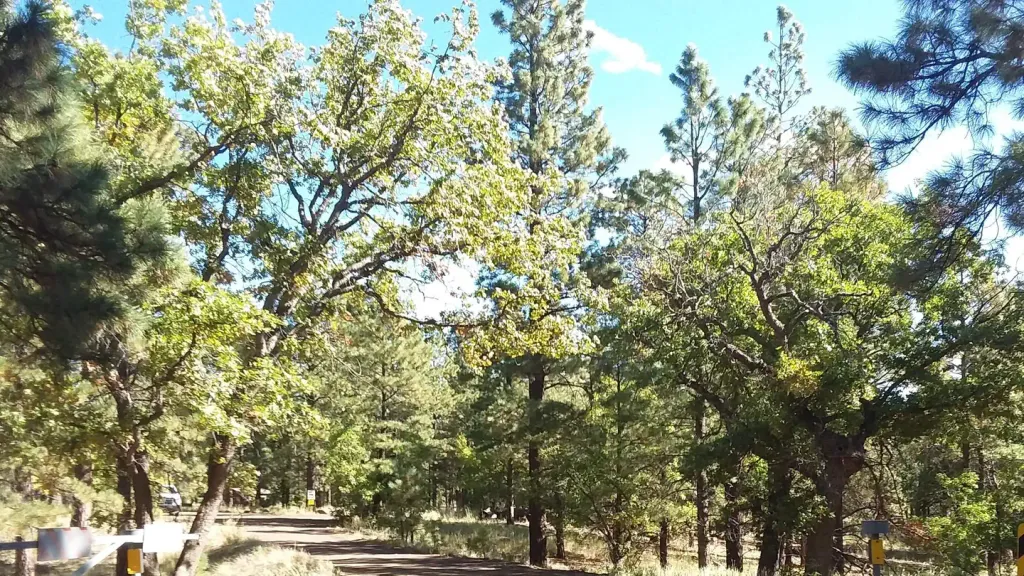
Lockett Meadow Campground
Campground
Campground · 3.3 mi from the trail
 Photo: Patty Ringle; Coconino National Forest, CC BY-SA 2.0 (via Wikimedia Commons)
Alert in the area
The Forest Service lists 5 alerts for Coconino National Forest.
West Fork Temporary Area Closure - Extension to 2/27/27
Agency alert covering Coconino National Forest · Order 03-04-00-26-09 · USFS · Coconino National Forest
Temporary Closure for West Wing Pile Burn
Agency alert covering Flagstaff Ranger District · Order 03-04-08-26-08 · USFS · Flagstaff Ranger District
Newman Park Pile Burn
Agency alert covering Flagstaff Ranger District · USFS · Flagstaff Ranger District
Kachina Village and Pumphouse Wash Camping and Campfire Restrictions
Agency alert covering Flagstaff Ranger District · Order 03-04-08-25-02 · USFS · Flagstaff Ranger District
Flagstaff-area camping and campfire restrictions in effect year-round
Agency alert covering Flagstaff Ranger District · Order 03-04-08-25-01 · USFS · Flagstaff Ranger District
As of · Source: USFS · Coconino National Forest. Agencies don't list every closure — check before you go.
Inner Basin is a short, low-elevation mountain biking route in the Flagstaff Ranger District of Coconino National Forest in Arizona. The Forest Service manages the land, and the ride covers about a quarter of a mile, rising from 10,727 feet to 10,973 feet. That's a climb of 269 feet, with the steepest stretch at about 0.15 miles in, where the grade reaches 20%. The route is close to several other destinations. Humphreys Summit Trail #151, a hiking route, lies about 0.9 miles away, and the Kachina and Inner Basin Trail #29 are each about 1.9 miles off. For climbing, Freidlein Prairie is roughly 2.2 miles away, and Lockett Meadow Campground, about 3.3 miles out, offers a place to stay.
Lockett Meadow Campground
Campground
Agassiz Lodge & Restaurant
Comfort food restaurant
Museum of Northern Arizona Research Center
Museum
Places © OpenStreetMap contributors, Places © Overture Maps Foundation
More in Kachina VillageNot on Roamze yet. Their page has how to reach them.
 Humphreys Summit Trail #151HikingPhoto: Fredlyfish4 — Wikimedia Commons (CC BY-SA 3.0)0.9 mi
 KachinaMountain bikingPhoto: Brady Smith; Coconino National Forest, CC BY-SA 2.0 (via Wikimedia Commons)1.9 mi
 Inner Basin Trail #29HikingPhoto: Coconino NF Photography, Public Domain Mark (via Flickr)1.9 mi
 Little Elden Springs HorsecampCampingPhoto: Recreation.gov (RIDB) / public domain6 mi
Source: Roamze catalog (indexable pages within 10 miles, PostGIS distance)
KachinaMountain biking · ~3 min drivePhoto: Brady Smith; Coconino National Forest, CC BY-SA 2.0 (via Wikimedia Commons) Ricochet TrailMountain biking · ~5 min drivePhoto: Coconino National Forest, CC0 (via Wikimedia Commons)
 Rocky MotoMountain biking · ~6 min drivePhoto: Brady Smith; Coconino National Forest, CC BY-SA 2.0 (via Wikimedia Commons)
 Lower Hotshots TrailMountain biking · ~7 min drivePhoto: inkknife_2000 (7.5 million views +), CC BY-SA 2.0 (via Wikimedia Commons)
 AbaloneMountain biking · ~7 min drivePhoto: Coconino National Forest, CC0 (via Wikimedia Commons)Can I?Mountain biking · ~7 min drivePhoto: inkknife_2000 (7.5 million views +), CC BY-SA 2.0 (via Wikimedia Commons)
 MotoMountain biking · ~7 min drivePhoto: Brady Smith. Credit: U.S. Forest Service, Southwestern Region, Coconino National Forest., CC BY-SA 2.0 (via Wikimedia Commons)Lower Brookbank TrailMountain biking · ~8 min drivePhoto: Coconino National Forest, CC0 (via Wikimedia Commons)
 Arizona Trail-Schultz CreekMountain biking · ~8 min drivePhoto: Chris English, CC BY-SA 3.0 (via Wikimedia Commons)Dry Lakes Loop TrailMountain biking · ~8 min drivePhoto: inkknife_2000 (7.5 million views +), CC BY-SA 2.0 (via Wikimedia Commons)
Also worth it near here
 Fremont PeakSummit · Next doorPhoto: Alan English CPA from Scottsdale, Arizona 85254, USA, CC BY-SA 2.0 (via Wikimedia Commons)
 South EndRock climbing · ~4 min drivePhoto: raganmd, CC BY-SA 2.0 (via Flickr)
Map and trail data © OpenStreetMap contributors
