Molino Basin
Campground
Campground · 0.5 mi from the trail
Closure in the area
There's a closure order in Santa Catalina Ranger District. It doesn't name Bellota Trail #15, so check the source for the area it covers.
Marshall Gulch Closure Order
Agency closure covering Santa Catalina Ranger District · Order 03-05-05-26-009 · USFS · Santa Catalina Ranger District
Border Barrier Construction Closure
Agency alert covering Coronado National Forest · Order 03-05-00-26-011 · USFS · Coronado National Forest
No Fire Restrictions
Agency alert covering Coronado National Forest · USFS · Coronado National Forest
Barfoot Snake Closure Order 03-05-01-24-004
Agency alert covering Coronado National Forest · USFS · Coronado National Forest
As of · Source: USFS · Santa Catalina Ranger District. Agencies don't list every closure — check before you go.
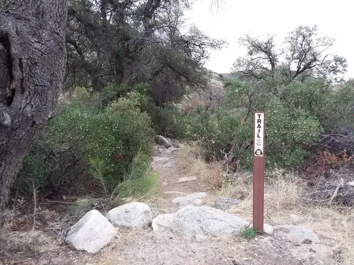
Bellota Trail #15 is a mountain biking route in the Santa Catalina Ranger District of Coronado National Forest in Arizona, managed by the Forest Service. The trail is about 2.25 miles long, with a one-way climb of 793 feet from a starting elevation of about 4,350 feet to a high point near 4,848 feet. The route also includes a descent of about 1,175 feet, and the steepest stretch comes early on, around 0.28 miles in, with a grade of about 23%. Spring and fall are the most comfortable times to ride. Typical averages from a nearby weather station at Oracle put April highs around 71°F and October highs around 77°F, while June and July average in the low 90s. The trail sits right next to a cluster of other destinations. Molino Basin Trail #11, Molino Basin Boulders and Molino Basin campground are all about 0.1 mile away, and the Aviator hike is a similar distance.
Molino Basin
Campground
Butler Hall
Fast food
Wildlife Viewing Area
Viewpoint
Places © OpenStreetMap contributors
More in OracleNot on Roamze yet. Their page has how to reach them.
 Molino Basin Trail #11HikingPhoto: theojones2, Public Domain Dedication (CC0) (via Flickr)0.1 miAviatorHikingPhoto: theojones2, Public Domain Dedication (CC0) (via Flickr)0.1 mi
 MolinoCampingPhoto: Recreation.gov (RIDB) / public domain0.4 mi
Source: Roamze catalog (indexable pages within 10 miles, PostGIS distance)
 La MilagrosaMountain biking · ~4 min drivePhoto: Katja Schulz from Washington, D. C., USA, CC BY 2.0 (via Wikimedia Commons)
 Sabino CanyonMountain biking · ~10 min drivePhoto: Raquel Baranow from Tucson, Arizona, U$A, CC BY-SA 2.0 (via Wikimedia Commons)Sabino CreekMountain biking · ~10 min drivePhoto: Raquel Baranow from Tucson, Arizona, U$A, CC BY-SA 2.0 (via Wikimedia Commons)Sabino HistoricMountain biking · ~10 min drivePhoto: Raquel Baranow from Tucson, Arizona, U$A, CC BY-SA 2.0 (via Wikimedia Commons)
 Box CampMountain biking · ~10 min drivePhoto: Debbie, CC BY 2.0 (via Wikimedia Commons)
 Sunset Trail #90Mountain biking · ~12 min drivePhoto: Mcraycroft, CC BY-SA 4.0 (via Wikimedia Commons)
 Phioneline Link NorthMountain biking · ~13 min drivePhoto: Ken Thomas, Public domain (via Wikimedia Commons)SunsetMountain biking · ~13 min drivePhoto: Mcraycroft, CC BY-SA 4.0 (via Wikimedia Commons)
 Box SpringMountain biking · ~11 min drivePhoto: Debbie, CC BY 2.0 (via Wikimedia Commons)Phoneline Link Trail #27AMountain biking · ~13 min drivePhoto: Ken Thomas, Public domain (via Wikimedia Commons)
Also worth it near here
Best months: October–May. Best months have typical highs of 55–85 °F, lows of 30 °F or warmer (32 °F where the station doesn't record snow), at most one snowy day and no more than 12 wet days.
Jan
56° / 35°
6 wet
Feb
58° / 37°
6 wet
Mar
64° / 42°
6 wet
Apr
71° / 46°
3 wet
May
82° / 56°
2 wet
Jun
92° / 66°
3 wet
Jul
91° / 69°
9 wet
Aug
90° / 67°
11 wet
Sep
86° / 63°
7 wet
Oct
77° / 52°
4 wet
Nov
64° / 42°
4 wet
Dec
55° / 36°
5 wet
Typical high / low (°F) and days with rain or snow, 1991–2020. Measured at Oracle 2 Se, AZ, 18.4 mi away at 4,510 ft. This station doesn't record snowfall. Source: NOAA NCEI U.S. Climate Normals 1991–2020.
Map and trail data © OpenStreetMap contributors

