Pass Mountain Trail
 Photo: kevin dooley, CC BY 2.0 (via Flickr)
- 7.3 mi
- loop
- 303 ft
- climb
- 2,628 ft
- high point
- Loop
- route
- Nov–Apr
- best months
Clear at last check
Weather is good · OpenWeather · checked 13 h ago
Pass Mountain Trail is a 7.3-mile loop in Arizona's Usery Mountain Regional Park, on regional agency land about 7 miles from Apache Junction. The route climbs from 1,885 feet to 2,628 feet, a total gain of 303 feet, and is rated hard. Its low point sits at about 1,900 feet, and its high at about 2,600 feet, so the trail runs at a steady mid-elevation rather than a steep mountain climb. The most comfortable months for a visit are typically November and March, when typical averages from a nearby weather station at Apache Junction run in the mid-70s to low 80s for highs and around 40 to 50 degrees for lows. That station sits about 550 feet below the trail's high point, so expect it to run a little cooler on the summit. The trail makes an easy pairing with Wind Cave, just 0.1 mile away, and Talon Trail at 0.4 mile. Pass Mountain Loop is about half a mile off. For an overnight stay, Larry Forbis campground is about 5.6 miles away.
Local outfitters
- VIP RV Resort5 mi away
- Arizona Desert Mountain Jeep Tours22 mi away
Not on Roamze yet. Their page has how to reach them.
Best time to go · Nov–Apr
Best time to visit Pass Mountain Trail
Best months: November–April. Best months have typical highs of 55–85 °F, lows of 30 °F or warmer (32 °F where the station doesn't record snow), at most one snowy day and no more than 12 wet days.
Jan
67° / 43°
4 wet
Feb
70° / 44°
4 wet
Mar
77° / 48°
4 wet
Apr
85° / 53°
2 wet
May
93° / 60°
2 wet
Jun
103° / 69°
1 wet
Jul
105° / 77°
4 wet
Aug
104° / 76°
6 wet
Sep
99° / 71°
4 wet
Oct
88° / 60°
3 wet
Nov
76° / 50°
3 wet
Dec
66° / 42°
4 wet
Typical high / low (°F) and days with rain or snow, 1991–2020. Measured at Apache Junction 5 Ne, AZ, 7.3 mi away at 2,070 ft. The station sits about 600 ft lower than this place, so expect it a little cooler here. Source: NOAA NCEI U.S. Climate Normals 1991–2020.
Keep exploring — more trails worth the drive
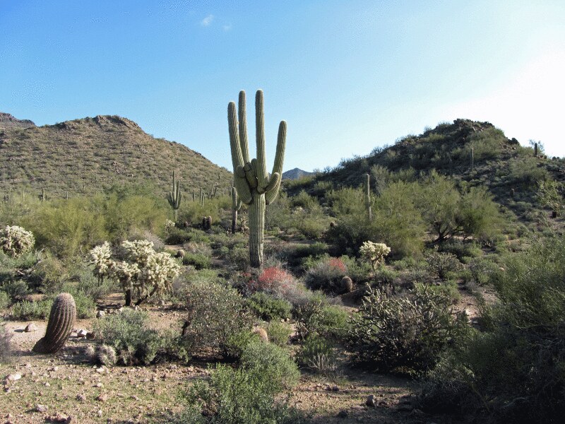 Photo: homeredwardprice, CC BY 2.0 (via Flickr)
Wind Cave
Next door
2.78-mile out-and-back trail to Wind Cave in Arizona with 1,015 ft of gain.
 Photo: kevin dooley, CC BY 2.0 (via Flickr)
Pass Mountain Loop
Next door
6.73-mile loop trail in Arizona with 621 ft of elevation gain.
 Photo: kevin dooley, CC BY 2.0 (via Flickr)
Merkle Trail
~1 min drive
0.86-mile loop with 155 ft elevation gain in Arizona
HIKE
Pass Mountain Summmit Trail
~2 min drive
1.86-mile out-and-back hike in Arizona with 1,053 ft gain and 3,255 ft max elevation.
Photo: homeredwardprice, CC BY 2.0 (via Flickr)Nature Trail
~1 min drive
0.35-mile loop trail in Arizona with 12 ft elevation gain.
HIKE
Bulldog Saddle Trail
~3 min drive
4.76-mile out-and-back trail in Arizona with 1,693 ft elevation gain.
Photo: kevin dooley, CC BY 2.0 (via Flickr)Chain Fruit Trail
~1 min drive
1.96-mile out-and-back hike in Arizona with 104 ft elevation gain
HIKE
Cactus Nectar Trail
~4 min drive
1.72-mile out-and-back trail in Arizona with 772 ft elevation gain.
Photo: kevin dooley, CC BY 2.0 (via Flickr)Moon Rock Trail
~2 min drive
2.1-mile out-and-back trail in Arizona with 92 ft elevation gain/loss.
HIKE
Hawes Loop Trail
~5 min drive
2.88-mile out-and-back trail in Arizona with 1,086 ft elevation gain


Map and trail data © OpenStreetMap contributors
