Old Trail
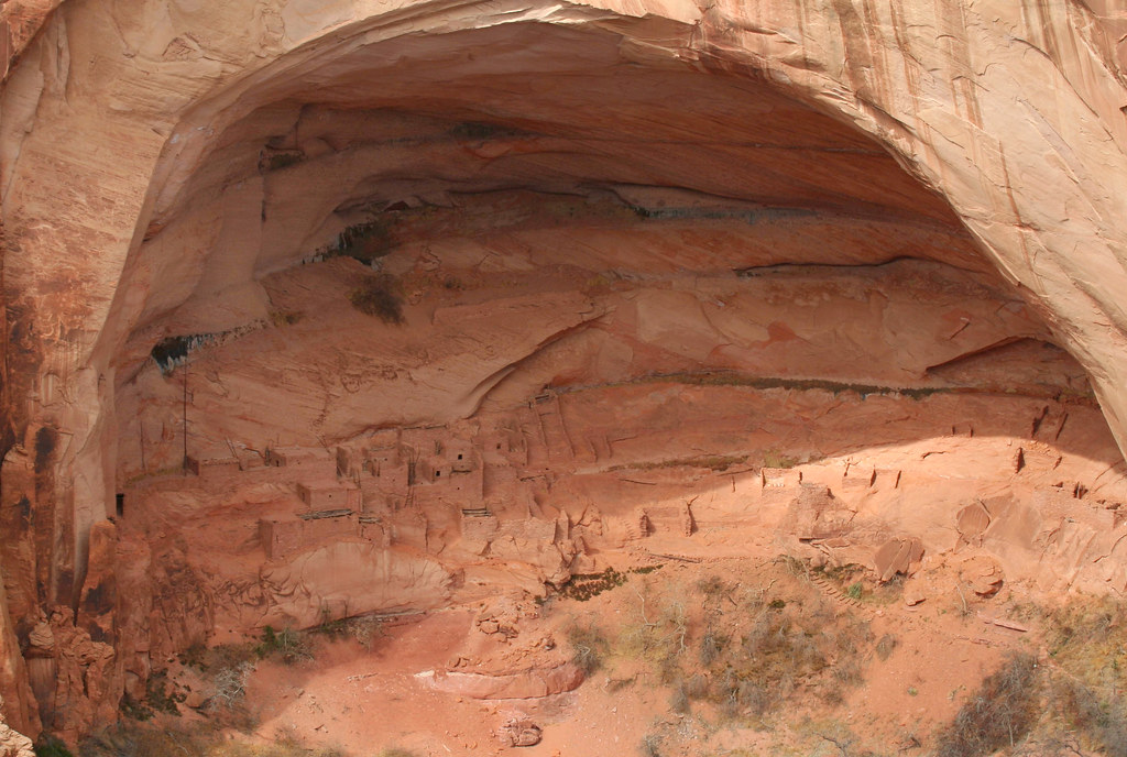
 Photo: Kimaz2412, CC BY 2.0 (via Flickr)
- 1.1 mi
- round trip
- 486 ft
- climb
- 6,337 ft
- high point
- Out and back
- route
- Apr–Jun, Aug–Oct
- best months
Old Trail is a short, easy hike in northern Arizona, set within the Navajo Region Fire and Aviation Management area. The route is an out-and-back of about 2.3 miles, with a total climb of 486 feet and a high point of 6,337 feet. The trail starts at that high point and descends to a low of 5,939 feet, so the climb is back-loaded, with the steepest stretch at about 0.35 miles from the start. The most comfortable months for a visit are typically May and September. Typical averages from the nearby Betatakin weather station show May highs around 71°F and September highs around 76°F, while winter brings highs near 40°F and a few snow days each month from December through February. The hike takes about an hour to complete. Keet Seel, another hike, lies about 10 miles away.
Local outfitters
- The View Campground24 mi away
- Sacred Monument Tours24 mi away
Not on Roamze yet. Their page has how to reach them.
Source: Roamze catalog (indexable pages within 10 miles, PostGIS distance)
 Betatakin TrailHiking · ~18 min drivePhoto: RuggyBearLA, CC BY-SA 2.0 (via Flickr)
 Mesa Top Trail to Tsegi Pt.Hiking · ~19 min drivePhoto: Jon Gudorf Photography, CC BY-SA 2.0 (via Flickr)
 Honaker TrailHiking · ~1h 9m drivePhoto: Peter K., CC BY-SA 3.0 (via Wikimedia Commons)
- Navajo Rail TrailHiking · ~32 min drive
 Wildcat TrailHiking · ~42 min drivePhoto: Navin75, CC BY-SA 2.0 (via Flickr)
 Aspen TrailHiking · ~20 min drivePhoto: rob stoeltje, CC BY 2.0 (via Flickr)
- Keet SeelHiking · ~17 min drive
- Johns Canyon RoadHiking · ~1h 14m drive
- Rainbow BridgeHiking · ~1h 17m drive
- Sandal TrailHiking · ~20 min drivePhoto: rob stoeltje, CC BY 2.0 (via Flickr)
Also worth it near here
Best time to visit Old Trail
Best months: April–June and August–October. Best months have typical highs of 55–85 °F, lows of 30 °F or warmer (32 °F where the station doesn't record snow), at most one snowy day and no more than 12 wet days.
Jan
40° / 22°
5 wet · 4 snow
Feb
44° / 25°
5 wet · 3 snow
Mar
52° / 30°
4 wet · 2 snow
Apr
61° / 35°
3 wet · 1 snow
May
71° / 44°
3 wet
Jun
82° / 55°
2 wet
Jul
86° / 60°
5 wet
Aug
83° / 58°
7 wet
Sep
76° / 52°
5 wet
Oct
64° / 41°
4 wet
Nov
51° / 30°
3 wet · 2 snow
Dec
40° / 22°
4 wet · 3 snow
Typical high / low (°F) and days with rain or snow, 1991–2020. Measured at Betatakin, AZ, 11.6 mi away at 7,286 ft. The station sits about 900 ft higher than this place, so expect it a little warmer here. Source: NOAA NCEI U.S. Climate Normals 1991–2020.


Map and trail data © OpenStreetMap contributors
