Aspen Trail
 Photo: rob stoeltje, CC BY 2.0 (via Flickr)
- 0.3 mi
- round trip
- 220 ft
- climb
- 7,265 ft
- high point
- Out and back
- route
- Apr–Jun, Aug–Oct
- best months
Aspen Trail is a short, easy out-and-back hike in Arizona, set within the Navajo Region Fire and Aviation Management unit and managed by the Bureau of Indian Affairs. The trail is about 0.34 miles long, with a total elevation gain of 220 feet, and it takes roughly half an hour to complete. The route starts at a low point of about 7,000 feet and climbs to a high of 7,265 feet. The steepest stretch comes early on, around 0.13 miles in, with a grade of about 15 percent. The trail is short enough to fit into a quick outing, and it pairs easily with other nearby hikes. For comfortable weather, late spring and early fall are the best bets. Typical averages from the nearby Betatakin weather station show May highs around 71°F and September highs around 76°F, while winter brings highs near 40°F and a few snowy days each month from December through February. Canyon View Trail and Sandal Trail both sit about 0.1 miles away, and Mesa Top Trail to Tsegi Pt. is about 0.7 miles off. Betatakin Trail lies roughly 1.3 miles away.
Local outfitters
- The View Campground32 mi away
- Sacred Monument Tours32 mi away
Not on Roamze yet. Their page has how to reach them.
- Canyon View TrailHikingPhoto: rob stoeltje, CC BY 2.0 (via Flickr)0.1 mi
- Sandal TrailHikingPhoto: rob stoeltje, CC BY 2.0 (via Flickr)0.1 mi
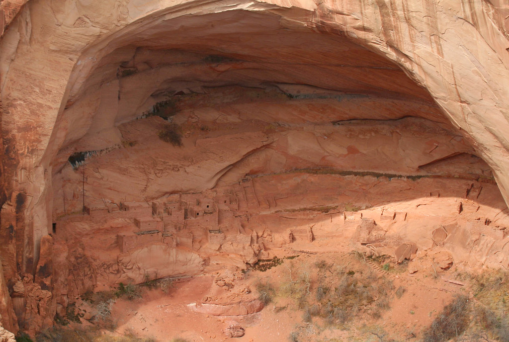 Mesa Top Trail to Tsegi Pt.HikingPhoto: Jon Gudorf Photography, CC BY-SA 2.0 (via Flickr)0.7 mi
 Betatakin TrailHikingPhoto: RuggyBearLA, CC BY-SA 2.0 (via Flickr)1.3 mi
- Keet SeelHiking2 mi
Source: Roamze catalog (indexable pages within 10 miles, PostGIS distance)
- Canyon View TrailHiking · Next doorPhoto: rob stoeltje, CC BY 2.0 (via Flickr)
- Betatakin TrailHiking · ~2 min drivePhoto: RuggyBearLA, CC BY-SA 2.0 (via Flickr)
 Reflection Canyon TrailHiking · ~1h 19m drivePhoto: Jason Hollinger, CC BY 2.0 (via Wikimedia Commons)
 Honaker TrailHiking · ~1h 22m drivePhoto: Peter K., CC BY-SA 3.0 (via Wikimedia Commons)
- Sandal TrailHiking · Next doorPhoto: rob stoeltje, CC BY 2.0 (via Flickr)
 Wildcat TrailHiking · ~55 min drivePhoto: Navin75, CC BY-SA 2.0 (via Flickr)
- Navajo Rail TrailHiking · ~19 min drive
- Keet SeelHiking · ~3 min drive
- Mesa Top Trail to Tsegi Pt.Hiking · ~1 min drivePhoto: Jon Gudorf Photography, CC BY-SA 2.0 (via Flickr)
 Antelope Canyon X Loop TrailHiking · ~1h 17m drivePhoto: Nicola since 1972, CC BY 2.0 (via Flickr)
Best time to visit Aspen Trail
Best months: April–June and August–October. Best months have typical highs of 55–85 °F, lows of 30 °F or warmer (32 °F where the station doesn't record snow), at most one snowy day and no more than 12 wet days.
Jan
40° / 22°
5 wet · 4 snow
Feb
44° / 25°
5 wet · 3 snow
Mar
52° / 30°
4 wet · 2 snow
Apr
61° / 35°
3 wet · 1 snow
May
71° / 44°
3 wet
Jun
82° / 55°
2 wet
Jul
86° / 60°
5 wet
Aug
83° / 58°
7 wet
Sep
76° / 52°
5 wet
Oct
64° / 41°
4 wet
Nov
51° / 30°
3 wet · 2 snow
Dec
40° / 22°
4 wet · 3 snow
Typical high / low (°F) and days with rain or snow, 1991–2020. Measured at Betatakin, AZ, 0.1 mi away at 7,286 ft. Source: NOAA NCEI U.S. Climate Normals 1991–2020.


