Kai-Vav-Wi Nature Trail #34
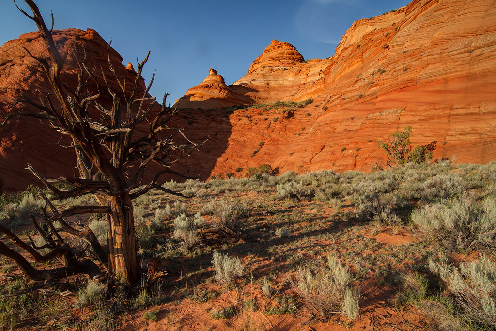
 Photo: Rodrigo Paredes from Ciudad Autónoma de Buenos Aires, Argentina, CC BY 2.0 (via Wikimedia Commons)
- 1.7 mi
- round trip
- 30 ft
- climb
- 7,913 ft
- high point
- Out and back
- route
- May–Oct
- best months
Caution today
Agency alerts are in effect for this area; weather is good · USFS, OpenWeather · checked 7 h ago
Is Kai-Vav-Wi Nature Trail #34 open right now?
Closure in the area
There's a closure order in Kaibab National Forest. It doesn't name Kai-Vav-Wi Nature Trail #34, so check the source for the area it covers (4 listed).
Heavy storm damages received - use extreme caution
Agency closure covering Kaibab National Forest · USFS · Kaibab National Forest
Christmas tree permits available online beginning October 8
Agency closure covering Kaibab National Forest · USFS · Kaibab National Forest
Forest Road 354 on Kaibab & Prescott NF Temporarily Closed for Repairs
Agency closure covering Kaibab National Forest · Order 03-07-26-02 · USFS · Kaibab National Forest
Effective April 17, 2026 - UPDATED - White Sage & Dragon Bravo Fires Temporary Area Closure
Agency closure covering North Kaibab Ranger District · Order 03-07-03-26-03 · USFS · North Kaibab Ranger District
As of · Source: USFS · Kaibab National Forest. Agencies don't list every closure — check before you go.
Kai-Vav-Wi Nature Trail #34 is a short, easy out-and-back hike in the North Kaibab Ranger District of Arizona's Kaibab National Forest, managed by the Forest Service. The trail is about 1.7 miles long, with a low point of 7,808 feet and a high of 7,913 feet, so the one-way climb is only about 30 feet. The most comfortable months for a visit are typically June and July, when typical averages from a nearby weather station run from highs around 73 to 77°F and lows in the upper 40s. Winter is cold, with typical January highs near 36°F and lows around 18°F. Jacob Lake Group Campground & Picnic Site sits just 0.2 miles away, and the Arizona Trail passes about 1.5 miles off. The Kaibab Plateau climbing area is about 1.2 miles away, and the Hayduke Trail #10 is about 1.9 miles away.
Local outfitters
- Kanab Tour Company28 mi away
- Kanab RV Corral28 mi away
Not on Roamze yet. Their page has how to reach them.
- Jacob Lake Group Campground & Picnic SiteCamping0.2 mi
- Kaibab PlateauRock climbing1.2 mi
 Arizona TrailHikingPhoto: Kaibab National Forest, CC BY-SA 2.0 (via Wikimedia Commons)1.5 mi
- Hayduke Trail #10Hiking1.9 mi
- Jacob Canyon Route #35Hiking3 mi
- Valley Truck TrailHiking8 mi
 Trail CanyonRock climbingPhoto: John Fowler from Placitas, NM, USA, CC BY 2.0 (via Wikimedia Commons)8.8 mi
- Snake Gulch Trail #59Hiking9 mi
Source: Roamze catalog (indexable pages within 10 miles, PostGIS distance)
- Arizona TrailHiking · ~3 min drivePhoto: Kaibab National Forest, CC BY-SA 2.0 (via Wikimedia Commons)
 Trail To Double Barrell ArchHiking · ~24 min drivePhoto: Petr Meissner, CC BY 2.0 (via Flickr)
- Arizona TrailHiking · ~3 min drivePhoto: Kaibab National Forest, CC BY-SA 2.0 (via Wikimedia Commons)
- Burma RoadHiking · ~19 min drive
 East Rim TrailHiking · ~37 min drivePhoto: deborah.soltesz, Public Domain Dedication (CC0) (via Flickr)
 Great Western Trail - ArizonaHiking · ~30 min drivePhoto: GSEC, CC BY 2.0 (via Flickr)
- Kane TrailHiking · ~24 min drive
 Rainbow RimHiking · ~38 min drivePhoto: Kaibab National Forest, CC BY-SA 2.0 (via Wikimedia Commons)
 The Maze TrailHiking · ~36 min drivePhoto: Shaan Hurley, CC BY 2.0 (via Flickr)
- Buffalo Ranch Road; HouserockHiking · ~29 min drive
Best time to visit Kai-Vav-Wi Nature Trail #34
Best months: May–October. Best months have typical highs of 55–85 °F, lows of 30 °F or warmer (32 °F where the station doesn't record snow), at most one snowy day and no more than 12 wet days.
Jan
36° / 18°
7 wet
Feb
37° / 19°
7 wet
Mar
44° / 23°
6 wet
Apr
52° / 28°
4 wet
May
62° / 36°
4 wet
Jun
73° / 43°
3 wet
Jul
77° / 49°
8 wet
Aug
74° / 48°
11 wet
Sep
67° / 42°
7 wet
Oct
56° / 33°
5 wet
Nov
45° / 24°
5 wet
Dec
36° / 17°
6 wet
Typical high / low (°F) and days with rain or snow, 1991–2020. Measured at Bright Angel Rs, AZ, 35.5 mi away at 8,000 ft. This station doesn't record snowfall. Source: NOAA NCEI U.S. Climate Normals 1991–2020.
Map and trail data © OpenStreetMap contributors
