Yavapai Campground
Campground
Campground · 6.2 mi from the trail
 Photo: Ken Lund from Reno, Nevada, USA, CC BY-SA 2.0 (via Wikimedia Commons)
Ecosa Trail is a short, easy out-and-back hike in Arizona, about half a mile from the community of Granite Dells. The trail is just under a mile long, with a total elevation gain of about 200 feet, and it reaches a high point of about 5,158 feet. The route is back-loaded, meaning the steeper part comes toward the end. The steepest stretch is about 0.37 miles in, with a grade of about 6 percent. The trail starts at roughly 5,146 feet and ends at about 5,089 feet, so the climb and descent are nearly equal. Spring and fall are the most comfortable times to go. Typical averages from a nearby weather station in Prescott show May highs around 76°F and October highs around 73°F, while July and August average about 90°F. The trip takes about half an hour. Basin Trail and Canyon Trail both start within a third of a mile, and The Lost Wall climbing area is about 0.4 miles away. For an overnight stay, Yavapai Campground is about 6 miles off.
Yavapai Campground
Campground
 If it rainsDoncram, CC BY-SA 3.0 · Wikimedia Commons
An open-air museum located in Prescott, Arizona
Places © OpenStreetMap contributors, Places © Overture Maps Foundation · Photos: Doncram, CC BY-SA 3.0 (commons)
More in PrescottNot on Roamze yet. Their page has how to reach them.
 Canyon TrailHikingPhoto: Ken Lund from Reno, Nevada, USA, CC BY-SA 2.0 (via Wikimedia Commons)0.3 mi
 The Lost WallRock climbingPhoto: Chris English, CC BY-SA 3.0 (via Wikimedia Commons)0.4 mi
 Main Wall RightRock climbingPhoto: Raniel Diaz from Corona del Mar, United States, CC BY 2.0 (via Wikimedia Commons)0.6 mi
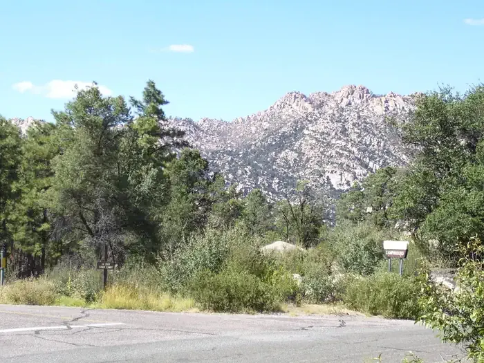 Yavapai CampgroundCampingPhoto: Recreation.gov (RIDB) / public domain6.2 mi
Source: Roamze catalog (indexable pages within 10 miles, PostGIS distance)
Canyon TrailHiking · Next doorPhoto: Ken Lund from Reno, Nevada, USA, CC BY-SA 2.0 (via Wikimedia Commons) Headwaters TrailHiking · ~3 min drivePhoto: Scottb211, CC BY 2.0 (via Flickr)Ron James Approach TrailHiking · Next doorPhoto: Ken Lund from Reno, Nevada, USA, CC BY-SA 2.0 (via Wikimedia Commons)
 Peavine TrailHiking · ~4 min drivePhoto: Tom Check from Prescott, USA, CC BY-SA 2.0 (via Wikimedia Commons)Rock Wall TrailHiking · Next doorPhoto: Ken Lund from Reno, Nevada, USA, CC BY-SA 2.0 (via Wikimedia Commons)
 Approach TrailHiking · Next doorPhoto: kevin dooley, CC BY 2.0 (via Flickr)
 Gateway TrailHiking · ~1 min drivePhoto: Scottb211, CC BY 2.0 (via Flickr)
 Soggy Bottom TrailHiking · ~2 min drivePhoto: Scottb211, CC BY 2.0 (via Flickr)Low Water TrailHiking · ~2 min drivePhoto: Ken Lund from Reno, Nevada, USA, CC BY-SA 2.0 (via Wikimedia Commons)
Best months: March–May and September–October. Best months have typical highs of 55–85 °F, lows of 30 °F or warmer (32 °F where the station doesn't record snow), at most one snowy day and no more than 12 wet days.
Jan
53° / 24°
5 wet
Feb
55° / 26°
6 wet
Mar
61° / 32°
5 wet
Apr
68° / 37°
3 wet
May
76° / 45°
3 wet
Jun
87° / 54°
3 wet
Jul
90° / 61°
9 wet
Aug
87° / 60°
10 wet
Sep
82° / 52°
6 wet
Oct
73° / 40°
4 wet
Nov
62° / 30°
4 wet
Dec
52° / 24°
5 wet
Typical high / low (°F) and days with rain or snow, 1991–2020. Measured at Prescott, AZ, 2.7 mi away at 5,205 ft. This station doesn't record snowfall. Source: NOAA NCEI U.S. Climate Normals 1991–2020.
Map and trail data © OpenStreetMap contributors
