Planja
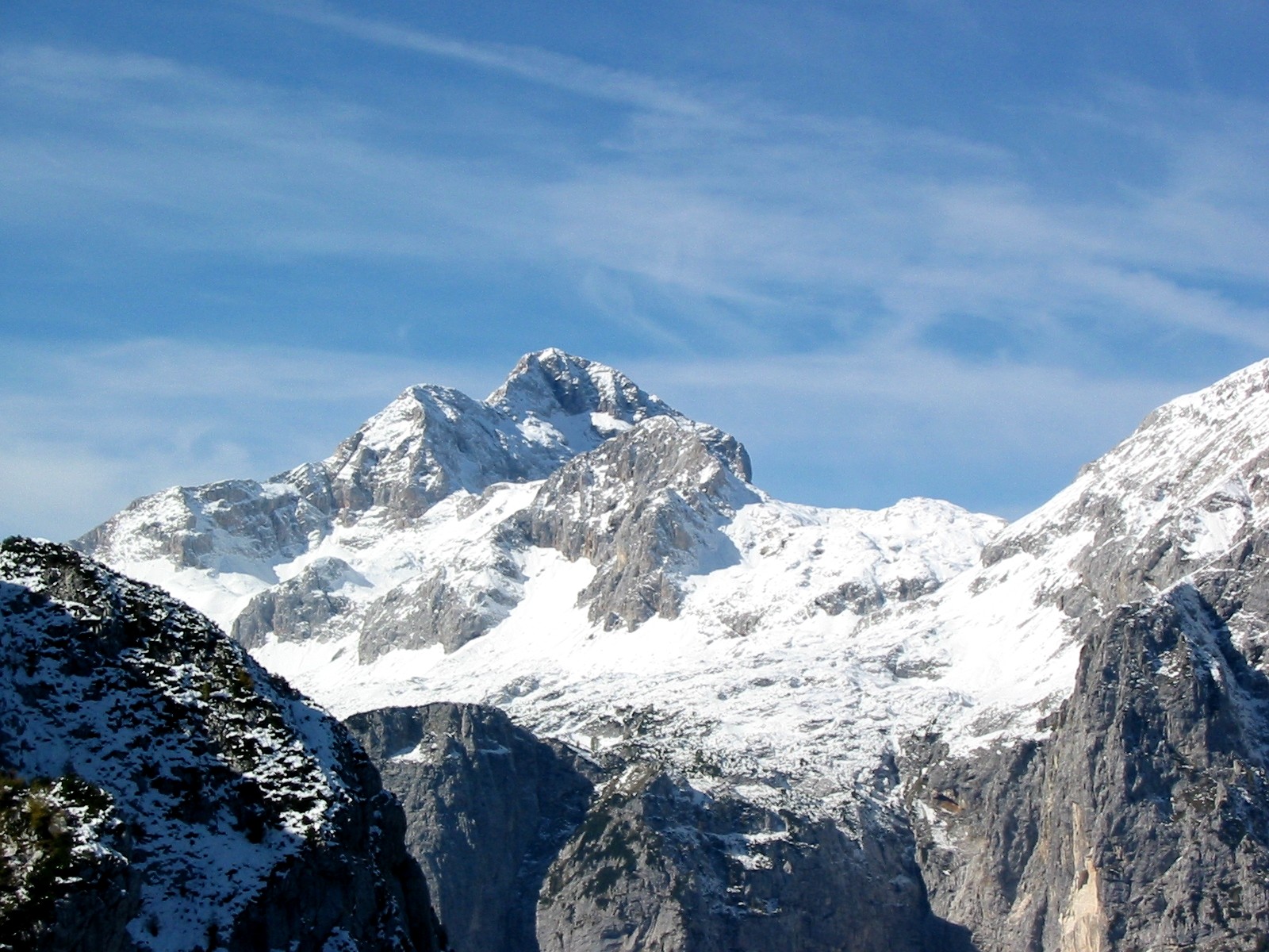
 Photo: JakobZ, CC BY-SA 3.0 (via Wikimedia Commons)
- 8,035 ft
- summit
Planja is a mountain in Bovec, Slovenia, with its summit at about 8,030 ft (2,449 m) above sea level. It stands inside Triglavski narodni park. Mapped trails that come within about half a mile of the top include Slovenska planinska pot. The nearest town is Kranjska Gora, about 5.4 miles south of the summit. Peaks within about 3 miles include Utrujeni stolp, Lešarjeva peč and Vrh Žlebičev. Lešarjev slap and Slap Kloma are within about 3 miles. For camping, Kamp Triglav and Camp Triglav Ranc are within about 6 miles. The location and elevation come from OpenStreetMap and the Copernicus 90 m elevation model. Check local access rules and conditions before you go.
Conditions and forecast
Daily highs and lows, wind and the chance of precipitation at the summit for the next 7 days, from the Open-Meteo model.
- Summit elevation
- 8,035 ft
We don't know of a mapped trail or route to the summit of Planja. Plan the approach with local maps, a guidebook or a local guide, and check conditions before you go.
Questions about Planja
How tall is Planja?
8,035 ft (2,449 m).
Is there a trail to the top of Planja?
We don't know of a mapped trail or route to the summit. Plan the approach with local maps, a guidebook or a local guide.
 Triglav9,396 ft · Bohinj, Slovenia1 route3.1 mi awayPhoto: Andrej Jakobčič, CC BY-SA 3.0 (via Wikimedia Commons)
 Mangart8,786 ft · Bovec, Slovenia1 route6.7 mi awayPhoto: kallerna, CC BY-SA 4.0 (via Wikimedia Commons)
 Jôf di Montasio9,035 ft · Friuli Venezia Giulia, Italy1 route17 mi awayPhoto: kallerna, CC BY-SA 4.0 (via Wikimedia Commons)
 Grintovec8,392 ft · Kamnik, Slovenia1 route36 mi awayPhoto: sl:Uporabnik:JakobZ, CC BY-SA 3.0 (via Wikimedia Commons)
 Grossglockner12,461 ft · Carinthia, Austria1 route69 mi awayPhoto: DennisPeeters, Public domain (via Wikimedia Commons)
 Hoher Dachstein9,826 ft · Upper Austria, Austria1 route74 mi awayPhoto: C.Stadler/Bwag, CC BY-SA 4.0 (via Wikimedia Commons)
 PlanjaSummit · Next doorPhoto: MKrolik-WMF, CC0 (via Wikimedia Commons)
 RazorSummit · Next doorPhoto: JakobZ at Slovenian Wikipedia, CC BY-SA 3.0 (via Wikimedia Commons)
 Mali RazorSummit · ~1 min drivePhoto: Johann Jaritz, CC BY-SA 4.0 (via Wikimedia Commons)
 GoličicaSummit · ~2 min drivePhoto: Unknown authorUnknown author, Public domain (via Wikimedia Commons)
 Zadnji PrisankSummit · ~2 min drivePhoto: Johann Jaritz, CC BY-SA 4.0 (via Wikimedia Commons)
 PrisojnikSummit · ~3 min drivePhoto: Johann Jaritz, CC BY-SA 3.0 (via Wikimedia Commons)
 StenarSummit · ~3 min drivePhoto: JakobZ, CC BY-SA 3.0 (via Wikimedia Commons)
- Utrujeni stolpSummit · Next door
- Lešarjeva pečSummit · Next door
- Vrh ŽlebičevSummit · Next door
Also worth it near here
- Lešarjev slapWaterfall · ~1 min drive
- Triglav: Kugyjeva (from the road end)Mountaineering · ~4 min drivePhoto: Andrej Jakobčič, CC BY-SA 3.0 (via Wikimedia Commons)
 Vršič - Mala MojstrovkaHiking · ~5 min drivePhoto: Erik from Laagri, Estonia, CC BY 2.0 (via Wikimedia Commons)
- Kamp TriglavCamping · ~5 min drive
Best time to visit Planja
No month here meets our mild-weather rule. Best months have typical highs of 55–85 °F, lows of 30 °F or warmer (32 °F where there's no snowfall data), at most one snowy day and no more than 12 wet days.
Jan
23° / 9°
11 wet
Feb
24° / 9°
11 wet
Mar
29° / 14°
13 wet
Apr
36° / 20°
16 wet
May
46° / 29°
16 wet
Jun
52° / 35°
17 wet
Jul
56° / 39°
16 wet
Aug
55° / 39°
15 wet
Sep
48° / 33°
15 wet
Oct
41° / 28°
14 wet
Nov
31° / 19°
14 wet
Dec
24° / 10°
13 wet
Typical high / low (°F) and days with rain or snow, 1981–2010. Modelled for the 1 km square this place sits in (average height 6,906 ft), not measured at a weather station. The square averages about 1,100 ft lower than this place, so expect it a little cooler here. Snowfall days aren't in this data. Source: CHELSA 1 km climate model (1981–2010) and CRU TS 4.09 wet days. Data: CHELSA V2.1 climatologies (Karger et al. 2017), WSL (CC0 1.0); CRU TS 4.09 (Harris et al. 2020), University of East Anglia Climatic Research Unit. Contains public sector information licensed under the Open Government Licence v3.0. (Open Government Licence v3.0).
Map and trail data © OpenStreetMap contributors
