Brandegg
- 6,594 ft
- summit
Brandegg is a mountain in Trentino-South Tyrol, Italy, with its summit at about 6,590 ft (2,010 m) above sea level. No mapped trail reaches the top in OpenStreetMap, so plan the approach with local maps or a guide. The nearest town is St. Peter - San Pietro, about 2.7 miles southwest of the summit. Peaks within about 3 miles include Segenbühl - Col Seghen, Glander - Monte Campo di Gardena and Resciesa Dedora - Ausserraschötz - Rasciesa di Fuori. Flitzer Wasserfall - Cascata di Valluzza and Gufidauner Wasserfall - Cascata di Gudon are within about 3 miles. For camping, Ansitz Gamp is within about 6 miles. The location and elevation come from OpenStreetMap and the Copernicus 90 m elevation model. Check local access rules and conditions before you go.
Conditions and forecast
Daily highs and lows, wind and the chance of precipitation at the summit for the next 7 days, from the Open-Meteo model.
- Summit elevation
- 6,594 ft
We don't know of a mapped trail or route to the summit of Brandegg. Plan the approach with local maps, a guidebook or a local guide, and check conditions before you go.
Questions about Brandegg
How tall is Brandegg?
6,594 ft (2,010 m).
Is there a trail to the top of Brandegg?
We don't know of a mapped trail or route to the summit. Plan the approach with local maps, a guidebook or a local guide.
 Piz Boè10,341 ft · Trentino-South Tyrol, Italy1 route12 mi awayPhoto: kallerna, CC BY-SA 4.0 (via Wikimedia Commons)
 Monte Civetta10,564 ft · Veneto, Italy1 route25 mi awayPhoto: 2015 Michael 2015, CC BY-SA 4.0 (via Wikimedia Commons)
 Monte Pelmo10,394 ft · Veneto, Italy1 route27 mi awayPhoto: 2015 Michael 2015, CC BY-SA 4.0 (via Wikimedia Commons)
 Wildspitze12,362 ft · Tyrol, Austria1 route41 mi awayPhoto: Pirmin Olde Weghuis, CC BY-SA 3.0 (via Wikimedia Commons)
 Großvenediger11,998 ft · Salzburg, Austria1 route48 mi awayPhoto: Jörg Braukmann, CC BY-SA 4.0 (via Wikimedia Commons)
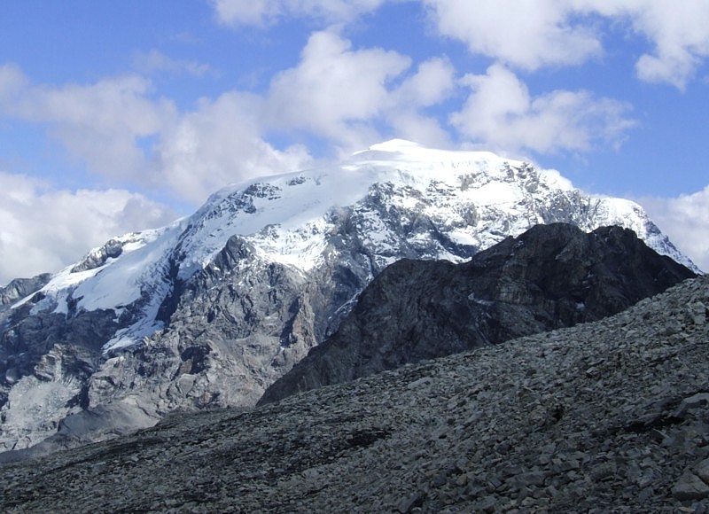 Ortler12,812 ft · Trentino-South Tyrol, Italy1 route53 mi awayPhoto: No machine-readable author provided. Idéfix~commonswiki assumed (based on copyright claims)., CC BY-SA 3.0 (via Wikimedia Commons)
 Resciesa Dedora - Ausserraschötz - Rasciesa di FuoriSummit · ~2 min drivePhoto: This Photo was taken by Wolfgang Moroder.
Feel free to use my photos, but please mention me as the author and send me a message.
This image is not in the public domain. Please respect the copyright protection. It may only be used according to the rules mentioned here. This specifically excludes use in social media, if applicable terms of the licenses listed here are not appropriate.
Please do not upload an updated image here without consultation with the Author. The author would like to make corrections only at his own source. This ensures that the changes are preserved.Please if you think that any changes should be required, please inform the author.Otherwise you can upload a new image with a new name. Please use one of the templates derivative or extract., CC BY-SA 3.0 (via Wikimedia Commons)
 Resciesa Dedite - Innerraschötz - Rasciesa di DentroSummit · ~4 min drivePhoto: This Photo was taken by Wolfgang Moroder.
Feel free to use my photos, but please mention me as the author and send me a message.
This image is not in the public domain. Please respect the copyright protection. It may only be used according to the rules mentioned here. This specifically excludes use in social media, if applicable terms of the licenses listed here are not appropriate.
Please do not upload an updated image here without consultation with the Author. The author would like to make corrections only at his own source. This ensures that the changes are preserved.Please if you think that any changes should be required, please inform the author.Otherwise you can upload a new image with a new name. Please use one of the templates derivative or extract., CC BY-SA 4.0 (via Wikimedia Commons)
 Puflatschspitz - Monte BullacciaSummit · ~6 min drivePhoto: Strubbl, CC BY-SA 4.0 (via Wikimedia Commons)
 Ëur de BredlesSummit · ~7 min drivePhoto: This Photo was taken by Wolfgang Moroder.
Feel free to use my photos, but please mention me as the author and send me a message.
This image is not in the public domain. Please respect the copyright protection. It may only be used according to the rules mentioned here. This specifically excludes use in social media, if applicable terms of the licenses listed here are not appropriate.
Please do not upload an updated image here without consultation with the Author. The author would like to make corrections only at his own source. This ensures that the changes are preserved.Please if you think that any changes should be required, please inform the author.Otherwise you can upload a new image with a new name. Please use one of the templates derivative or extract., CC BY-SA 3.0 (via Wikimedia Commons)
 Säbener Berg - Monte SabionaSummit · ~7 min drivePhoto: Unknown authorUnknown author, Public domain (via Wikimedia Commons)
 Secëda - Monte SecedaSummit · ~7 min drivePhoto: Wolfgang Moroder, CC BY-SA 3.0 (via Wikimedia Commons)
 SëurasasSummit · ~7 min drivePhoto: This Photo was taken by Wolfgang Moroder.
Feel free to use my photos, but please mention me as the author and send me a message.
This image is not in the public domain. Please respect the copyright protection. It may only be used according to the rules mentioned here. This specifically excludes use in social media, if applicable terms of the licenses listed here are not appropriate.
Please do not upload an updated image here without consultation with the Author. The author would like to make corrections only at his own source. This ensures that the changes are preserved.Please if you think that any changes should be required, please inform the author.Otherwise you can upload a new image with a new name. Please use one of the templates derivative or extract., CC BY-SA 3.0 (via Wikimedia Commons)
 Pic - Monte Pic - PitschbergSummit · ~8 min drivePhoto: This Photo was taken by Wolfgang Moroder.
Feel free to use my photos, but please mention me as the author and send me a message.
This image is not in the public domain. Please respect the copyright protection. It may only be used according to the rules mentioned here. This specifically excludes use in social media, if applicable terms of the licenses listed here are not appropriate.
Please do not upload an updated image here without consultation with the Author. The author would like to make corrections only at his own source. This ensures that the changes are preserved.Please if you think that any changes should be required, please inform the author.Otherwise you can upload a new image with a new name. Please use one of the templates derivative or extract., CC BY-SA 3.0 (via Wikimedia Commons)
 Monte PedrocSummit · ~8 min drivePhoto: This Photo was taken by Wolfgang Moroder.
Feel free to use my photos, but please mention me as the author and send me a message.
This image is not in the public domain. Please respect the copyright protection. It may only be used according to the rules mentioned here. This specifically excludes use in social media, if applicable terms of the licenses listed here are not appropriate.
Please do not upload an updated image here without consultation with the Author. The author would like to make corrections only at his own source. This ensures that the changes are preserved.Please if you think that any changes should be required, please inform the author.Otherwise you can upload a new image with a new name. Please use one of the templates derivative or extract., CC BY-SA 3.0 (via Wikimedia Commons)
- Segenbühl - Col SeghenSummit · ~1 min drive
Also worth it near here
 Utia Resciesa - Schutzhütte Raschötz - Rifugio ResciesaHut camping · ~2 min drivePhoto: 2015 Michael 2015, CC BY-SA 4.0 (via Wikimedia Commons)
 Raida dl ResciesaMountain biking · ~2 min drivePhoto: This Photo was taken by Wolfgang Moroder.
Feel free to use my photos, but please mention me as the author and send me a message.
This image is not in the public domain. Please respect the copyright protection. It may only be used according to the rules mentioned here. This specifically excludes use in social media, if applicable terms of the licenses listed here are not appropriate.
Please do not upload an updated image here without consultation with the Author. The author would like to make corrections only at his own source. This ensures that the changes are preserved.Please if you think that any changes should be required, please inform the author.Otherwise you can upload a new image with a new name. Please use one of the templates derivative or extract., CC BY-SA 3.0 (via Wikimedia Commons)
 Loipe Panider Sattel - Pista Passo PineiCross-country skiing · ~4 min drivePhoto: Foto Fitti, CC BY-SA 3.0 (via Wikimedia Commons)
- Troi da la TambresHiking · ~5 min drive
- Ansitz GampCamping · ~6 min drive
Best time to visit Brandegg
No month here meets our mild-weather rule. Best months have typical highs of 55–85 °F, lows of 30 °F or warmer (32 °F where there's no snowfall data), at most one snowy day and no more than 12 wet days.
Jan
25° / 5°
13 wet
Feb
29° / 9°
12 wet
Mar
35° / 16°
15 wet
Apr
41° / 23°
17 wet
May
51° / 31°
17 wet
Jun
58° / 37°
18 wet
Jul
63° / 41°
18 wet
Aug
62° / 41°
18 wet
Sep
55° / 35°
15 wet
Oct
46° / 29°
13 wet
Nov
34° / 18°
15 wet
Dec
26° / 7°
15 wet
Typical high / low (°F) and days with rain or snow, 1981–2010. Modelled for the 1 km square this place sits in (average height 6,168 ft), not measured at a weather station. Snowfall days aren't in this data. Source: CHELSA 1 km climate model (1981–2010) and CRU TS 4.09 wet days. Data: CHELSA V2.1 climatologies (Karger et al. 2017), WSL (CC0 1.0); CRU TS 4.09 (Harris et al. 2020), University of East Anglia Climatic Research Unit. Contains public sector information licensed under the Open Government Licence v3.0. (Open Government Licence v3.0).
Map and trail data © OpenStreetMap contributors
