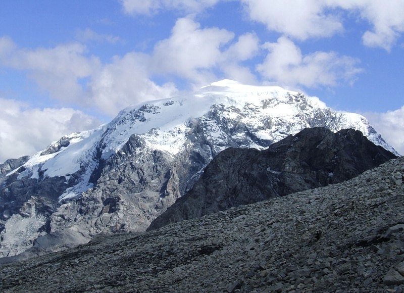
Mountain · 1 route
Ortler
12,812 ft · Trentino-South Tyrol, Italy
Photo: No machine-readable author provided. Idéfix~commonswiki assumed (based on copyright claims)., CC BY-SA 3.0 (via Wikimedia Commons)
- Summit
- 12,812 ft
- Routes
- 1 way up
About Ortler
Ortler is a mountain in Trentino-South Tyrol, Italy, with its summit at 12,812 ft (3,905 m). Roamze has one mapped route to the top. The Minnigherode route starts from Mittelstation - Stazione intermedia cable car station, at about 7,100 ft, and climbs about 5,800 ft to the summit. It is a high-altitude mountaineering route, and OpenStreetMap grades the path as a difficult alpine route. The route page shows the mapped line, the round-trip distance and the climb. This page has a 7-day mountain forecast; check current conditions before you go.
Forecast on Ortler
Daily highs and lows, wind and the chance of precipitation at the summit and mittelstation - stazione intermedia cable car station for the next 7 days, from the Open-Meteo model.
Questions about Ortler
How tall is Ortler?
12,812 ft (3,905 m).
How many routes go to the summit of Ortler?
One: Minnigherode (from Mittelstation - Stazione intermedia cable car station).
Where do the routes up Ortler start?
Minnigherode (from Mittelstation - Stazione intermedia cable car station) starts at Mittelstation - Stazione intermedia cable car station.
Mountains nearby
 Presanella11,667 ft · Trentino-South Tyrol, Italy1 route21 mi awayPhoto: Grasso83, CC BY-SA 3.0 (via Wikimedia Commons)
 Wildspitze12,362 ft · Tyrol, Austria1 route30 mi awayPhoto: Pirmin Olde Weghuis, CC BY-SA 3.0 (via Wikimedia Commons)
 Piz Bernina13,281 ft · Grisons, Switzerland1 route32 mi awayPhoto: Günter Seggebäing, CC BY-SA 3.0 (via Wikimedia Commons)
 Piz Boè10,341 ft · Trentino-South Tyrol, Italy1 route61 mi awayPhoto: kallerna, CC BY-SA 4.0 (via Wikimedia Commons)
 Zugspitze9,718 ft · Tyrol, Austria1 route66 mi awayPhoto: Tuxyso, CC BY-SA 4.0 (via Wikimedia Commons)
 Rheinwaldhorn11,161 ft · Grisons, Switzerland1 route72 mi awayPhoto: Werner Friedli, CC BY-SA 4.0 (via Wikimedia Commons)
Map and trail data © OpenStreetMap contributors
