Mountains in Trentino-South Tyrol
201 mountains and 200 routes in Trentino-South Tyrol, Italy, each with its own page: heights, seasons, and every way to the top we have mapped.
Mountains
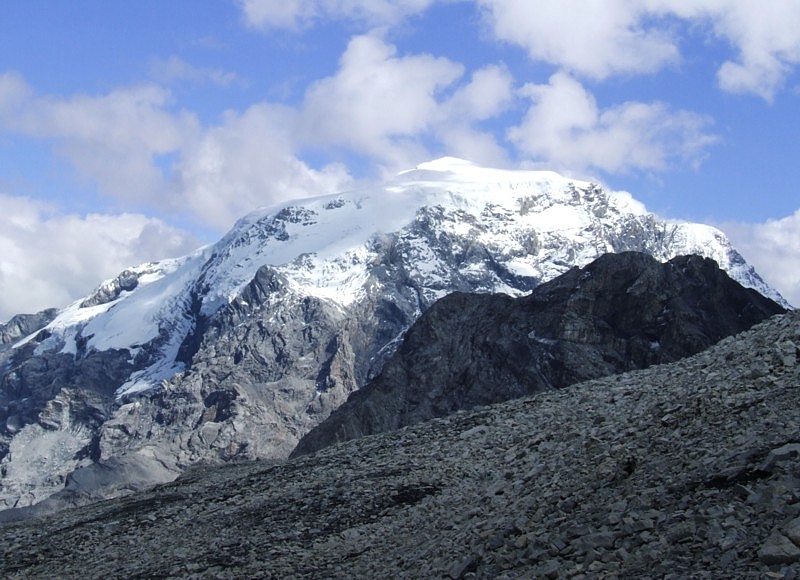 Ortler12,812 ft · Trentino-South Tyrol, Italy1 route · ScramblePhoto: No machine-readable author provided. Idéfix~commonswiki assumed (based on copyright claims)., CC BY-SA 3.0 (via Wikimedia Commons)
 Ortler Vorgipfel - Ortles Anticima12,615 ft · Trentino-South Tyrol, ItalyPhoto: Henry Be henry_be, CC0 (via Wikimedia Commons)
 Monte Zebrù12,254 ft · Trentino-South Tyrol, ItalyPhoto: Plentn, CC0 (via Wikimedia Commons)
- Monte Zebrù Südostgipfel - Cima di Sud Est12,218 ft · Trentino-South Tyrol, Italy
 Thurwieserspitze - Punta Thurwieser12,001 ft · Trentino-South Tyrol, ItalyPhoto: Schlesinger, CC BY-SA 4.0 (via Wikimedia Commons)
 Similaun11,801 ft · Trentino-South Tyrol, ItalyPhoto: Helmut Liebelt lovelt, CC0 (via Wikimedia Commons)
 Trafoier Eiswand - Cima di Trafoi11,696 ft · Trentino-South Tyrol, ItalyPhoto: Fklopfer, CC BY-SA 3.0 (via Wikimedia Commons)
- Innerer Bärenbartkogel - Cima Barba d'Orso di Dentro11,670 ft · Trentino-South Tyrol, Italy
 Presanella11,667 ft · Trentino-South Tyrol, Italy1 route · ScramblePhoto: Grasso83, CC BY-SA 3.0 (via Wikimedia Commons)
- Punta di Marzèl Est/Östliche Marzellspitze11,663 ft · Trentino-South Tyrol, Italy
- Großeiskogel11,637 ft · Trentino-South Tyrol, Italy
 Vertainspitze - Cima Vertana11,631 ft · Trentino-South Tyrol, ItalyPhoto: Svíčková, CC BY-SA 3.0 (via Wikimedia Commons)
- Mittlere Marzellspitze - Punta di Marzèl di Mezzo11,578 ft · Trentino-South Tyrol, Italy
 Hohe Angelusspitze - L'Angelo Grande11,552 ft · Trentino-South Tyrol, ItalyPhoto: Bernd Meyer, Public domain (via Wikimedia Commons)
- Coni di Ghiaccio11,517 ft · Trentino-South Tyrol, Italy
 Hochfeiler - Gran Pilastro11,512 ft · Trentino-South Tyrol, ItalyPhoto: Carsten Steger, CC BY-SA 4.0 (via Wikimedia Commons)
- Kleine Piccolo11,457 ft · Trentino-South Tyrol, Italy
- Südliche Finailspitze11,450 ft · Trentino-South Tyrol, Italy
 Hochwilde - Cima Altissima11,424 ft · Trentino-South Tyrol, ItalyPhoto: Thesurvived99, CC BY-SA 3.0 (via Wikimedia Commons)
 Hinterer Seelenkogel - Cima delle Anime11,401 ft · Trentino-South Tyrol, ItalyPhoto: No machine-readable author provided. Cactus26 assumed (based on copyright claims)., CC BY 2.5 (via Wikimedia Commons)
- Croda Di Trafoi11,399 ft · Trentino-South Tyrol, Italy
- Äußerer Bärenbartkogel - Cima Barba d'Orso di Fuori11,394 ft · Trentino-South Tyrol, Italy
- Carè Alto11,368 ft · Trentino-South Tyrol, Italy
- Mittlere Pederspitze - Punta Peder di Mezzo11,358 ft · Trentino-South Tyrol, Italy
- Tuckettspitze11,358 ft · Trentino-South Tyrol, Italy
- Schildspitze / Punta dello Scudo11,355 ft · Trentino-South Tyrol, Italy
- Hochwilde (Nordgipfel)11,355 ft · Trentino-South Tyrol, Italy
 Cima di Vermiglio11,348 ft · Trentino-South Tyrol, ItalyPhoto: Denis Faustinelli, CC BY 3.0 (via Wikimedia Commons)
- Schwemser Spitze - Punta di Oberettes11,339 ft · Trentino-South Tyrol, Italy
- Monte Gabbiolo11,335 ft · Trentino-South Tyrol, Italy
 Sonklarspitze - Cima di Malavalle11,299 ft · Trentino-South Tyrol, ItalyPhoto: Jörg Braukmann, CC BY-SA 4.0 (via Wikimedia Commons)
- Hinterer Eggenspitz - Cima Sternai11,296 ft · Trentino-South Tyrol, Italy
- Lagaunspitze - Punta di Lagaun11,286 ft · Trentino-South Tyrol, Italy
 Zufrittspitze - Gioveretto11,283 ft · Trentino-South Tyrol, ItalyPhoto: Plentn, CC0 (via Wikimedia Commons)
- Monte Cavallo di Fosse/Pfasserspitze11,280 ft · Trentino-South Tyrol, Italy
 Saldurspitze - Punta Saldura11,263 ft · Trentino-South Tyrol, ItalyPhoto: AD2008July01_Oetztal_Alps_main_chain_-_Fineil_ridge_-_panoramic_view_from_north.jpg: Ernie derivative work: AFBorchert, Public domain (via Wikimedia Commons)
- Croda del Forno11,257 ft · Trentino-South Tyrol, Italy
- Madaccio di Dentro11,247 ft · Trentino-South Tyrol, Italy
- Hohe Wart - Guardia Alta11,234 ft · Trentino-South Tyrol, Italy
- Plattenspitze / Punta delle Laste11,227 ft · Trentino-South Tyrol, Italy
- Monte Saldura/Oberer Saldurkopf11,227 ft · Trentino-South Tyrol, Italy
 Hintere Faulwand - Croda Marcia11,207 ft · Trentino-South Tyrol, ItalyPhoto: Whgler, CC BY 4.0 (via Wikimedia Commons)
 Turnerkamp - Cima di Campo11,207 ft · Trentino-South Tyrol, ItalyPhoto: Carsten Steger, CC BY-SA 4.0 (via Wikimedia Commons)
- Östlicher Fineilkopf11,204 ft · Trentino-South Tyrol, Italy
- Große Schneeglocke - Cima Campana Grande11,188 ft · Trentino-South Tyrol, Italy
- Westlicher Fineilkopf - Punta dei Corvi occidentale11,178 ft · Trentino-South Tyrol, Italy
- Äußere Pederspitze - Punta Peder di Fuori11,175 ft · Trentino-South Tyrol, Italy
- Corno di Cavento11,175 ft · Trentino-South Tyrol, Italy
 Hoher First - Monte Principe11,171 ft · Trentino-South Tyrol, ItalyPhoto: BPARiedl, Public domain (via Wikimedia Commons)
- Kleine Schneeglocke - Cima Campana Piccola11,168 ft · Trentino-South Tyrol, Italy
 Liebener Spitze - Cima della Chiesa11,155 ft · Trentino-South Tyrol, ItalyPhoto: Svíčková, CC BY 3.0 (via Wikimedia Commons)
 Hinterer Weißspitz11,142 ft · Trentino-South Tyrol, ItalyPhoto: Jerzas at Polish Wikipedia, CC BY 3.0 (via Wikimedia Commons)
 Rabenkopf - Cima dei Corvi11,135 ft · Trentino-South Tyrol, ItalyPhoto: Whgler, CC BY-SA 4.0 (via Wikimedia Commons)
- Mittlere Eggenspitze11,129 ft · Trentino-South Tyrol, Italy
- Hohes Eis11,129 ft · Trentino-South Tyrol, Italy
- Westl. Liebener Spitze11,119 ft · Trentino-South Tyrol, Italy
 Cima Venezia - Veneziaspitze11,109 ft · Trentino-South Tyrol, ItalyPhoto: Herzi Pinki, CC BY-SA 3.0 (via Wikimedia Commons)
 Presanella Bassa11,109 ft · Trentino-South Tyrol, ItalyPhoto: Robertk9410, CC BY-SA 4.0 (via Wikimedia Commons)
- Vorderer Eggenspitz - Cima Sternai Meridionale11,106 ft · Trentino-South Tyrol, Italy
 Äußere Quellspitze - Cima della Sorgente di Fuori11,106 ft · Trentino-South Tyrol, ItalyPhoto: Cactus26 (talk), CC BY-SA 3.0 (via Wikimedia Commons)
 Cima di Solda - Suldenspitze11,076 ft · Trentino-South Tyrol, ItalyPhoto: Ankermast, CC BY 4.0 (via Wikimedia Commons)
- Anticima Sud11,076 ft · Trentino-South Tyrol, Italy
 Croda di Cengels - Tschenglser Hochwand11,073 ft · Trentino-South Tyrol, ItalyPhoto: Sternchenzaehler, CC BY-SA 4.0 (via Wikimedia Commons)
- Zweite Veneziaspitze - Cima Venezia II11,060 ft · Trentino-South Tyrol, Italy
 Hoher Weißzint - Punta Bianca11,060 ft · Trentino-South Tyrol, ItalyPhoto: Svickova, Public domain (via Wikimedia Commons)
- Lyfihorn - Corno Livi11,056 ft · Trentino-South Tyrol, Italy
- Torre Scarazón11,056 ft · Trentino-South Tyrol, Italy
 Schwarzenstein - Sasso Nero11,053 ft · Trentino-South Tyrol, ItalyPhoto: Schlesinger, CC BY-SA 3.0 (via Wikimedia Commons)
 Freibrunner Spitze - Cima Fontana11,043 ft · Trentino-South Tyrol, ItalyPhoto: Whgler, CC BY 4.0 (via Wikimedia Commons)
- Ramudlaspitz - Punta Silandro11,037 ft · Trentino-South Tyrol, Italy
 Falschungsspitze11,033 ft · Trentino-South Tyrol, ItalyPhoto: Whgler, CC BY-SA 3.0 (via Wikimedia Commons)
- Fanatspitze11,027 ft · Trentino-South Tyrol, Italy
 Südliche Valvelspitze11,024 ft · Trentino-South Tyrol, ItalyPhoto: Jiří Bubeníček, CC BY-SA 4.0 (via Wikimedia Commons)
 Monte Nevoso - Schneebiger Nock11,017 ft · Trentino-South Tyrol, ItalyPhoto: Cactus26, CC BY-SA 3.0 (via Wikimedia Commons)
 Schwarzwandspitz - Croda Nera di Malavalle11,017 ft · Trentino-South Tyrol, ItalyPhoto: Simon Legner (User:simon04), CC BY-SA 4.0 (via Wikimedia Commons)
- Hinterer Schranspitz - Punta Martello11,014 ft · Trentino-South Tyrol, Italy
- Dritte Veneziaspitze - Cima Venezia III11,010 ft · Trentino-South Tyrol, Italy
- Crozzon di Làres11,004 ft · Trentino-South Tyrol, Italy
 Schwarze Wand - Croda Nera11,004 ft · Trentino-South Tyrol, ItalyPhoto: Whgler, CC BY-SA 4.0 (via Wikimedia Commons)
 Lyfispitze - Punta Livi10,997 ft · Trentino-South Tyrol, ItalyPhoto: Whgler, CC BY-SA 4.0 (via Wikimedia Commons)
- Hintere Rotspitze - Cima Rossa di Saent10,981 ft · Trentino-South Tyrol, Italy
- Lorchenspitz - Cima Lorchen10,981 ft · Trentino-South Tyrol, Italy
- Köllkuppe - Cima Marmotta10,978 ft · Trentino-South Tyrol, Italy
- Monte Nero10,971 ft · Trentino-South Tyrol, Italy
 Punta Penia10,968 ft · Trentino-South Tyrol, ItalyPhoto: kallerna, CC BY-SA 4.0 (via Wikimedia Commons)
 Rotegg10,961 ft · Trentino-South Tyrol, ItalyPhoto: Svíčková, CC BY-SA 3.0 (via Wikimedia Commons)
 Roteck - Monte Rosso10,948 ft · Trentino-South Tyrol, ItalyPhoto: Bavibaby, CC BY-SA 3.0 (via Wikimedia Commons)
- Monte Folletto10,945 ft · Trentino-South Tyrol, Italy
- Annakogel10,945 ft · Trentino-South Tyrol, Italy
 Rotmooskogel10,945 ft · Trentino-South Tyrol, ItalyPhoto: S.flaischlen, CC BY-SA 4.0 (via Wikimedia Commons)
 Ramudlakopf - Cima Ramudla10,925 ft · Trentino-South Tyrol, ItalyPhoto: Jiří Bubeníček, CC BY-SA 4.0 (via Wikimedia Commons)
- Nördliche Valvelspitze10,922 ft · Trentino-South Tyrol, Italy
 Hintere Schöntaufspitze - Punta Beltovo di Dentro10,909 ft · Trentino-South Tyrol, ItalyPhoto: Whgler, CC BY-SA 3.0 (via Wikimedia Commons)
 Cima Busazza10,909 ft · Trentino-South Tyrol, ItalyPhoto: Denis Faustinelli, CC BY 3.0 (via Wikimedia Commons)
- La Bottiglia10,902 ft · Trentino-South Tyrol, Italy
- Gamsspitz - Cima dei Camosci10,892 ft · Trentino-South Tyrol, Italy
 Texelspitze - Cima Tessa10,886 ft · Trentino-South Tyrol, ItalyPhoto: Bavibaby, CC BY-SA 3.0 (via Wikimedia Commons)
- Kleine Angelus Spitze - L'Angelo Piccolo10,886 ft · Trentino-South Tyrol, Italy
- Mittlere Madatschsptze - Madaccio di Mezzo10,869 ft · Trentino-South Tyrol, Italy
- Lazaunspitze - Cima di Lazaun10,869 ft · Trentino-South Tyrol, Italy
- Hinterer Pederspitz - Punta Peder di Dentro10,869 ft · Trentino-South Tyrol, Italy
- Bankkogel10,860 ft · Trentino-South Tyrol, Italy
 Punta Rocca10,860 ft · Trentino-South Tyrol, ItalyPhoto: Matteo Bartoli, CC BY 3.0 (via Wikimedia Commons)
- III Dente10,850 ft · Trentino-South Tyrol, Italy
- Schafbergspitze - Cima delle Pecore10,846 ft · Trentino-South Tyrol, Italy
 Laaser Spitze - Punta di Lasa10,843 ft · Trentino-South Tyrol, ItalyPhoto: Svíčková, CC BY-SA 3.0 (via Wikimedia Commons)
 Granatenkogel - Monte dei Granati10,840 ft · Trentino-South Tyrol, ItalyPhoto: No machine-readable author provided. Hullie assumed (based on copyright claims)., CC BY 2.5 (via Wikimedia Commons)
- I Dente10,837 ft · Trentino-South Tyrol, Italy
- Kasererwartl10,837 ft · Trentino-South Tyrol, Italy
- II Dente10,837 ft · Trentino-South Tyrol, Italy
- Punta NE10,833 ft · Trentino-South Tyrol, Italy
- Butzenspitze - Cima Pozzo10,827 ft · Trentino-South Tyrol, Italy
- I Gobba10,823 ft · Trentino-South Tyrol, Italy
- Anticima Est10,823 ft · Trentino-South Tyrol, Italy
- Anticima Ovest10,814 ft · Trentino-South Tyrol, Italy
- Südliche Oberettesspitze - Punta d'Oberettes sud10,814 ft · Trentino-South Tyrol, Italy
- V Dente10,814 ft · Trentino-South Tyrol, Italy
- V Gobba10,807 ft · Trentino-South Tyrol, Italy
- Punta Attilio Calvi10,801 ft · Trentino-South Tyrol, Italy
 Ago di Nardis10,797 ft · Trentino-South Tyrol, ItalyPhoto: Fdbef, Public domain (via Wikimedia Commons)
- Torre Bignami10,791 ft · Trentino-South Tyrol, Italy
- IV Dente10,774 ft · Trentino-South Tyrol, Italy
- Punta SW10,774 ft · Trentino-South Tyrol, Italy
- Monte Cèrcen10,771 ft · Trentino-South Tyrol, Italy
 Seeberspitz - Cima del Lago10,768 ft · Trentino-South Tyrol, ItalyPhoto: Svíčková, CC BY-SA 3.0 (via Wikimedia Commons)
 Kirchenkogel10,768 ft · Trentino-South Tyrol, ItalyPhoto: Björn S..., CC BY-SA 2.0 (via Wikimedia Commons)
- Torre Bonacossa10,768 ft · Trentino-South Tyrol, Italy
- IV Gobba10,755 ft · Trentino-South Tyrol, Italy
 Hohe Weiße - Cima Bianca Grande10,751 ft · Trentino-South Tyrol, ItalyPhoto: Svíčková, CC BY 3.0 (via Wikimedia Commons)
- Monte Botteri10,745 ft · Trentino-South Tyrol, Italy
- Cima Tre Cannoni10,745 ft · Trentino-South Tyrol, Italy
- Punta Centrale10,741 ft · Trentino-South Tyrol, Italy
 Magerstein10,738 ft · Trentino-South Tyrol, ItalyPhoto: Sternchenzaehler, CC BY-SA 4.0 (via Wikimedia Commons)
 Wildgall10,738 ft · Trentino-South Tyrol, ItalyPhoto: Plentn, CC0 (via Wikimedia Commons)
 Cima d'Amola10,732 ft · Trentino-South Tyrol, ItalyPhoto: Robertk9410, CC BY-SA 4.0 (via Wikimedia Commons)
 Vorderer Weißspitz - Cima di Sopramonte10,725 ft · Trentino-South Tyrol, ItalyPhoto: Svíčková, CC BY-SA 3.0 (via Wikimedia Commons)
- Torre Bogani10,722 ft · Trentino-South Tyrol, Italy
- Tribbachspitze - Punta di Rio Torbo10,719 ft · Trentino-South Tyrol, Italy
 Östlicher Feuerstein - Montarso Orientale10,719 ft · Trentino-South Tyrol, ItalyPhoto: Svíčková, CC BY-SA 3.0 (via Wikimedia Commons)
- Großer Raffein-Rabenspitz10,712 ft · Trentino-South Tyrol, Italy
- Hochalt - Monte Alto10,712 ft · Trentino-South Tyrol, Italy
 Madritschspitze - Cima Madriccio10,712 ft · Trentino-South Tyrol, ItalyPhoto: Herzi Pinki, CC BY-SA 3.0 (via Wikimedia Commons)
- Niederer Weißzint - Punta Bianca Bassa10,705 ft · Trentino-South Tyrol, Italy
- Hinterer Falgginkopf10,699 ft · Trentino-South Tyrol, Italy
- Trübwand10,696 ft · Trentino-South Tyrol, Italy
- II Gobba10,692 ft · Trentino-South Tyrol, Italy
- Schluderzahn - Dente di Sluder10,689 ft · Trentino-South Tyrol, Italy
 Hasenöhrl - L'Orecchia di Lepre10,686 ft · Trentino-South Tyrol, ItalyPhoto: Plentn, CC0 (via Wikimedia Commons)
- Cima Scarpacò10,679 ft · Trentino-South Tyrol, Italy
 III. Hornspitze (Berliner Spitze)10,676 ft · Trentino-South Tyrol, ItalyPhoto: Maria Krüger, CC BY-SA 2.5 (via Wikimedia Commons)
 Weißbrunnspitze - Cima Fontana Bianca10,673 ft · Trentino-South Tyrol, ItalyPhoto: Plentn, CC0 (via Wikimedia Commons)
- Rotwand10,669 ft · Trentino-South Tyrol, Italy
- Hinterer Nonnenspitz - Cima di Rabbi10,669 ft · Trentino-South Tyrol, Italy
 Botzer - Il Capro10,666 ft · Trentino-South Tyrol, ItalyPhoto: giovanni bidi, CC BY 3.0 (via Wikimedia Commons)
 Grawand - Croda delle Cornacchie10,666 ft · Trentino-South Tyrol, ItalyPhoto: Im_Hinteren_Eis_Panorama.jpg: Whgler derivative work: Svíčková (talk), CC BY-SA 3.0 (via Wikimedia Commons)
- Frauenköpfl10,666 ft · Trentino-South Tyrol, Italy
- Cima Ovest, cr. Dibona10,666 ft · Trentino-South Tyrol, Italy
 Fernerköpfl10,659 ft · Trentino-South Tyrol, ItalyPhoto: Albert Backer, CC BY-SA 4.0 (via Wikimedia Commons)
 Punta Ombretta10,653 ft · Trentino-South Tyrol, ItalyPhoto: Davide Cantelli cant89, CC0 (via Wikimedia Commons)
- Roter Kopf - Cima Rossa10,650 ft · Trentino-South Tyrol, Italy
- Schwarzenbachspitz - Monte Rio Nero10,650 ft · Trentino-South Tyrol, Italy
- III Gobba10,650 ft · Trentino-South Tyrol, Italy
 Westlicher Feuerstein - Montarso Occidentale10,646 ft · Trentino-South Tyrol, ItalyPhoto: Jörg Braukmann, CC BY-SA 4.0 (via Wikimedia Commons)
- Cimon delle Rocchette10,633 ft · Trentino-South Tyrol, Italy
- Pilastro Nino10,630 ft · Trentino-South Tyrol, Italy
 Heuflerkogel - Monte del Cumulo10,623 ft · Trentino-South Tyrol, ItalyPhoto: Björn S..., CC BY-SA 2.0 (via Wikimedia Commons)
- Felsköpfl - Punta del Balzo10,614 ft · Trentino-South Tyrol, Italy
- Anticima Est di Scarpacò10,610 ft · Trentino-South Tyrol, Italy
- Eisseespitze - Punta del Lago Gelato10,597 ft · Trentino-South Tyrol, Italy
- Schluderspitze - Punta di Slúder10,597 ft · Trentino-South Tyrol, Italy
- Altplittschneid - Cresta Alta10,591 ft · Trentino-South Tyrol, Italy
 Lodner - Cima Fiammante10,591 ft · Trentino-South Tyrol, ItalyPhoto: Bavibaby, CC BY-SA 3.0 (via Wikimedia Commons)
- Teufelsegg - Cresta del Diavolo10,587 ft · Trentino-South Tyrol, Italy
- Hohenfernerspitz10,584 ft · Trentino-South Tyrol, Italy
- Cima Centrale, cr. Dibona10,577 ft · Trentino-South Tyrol, Italy
- Punta Graffer10,577 ft · Trentino-South Tyrol, Italy
- Torre Cremona10,568 ft · Trentino-South Tyrol, Italy
- Prima Torre del Dosson10,554 ft · Trentino-South Tyrol, Italy
- Salentspitz - Cima di Saent10,548 ft · Trentino-South Tyrol, Italy
- anticima Sud di Scarpacò10,548 ft · Trentino-South Tyrol, Italy
- Vordere Schöntaufspitze10,545 ft · Trentino-South Tyrol, Italy
 Breitnock - Dosso Largo10,538 ft · Trentino-South Tyrol, ItalyPhoto: böhringer friedrich, CC BY-SA 2.5 (via Wikimedia Commons)
 Remsspitze10,538 ft · Trentino-South Tyrol, ItalyPhoto: Whgler, CC BY 4.0 (via Wikimedia Commons)
 Gran Vernel10,531 ft · Trentino-South Tyrol, ItalyPhoto: Maurizio Ceol, CC BY 3.0 (via Wikimedia Commons)
- Cima Vedrettine10,528 ft · Trentino-South Tyrol, Italy
- Kreuzspitz10,522 ft · Trentino-South Tyrol, Italy
- Hinterer Schmied10,522 ft · Trentino-South Tyrol, Italy
- Litzer Spitz - Punta d'Alliz10,518 ft · Trentino-South Tyrol, Italy
- La Cuspide10,518 ft · Trentino-South Tyrol, Italy
 Piz Sesvenna10,512 ft · Trentino-South Tyrol, ItalyPhoto: Luidger, CC BY-SA 3.0 (via Wikimedia Commons)
- Graue Wand - Croda Grigia10,505 ft · Trentino-South Tyrol, Italy
- Nock10,505 ft · Trentino-South Tyrol, Italy
- Essener Spitze10,499 ft · Trentino-South Tyrol, Italy
- Malanderspitz10,499 ft · Trentino-South Tyrol, Italy
- Falbenairspitze - Punta di Val Benair10,495 ft · Trentino-South Tyrol, Italy
- II. Hornspitze - Corno di Ghega10,495 ft · Trentino-South Tyrol, Italy
 IV. Hornspitz10,492 ft · Trentino-South Tyrol, ItalyPhoto: Stefan.straub, CC BY-SA 4.0 (via Wikimedia Commons)
 Lobbia Alta10,486 ft · Trentino-South Tyrol, ItalyPhoto: Zonta72, CC BY-SA 4.0 (via Wikimedia Commons)
 Becher - Bicchiere10,482 ft · Trentino-South Tyrol, ItalyPhoto: Frstgr, CC BY-SA 3.0 (via Wikimedia Commons)
 Westliche Floitenspitze - Cima di Floite Ovest10,482 ft · Trentino-South Tyrol, ItalyPhoto: Cactus26, CC BY-SA 3.0 (via Wikimedia Commons)
 Piz Boè10,341 ft · Trentino-South Tyrol, Italy1 routePhoto: kallerna, CC BY-SA 4.0 (via Wikimedia Commons)
Routes that start here
- "Le fiabe nel bosco" percorso di Arte e NaturaEasy · 3.7 mi round trip · 2,273 ft gain
- 1 - Totenmoos - 1 - Torbiera TotesEasy · 1.1 mi round trip · 603 ft gain
- 10 giro del valarHard · 1.1 mi round trip · 599 ft gain
- 12 - Seiser-Alm-Steig - Sentiero Alpe di SiusiExpert · 3.0 mi round trip · 2,899 ft gain
- 12 ZirmersteigModerate · 0.8 mi · 1,368 ft gain
- 13 Sant AntoneExpert · 5.0 mi round trip · 3,967 ft gain
- 2 B0.4 mi · 345 ft gain
- 23 St. Peter - 23 S. PietroModerate · 3.1 mi round trip · 1,665 ft gain
- 23, Scheibenkofel TrailHard · 1.4 mi round trip · 1,445 ft gain
- 25 - JagersteigExpert · 2.0 mi round trip · 2,081 ft gain
- 2A Pidrô - Spëscia1.5 mi round trip · 1,155 ft gain
- 34 Dolomitenhöhenweg Nr. 3 - 34 Alta Via delle Dolomiti 3Expert · 1.2 mi round trip · 809 ft gain
- 4-gewinnt-13 TrailExpert · 1.9 mi round trip · 2,578 ft gain
- 521 TelefonsteigModerate · 0.8 mi · 139 ft gain
- 538 PrazollersteigExpert · 4.1 mi round trip · 2,880 ft gain
- 8 - Cyrillusweg Europa Besinnungsweg0.4 mi · 233 ft gain
- A 5 Archäologischer WanderwegModerate · 1.2 mi · 95 ft gain
- A.-Hartdegen-WegModerate · 7.2 mi · 3,793 ft gain
- A1 Archäologischer Wanderweg - A1 Sentiero escursionistico archeologicoModerate · 1.9 mi round trip · 2,391 ft gain
- A1 Archäologischer Wanderweg - Sentiero escursionistico archeologico A1Hard · 1.3 mi round trip · 536 ft gain
- A1 Archäologischer Wanderweg – A1 Sentiero escursionistico archeologicoModerate · 5.2 mi round trip · 4,416 ft gain
- Accesso Diretto ThurwieserExpert · 1.1 mi round trip · 1,599 ft gain
- Agricamp Altogarda
- Agricampeggio Ai Gaggi
- Agricampeggio ai Prati
- agricampeggio Calicantus
- Agricampeggio L'albero delle mele
- Agricampeggio Le Perlaie
- Agricampeggio Paolino
- Agricampeggio Terrazza Paganella
- Agricamping Bauer Trento
- Agritur Airone Bed and Camping
- Agritur Malga Valmaggiore
- Agriturismo Malga Masi
- Agriturismo Montibeller
- Agumser Bergwaal - Sentiero della roggia montana di AgumesHard · 1.9 mi round trip · 1,336 ft gain
- Ahner Berghof
- Ahrntaler Höfelandschaften - Paesaggi rurali della Valle Aurina
- Ahrntaler Schmugglerpfad - Sentiero dei contrabbandieri della Valle AurinaHard · 3.6 mi round trip · 3,763 ft gain
- Aigen Trail, 4Moderate · 2.0 mi round trip · 1,247 ft gain
- Al Bagn - Armentara1.0 mi round trip · 860 ft gain
- Al Dente Del CiclopeExpert · 0.7 mi round trip · 1,934 ft gain
- Al Faggio
- Al passo PolpenModerate · 0.6 mi round trip · 489 ft gain
- Al Plan
- Alitzer AlmwegModerate · 7.1 mi round trip · 3,216 ft gain
- AlmenwegModerate · 0.4 mi · 67 ft gain
- AlmenwegExpert · 5.8 mi round trip · 3,772 ft gain
- AlmenwegModerate · 4.3 mi · 2,749 ft gain
- Almenweg - Sentiero delle MalgheModerate · 3.3 mi · 1,930 ft gain
- Almweg - Via della MalgaModerate · 5.1 mi round trip · 1,121 ft gain
- Almweg2000Easy · 1.3 mi · 757 ft gain
- Almwg ValsEasy · 6.4 mi round trip · 3,756 ft gain
- Alochet1.1 mi · 118 ft gain
- Alpen Natur Camping
- Alpenrose
- Alpenrosenweg - 27AEasy · 3.4 mi round trip · 2,138 ft gain
- Alpine Pearls - RittersteigExpert · 1.3 mi round trip · 1,804 ft gain
- Alpinisteig - Strada degli AlpiniExpert · 2.9 mi · 3,109 ft gain
- Alta Via di ViezenaModerate · 2.4 mi · 379 ft gain
- Alta Via Fanis Luigi VeronesiHard · 1.1 mi round trip · 3,758 ft gain
- Alta Via MariotaModerate · 1.0 mi · 945 ft gain
- Alte Rodelbahn - Vecchia pista da slittinoModerate · 1.1 mi round trip · 772 ft gain
- Alter AlmsteigHard · 2.1 mi round trip · 1,179 ft gain
- Alter AlmwegEasy · 1.6 mi round trip · 1,105 ft gain
- Alter BergeralmwegEasy · 2.4 mi round trip · 2,715 ft gain
- Alter Branzoller Weg - Vecchia mulatiera Aldino-BronzoloHard · 3.5 mi round trip · 2,741 ft gain
- Alter Fennerweg - Vecchio Sentiero FavognaEasy · 3.5 mi round trip · 2,821 ft gain
- Alter Montiglerweg - Vecchio Sentiero di MonticoloModerate · 1.6 mi round trip · 1,056 ft gain
- Alter Rodenecker AlmwegModerate · 1.6 mi round trip · 1,015 ft gain
- Alter Rodenecker Almweg obenModerate · 1.1 mi round trip · 313 ft gain
- Alter Tschaminweg - Vecchio Sentiero di CiaminEasy · 0.6 mi · 459 ft gain
- Alter ZerzerwegHard · 1.5 mi round trip · 719 ft gain
- alternativa malga zocchiModerate · 1.3 mi round trip · 774 ft gain
- Altfasstal - Vallw Altfass
- Altreier SagenwegHard · 1.0 mi round trip · 822 ft gain
- Andalo
- Animal House0.8 mi · 744 ft gain
- Ansitz Gamp
- Arabba – Pralongià5.2 mi · 1,175 ft gain
- Archäologischer WanderwegHard · 4.3 mi round trip · 2,866 ft gain
- Archäologischer Wanderweg - Percorso archeologicoModerate · 1.9 mi · 419 ft gain
- Arco Bed&Camping
- Arco Lido
- Area di sosta "Al Plan"
- Arlanch-CorteEasy · 1.0 mi round trip · 427 ft gain
- Arquin
- Arunda Alter Almweg untenEasy · 1.1 mi round trip · 1,165 ft gain
- Arunda Alter Almweg untenEasy · 1.0 mi round trip · 719 ft gain
- Aufstieg zum Rotwand-KlettersteigExpert · 1.0 mi round trip · 1,405 ft gain
- AVS Notraum - AVS Bivacco di emergenza
- Badia DownhillstreckeModerate · 1.0 mi round trip · 1,041 ft gain
- Baggerlacke
- Bagni di Rabbi – Malga Bordolona di Sotto2.8 mi · 1,201 ft gain
- Bait Cacciatori
- Bait dal Batista
- Bait de le bece
- Bait dei Nìcioli
- Bait del Vescovo
- Bait delle Bieze
- Bait la Plantola
- Bait Lago di Cece
- Bait Mandrio Buse
- Baita alle Cascate
- Baita Alpini
- Baita Bragone
- Baita Busa Prima
- Baita Cargoni
- Baita Cuz
- Baita dei cacciatori
- Baita dell'Alpino
- Baita della Pace
- Baita El Coston
- Baita La Zondra
- Baita Marino Pederiva
- Baita Monte Silana
- Baita Natalia
- Baita Portolo
- Baita Pozzi
- Baita Regina del Bosco
- Baita Sadri
- Baita Segantini
- Baito Bambesta
- Baito Campivelo
- Baito Casera Vecchia
- Baito de medo
- Baito dei Slavazi
- Baito del Cadinel
- Baito del Germano
- Baito del Gusto
- Baito dell'Aia di Val Caldiera
- Baito della Portela
- Baito Fontana delle Laste
- Baito Novo de la Storta
- Baito Pudria
- Baito Val Sossoi
- Baito Vanesi
- BaldìsEasy · 0.9 mi · 109 ft gain
- Bancoline > le PalùHard · 1.8 mi round trip · 548 ft gain
- Barbarossa-TrailHard · 2.4 mi · 1,104 ft gain
- Becherhaus - Rifugio Gino Biasi al Bicchiere
- BeckmanExpert · 3.5 mi round trip · 2,766 ft gain
- Bergerhütte - Malga il Monte
- Berglhütte - Rifugio Borletti
- BesinnungswegEasy · 0.3 mi · 583 ft gain
- Best Ledro Camping
- Besta Beach
- Bichlsteig - Sentiero del ColleModerate · 1.3 mi round trip · 493 ft gain
- Bike & Freeride Gassl (red)Moderate · 4.0 mi · 282 ft gain
- Biketrail FlachjochModerate · 1.1 mi · 1,059 ft gain
- BimBamTrail (Nr. 16)Hard · 4.7 mi round trip · 3,301 ft gain
- Biotop Aichnermoos
- Biotop Antholzer See - Biotopo Lago di Anterselva
- Biotop Außerwumblsmoos
- Biotop Castelfeder
- Biotop Eislöcher - Biotopo Buche di ghiaccio
- Biotop Eyrser Au - Biotopo Ontaneto di Oris
- Biotop Falschauer - Biotopo Delta del Valsura
- Biotop Fennberger See - Biotopo Lago di Favogna
- Biotop Flaggermöser
- Biotop Frühlingstal - Biotopo Valle primavera
- Biotop Fuchsnau
- Biotop Gisser Auen
- Biotop Gögemöser
- Biotop Grahmoos
- Biotop Großes Moos - Biotopo Gran Palù
- Biotop Hühnerspiel
- Biotop Ilsterner Au
- Biotop Kalterer See - Biotopo Lago di Caldaro
- Biotop Kematner Ahrauen
- Biotop Kortscher Leiten
- Biotop Kramoos
- Biotop Langes Moos - Biotopo Palù Lunga
- Biotop Montani - Biotopo Montani
- Biotop Montiggler Seen - Biotopo Laghi di Monticolo
- Biotop Niedermoor Uina - Biotopo Torbiera bassa Uina
- Biotop Obere Au
- Biotop Obere Leiten
- Biotop Obermarzoner Möser
- Biotop Patzenfeld-Moschermoos
- Biotop Peagnaue
- Biotop Pidigbach
- Biotop Prader Sand
- Biotop Prantnermoos
- Biotop Pürschtalmoos - Biotopo Torbiera Pürschtal
- Biotop Putzerbödenmöser
- Biotop Raier Moos - Biotopo Palù Raier
- Biotop Rasner Möser - Torbiera di Rasun
- Biotop Ratsbergermöser - Biotopo Pascoli paludosi del Monte Rota
- Biotop Riederau - Biotopo Palude Lago di Vizze
- Biotop Rienzau - Biotopo Ontaneto della Rienza
- Biotop Rienzau-Welsberg
- Biotop Salwandalm-Kogbach
- Biotop Schlanderser Leiten - Biotopo Coste di Silandro
- Biotop Schludernser Au - Biotopo Ontaneto di Sluderno
- Biotop Schönau
- Biotop Schönauer Moose
- Biotop Schrafflau
- Biotop Seikofel-Nemes - Biotopo Monte Covolo-Nemes
- Biotop Sonnenberg
