Camping Acquafraggia
A campground in Lombardy, Italy.
 Photo: Hkmaly, CC BY-SA 4.0 (via Wikimedia Commons)
- At 1,371 ft
Camping Acquafraggia is a campground in Lombardy, Italy, at about 1,370 ft above sea level. OpenStreetMap lists toilets, drinking water, showers and electric hookups. Camping here is paid. It has about 60 sites. Trails within about a mile include Via Bregaglia, Percorso Vita and Sant'Abbondio - Savogno. It is on the edge of Borgonuovo. Peaks within about 3 miles include Sasso del Drago, Dosso della Marcia and Il Mottaccio. Cascata del Cavrii and Cascata della Valle di Olcera are within about 3 miles. The location and elevation come from OpenStreetMap and the Copernicus 90 m elevation model. Check local access rules and conditions before you go.
Make it a trip
Roamze builds the days around this campground: where to sleep, where to eat after, what to do if it rains. You change anything.
Keep exploring — more campsites worth the drive
 Photo: Schölla Schwarz, CC BY 3.0 (via Wikimedia Commons)
Rifugio Savogno
~1 min drive
A mountain hut in Lombardy, Italy.
Campodolcino Camping
~12 min drive
A campground in Lombardy, Italy.
 Photo: Schölla Schwarz, CC BY 3.0 (via Wikimedia Commons)
Rifugio Uschione
~2 min drive
A mountain hut in Lombardy, Italy.
El Ranchero
~14 min drive
A campground in Lombardy, Italy.
 Photo: Gianluca Moroni, CC BY-SA 1.0 (via Wikimedia Commons)
Rifugio Chiavenna
~9 min drive
A mountain hut in Lombardy, Italy.
 Photo: Mænsard Vokser, CC BY-SA 4.0 (via Wikimedia Commons)
Bivacco Forcola
~10 min drive
An unstaffed wilderness hut in Lombardy, Italy.
 Photo: tampe, CC BY-SA 3.0 (via Wikimedia Commons)
Base Scout - La Centralina
~11 min drive
A mountain hut in Lombardy, Italy.
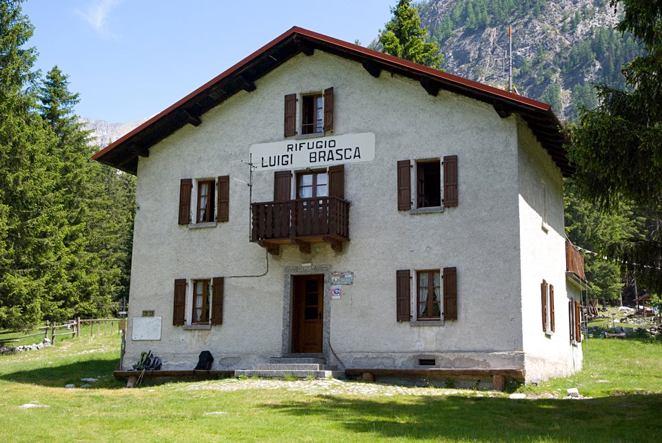 Photo: Ras78, CC BY-SA 3.0 (via Wikimedia Commons)
Rifugio Luigi Brasca
~11 min drive
A mountain hut in Lombardy, Italy.
 Photo: Coronium, CC BY-SA 3.0 (via Wikimedia Commons)
Capanna Sasc Furä
~12 min drive
A mountain hut in Grisons, Switzerland.
 Photo: Superchilum, CC BY-SA 4.0 (via Wikimedia Commons)
Bivacco Carlo Valli
~13 min drive
An unstaffed wilderness hut in Lombardy, Italy.
Also worth it near here
 Photo: schoella, CC BY 3.0 (via Wikimedia Commons)
Sentiero da Santa Croce a Stalle ai Ronchi
~1 min drive
Cascata del Cavrii
~1 min drive
 Photo: Schölla Schwarz, CC BY 3.0 (via Wikimedia Commons)
Motto del Piano
~4 min drive
 Photo: Schölla Schwarz, CC BY 3.0 (via Wikimedia Commons)
Sentiero per Avero
~5 min drive
Lido della Boggia
~8 min drive
Conditions and forecast
Daily highs and lows, wind and the chance of precipitation at Camping Acquafraggia for the next 7 days, from the Open-Meteo model.
Map and trail data © OpenStreetMap contributors
