Vallon du Colombier
- 2.6 mi
- one way
- 1,463 ft
- climb
- 1,513 ft
- high point
- Point to point
- route
Vallon du Colombier is a 2.6-mile point-to-point route in Provence-Alpes-Côte d'Azur, France, inside Parc naturel régional du Luberon. It runs between about 460 ft and 1,510 ft above sea level, with roughly 1,460 ft of climbing one way. It is mapped as a named hiking route, with the sections joined into one trail here. The nearest town is Taillades, about 1.1 miles south of the trailhead. For camping, Camping les Royères du Prieuréalt and La Durance are within about 6 miles. There are 10 other mapped trails within about 3 miles, so you can combine or extend the outing. Distances, elevations and the route shape here come from OpenStreetMap and the Copernicus 90 m elevation model. Trails, access rules and conditions change, so check locally before you go.
Keep exploring — more trails worth the drive
 Photo: Tiberio Frascari from Bologna, Italia, Public domain (via Wikimedia Commons)
Via Aurelia, Aix - Salon de Provence
~21 min drive
A 25-mile point-to-point route in Provence-Alpes-Côte d'Azur, France.
 Photo: Mathieu BROSSAIS, CC BY 4.0 (via Wikimedia Commons)
Sentier du Pas de l'Escalette
~53 min drive
A 0.4-mile point-to-point route in Provence-Alpes-Côte d'Azur, France.
 Photo: Mathieu BROSSAIS, CC BY 4.0 (via Wikimedia Commons)
Sentier du pas du moine
~53 min drive
A 1.4-mile point-to-point route in Provence-Alpes-Côte d'Azur, France.
HIKE
Sentier de la Touloubre
~25 min drive
An out-and-back trail, 0.3 miles each way (0.7 miles round trip) in Provence-Alpes-Côte d'Azur, France.
HIKE
Ravin du Loup
~35 min drive
An out-and-back trail, 0.8 miles each way (1.6 miles round trip) in Provence-Alpes-Côte d'Azur, France.
 Photo: Stéphane Gallay from Laconnex, Switzerland, CC BY 2.0 (via Wikimedia Commons)
Château de Buoux - Les Picatiers
~24 min drive
A 0.9-mile point-to-point route in Provence-Alpes-Côte d'Azur, France.
HIKE
Roche ronde
~2 min drive
An out-and-back trail, 0.9 miles each way (1.7 miles round trip) in Provence-Alpes-Côte d'Azur, France.
HIKE
Descente du cul par terre
~2 min drive
A 1.1-mile point-to-point route in Provence-Alpes-Côte d'Azur, France.
HIKE
Chemin de Tranche Boudin
~37 min drive
An out-and-back trail, 0.7 miles each way (1.5 miles round trip) in Provence-Alpes-Côte d'Azur, France.
 Photo: This picture belongs to Xavier Caré.
Please credit : Xavier Caré / Wikimedia Commons / CC-BY-SA.
If you would like special permission to use, license, or purchase the image please contact me to negotiate terms.
I'd appreciate if you could let me know about it or mail me ( xavier.carepm.me) if you want to use this picture out of the Wikimedia project scope., CC BY-SA 4.0 (via Wikimedia Commons)
Abbaye Saint-Honorat – Arènes d'Arles
~43 min drive
A 0.7-mile point-to-point route in Provence-Alpes-Côte d'Azur, France.
Also worth it near here
 Photo: Véronique PAGNIER, CC BY-SA 3.0 (via Wikimedia Commons)
Colline Saint-Jacques
~6 min drive
SEE
Bastidon du Pradon
~7 min drive
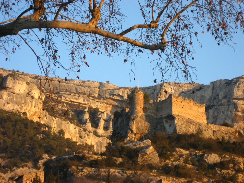 Photo: Joel Takv, CC BY-SA 2.5 (via Wikimedia Commons)
Circuit VTT : Fontaine de Vaucluse
~12 min drive
 Photo: Stuart Locke, CC BY-SA 3.0 (via Wikimedia Commons)
Les Oliviers
~14 min drive
SEE
Canal de Marseille
~18 min drive
Conditions and forecast
Daily highs and lows, wind and the chance of precipitation at Vallon du Colombier for the next 7 days, from the Open-Meteo model.
Map and trail data © OpenStreetMap contributors
