Piz Urtiola
- 9,544 ft
- summit
Piz Urtiola is a mountain in Grisons, Switzerland, with its summit at about 9,540 ft (2,909 m) above sea level. It stands inside Biosfera Val Müstair. No mapped trail reaches the top in OpenStreetMap, so plan the approach with local maps or a guide. The nearest town is Lü, about 1.8 miles northeast of the summit. Peaks within about 3 miles include Piz Terza, Muntet and Döss da Val S-chüra. Cascada da Pisch is within about 3 miles. For camping, Camping Muglin and Pe da Munt are within about 6 miles. It sits on the border between Switzerland and Italy. It is part of the Sesvenna Range. Its topographic prominence, the height it rises above the lowest col linking it to higher ground, is about 900 ft (275 m). These details come from Wikidata. The location and elevation come from OpenStreetMap and the Copernicus 90 m elevation model. Check local access rules and conditions before you go.
Conditions and forecast
Daily highs and lows, wind and the chance of precipitation at the summit for the next 7 days, from the Open-Meteo model.
- Summit elevation
- 9,544 ft
We don't know of a mapped trail or route to the summit of Piz Urtiola. Plan the approach with local maps, a guidebook or a local guide, and check conditions before you go.
Questions about Piz Urtiola
How tall is Piz Urtiola?
9,544 ft (2,909 m).
Is there a trail to the top of Piz Urtiola?
We don't know of a mapped trail or route to the summit. Plan the approach with local maps, a guidebook or a local guide.
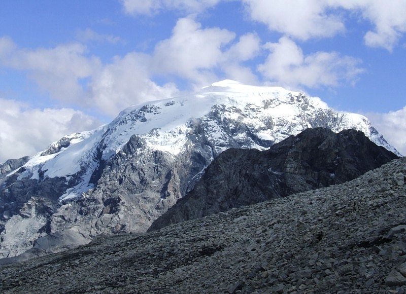 Ortler12,812 ft · Trentino-South Tyrol, Italy1 route11 mi awayPhoto: No machine-readable author provided. Idéfix~commonswiki assumed (based on copyright claims)., CC BY-SA 3.0 (via Wikimedia Commons)
 Wildspitze12,362 ft · Tyrol, Austria1 route28 mi awayPhoto: Pirmin Olde Weghuis, CC BY-SA 3.0 (via Wikimedia Commons)
 Piz Bernina13,281 ft · Grisons, Switzerland1 route29 mi awayPhoto: Günter Seggebäing, CC BY-SA 3.0 (via Wikimedia Commons)
 Presanella11,667 ft · Trentino-South Tyrol, Italy1 route32 mi awayPhoto: Grasso83, CC BY-SA 3.0 (via Wikimedia Commons)
 Zugspitze9,718 ft · Tyrol, Austria1 route61 mi awayPhoto: Tuxyso, CC BY-SA 4.0 (via Wikimedia Commons)
 Rheinwaldhorn11,161 ft · Grisons, Switzerland1 route66 mi awayPhoto: Werner Friedli, CC BY-SA 4.0 (via Wikimedia Commons)
- Piz Terza (Skitour)Ski touring1.8 mi
 Biosfera Val MüstairState parkPhoto: Badener, CC BY-SA 3.0 (via Wikimedia Commons)2.3 mi
- Münstertal TrailMountain biking2.3 mi
- Camping MuglinCamping2.5 mi
 MinschunsSummitPhoto: gertrudis2010, CC BY-SA 3.0 (via Wikimedia Commons)3 mi
- Pe da MuntCamping3.1 mi
 Piz SesvennaSummitPhoto: Luidger, CC BY-SA 3.0 (via Wikimedia Commons)4.6 mi
 Schweizerischer NationalparkState parkPhoto: Hansueli Krapf, CC BY-SA 3.0 (via Wikimedia Commons)8.1 mi
Source: Roamze catalog (indexable pages within 10 miles, PostGIS distance)
- MinschunsSummit · ~5 min drivePhoto: gertrudis2010, CC BY-SA 3.0 (via Wikimedia Commons)
 Munt da la BeschaSummit · ~7 min drivePhoto: Hermann Hammer (User:Haneburger), CC0 (via Wikimedia Commons)
- Piz SesvennaSummit · ~8 min drivePhoto: Luidger, CC BY-SA 3.0 (via Wikimedia Commons)
 Piz Chavalatsch - Monte CavallaccioSummit · ~8 min drivePhoto: Kuebi, CC BY-SA 3.0 (via Wikimedia Commons)
 Piz LadSummit · ~8 min drivePhoto: Thomas Woodtli from Zürich, Switzerland, CC BY-SA 2.0 (via Wikimedia Commons)
 Piz TurettasSummit · ~8 min drivePhoto: Capricorn4049, CC BY-SA 4.0 (via Wikimedia Commons)
 Piz DoraSummit · ~9 min drivePhoto: Speleo14, CC BY-SA 3.0 (via Wikimedia Commons)
 Piz StarlexSummit · ~3 min drivePhoto: 32 Fuß-Freak, CC BY-SA 4.0 (via Wikimedia Commons)
 Piz StarlexSummit · ~3 min drivePhoto: 32-Fuß-Freak, CC BY-SA 4.0 (via Wikimedia Commons)
 Piz PlazèrSummit · ~8 min drivePhoto: Capricorn4049, CC BY-SA 4.0 (via Wikimedia Commons)

Map and trail data © OpenStreetMap contributors
