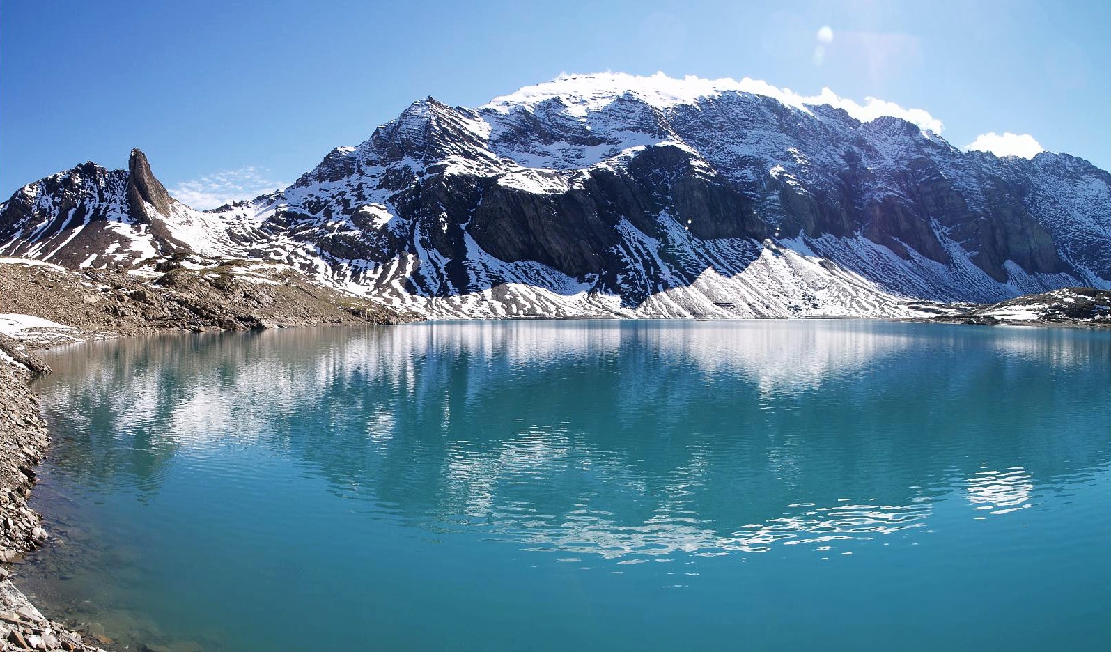
Muttenstock
 Photo: Capricorn4049, CC BY-SA 3.0 (via Wikimedia Commons)
- 10,135 ft
- summit
Muttenstock is a mountain in Grisons, Switzerland, with its summit at about 10,130 ft (3,089 m) above sea level. No mapped trail reaches the top in OpenStreetMap, so plan the approach with local maps or a guide. The nearest town is Pigniu, about 4.3 miles northwest of the summit. Peaks within about 3 miles include Piz Gavirolas, Muttenbergen and Crap Ner. It is part of the Tödi-Hausstock Group. Its topographic prominence, the height it rises above the lowest col linking it to higher ground, is about 340 ft (103 m). These details come from Wikidata. The location and elevation come from OpenStreetMap and the Copernicus 90 m elevation model. Check local access rules and conditions before you go.
Conditions and forecast
Daily highs and lows, wind and the chance of precipitation at the summit for the next 7 days, from the Open-Meteo model.
- Summit elevation
- 10,135 ft
We don't know of a mapped trail or route to the summit of Muttenstock. Plan the approach with local maps, a guidebook or a local guide, and check conditions before you go.
Questions about Muttenstock
How tall is Muttenstock?
10,135 ft (3,089 m).
Is there a trail to the top of Muttenstock?
We don't know of a mapped trail or route to the summit. Plan the approach with local maps, a guidebook or a local guide.
 Tödi11,850 ft · Glarus, Switzerland1 route6.8 mi awayPhoto: Carsten Steger, CC BY-SA 4.0 (via Wikimedia Commons)
 Rheinwaldhorn11,161 ft · Grisons, Switzerland1 route25 mi awayPhoto: Werner Friedli, CC BY-SA 4.0 (via Wikimedia Commons)
 Dammastock11,909 ft · Uri, Switzerland1 route33 mi awayPhoto: Paebi, CC BY-SA 3.0 (via Wikimedia Commons)
 Piz Bernina13,281 ft · Grisons, Switzerland1 route52 mi awayPhoto: Günter Seggebäing, CC BY-SA 3.0 (via Wikimedia Commons)
 Jungfrau13,642 ft · Valais, Switzerland1 route56 mi awayPhoto: Daniel Reust, CC BY-SA 4.0 (via Wikimedia Commons)
 Weissmies13,166 ft · Valais, Switzerland1 route70 mi awayPhoto: Michael Schmid, CC BY-SA 3.0 (via Wikimedia Commons)
 MuttenbergenSummitPhoto: Staublex, CC BY-SA 4.0 (via Wikimedia Commons)0.6 mi
 Crap NerSummitPhoto: Dominicus Johannes Bergsma, CC BY-SA 4.0 (via Wikimedia Commons)0.9 mi
 KistenpasshütteHut campingPhoto: meg1978, CC BY 2.0 (via Wikimedia Commons)1 mi
 RuchiSummitPhoto: Wala, CC BY-SA 3.0 (via Wikimedia Commons)1 mi
 MuttseehütteHut campingPhoto: Capricorn4049, CC BY-SA 3.0 (via Wikimedia Commons)1.4 mi
 BifertenhütteHut campingPhoto: No machine-readable author provided. Albin35~commonswiki assumed (based on copyright claims)., CC BY-SA 2.5 (via Wikimedia Commons)2.6 mi
- Senda Pass dil VeptgaMountain biking3.7 mi
- Tödi: Approach to 7,800 ft from the road endHikingPhoto: Carsten Steger, CC BY-SA 4.0 (via Wikimedia Commons)4.4 mi
Source: Roamze catalog (indexable pages within 10 miles, PostGIS distance)
- MuttenbergenSummit · ~1 min drivePhoto: Staublex, CC BY-SA 4.0 (via Wikimedia Commons)
- Crap NerSummit · ~2 min drivePhoto: Dominicus Johannes Bergsma, CC BY-SA 4.0 (via Wikimedia Commons)
- RuchiSummit · ~2 min drivePhoto: Wala, CC BY-SA 3.0 (via Wikimedia Commons)
 Chli RuchiSummit · ~2 min drivePhoto: Capricorn4049, CC BY-SA 3.0 (via Wikimedia Commons)
 Piz FluazSummit · ~3 min drivePhoto: Agnes Monkelbaan, CC BY-SA 4.0 (via Wikimedia Commons)
 KistenstöckliSummit · ~4 min drivePhoto: Pirmin Janka at de.wikipedia, CC BY-SA 3.0 (via Wikimedia Commons)
 Hinter SelbsanftSummit · ~6 min drivePhoto: Stan45, Public domain (via Wikimedia Commons)
 NüschenstockSummit · ~3 min drivePhoto: Capricorn4049, CC BY-SA 3.0 (via Wikimedia Commons)
 HausstockSummit · ~3 min drivePhoto: böhringer friedrich, CC BY-SA 2.5 (via Wikimedia Commons)
 RüchiSummit · ~4 min drivePhoto: Capricorn4049, CC BY-SA 3.0 (via Wikimedia Commons)
Also worth it near here
- KistenpasshütteHut camping · ~2 min drivePhoto: meg1978, CC BY 2.0 (via Wikimedia Commons)
- Tödi: Approach to 7,800 ft from the road endHiking · ~8 min drivePhoto: Carsten Steger, CC BY-SA 4.0 (via Wikimedia Commons)
- BerglistüberWaterfall · ~9 min drive
 Crap MasegnMountain biking · ~11 min drivePhoto: Adrian Michael, CC BY-SA 3.0 (via Wikimedia Commons)
- Wohnmobil-/Zeltstellplatz TufCamping · ~11 min drive
Map and trail data © OpenStreetMap contributors
