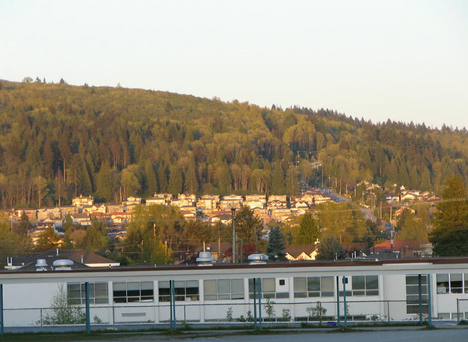
Mount Burke
 Photo: BurkeCoquitlam, CC BY-SA 3.0 (via Wikimedia Commons)
- 797 ft
- summit
- May–Sep
- best months
Mount Burke is a mountain in British Columbia, Canada, with its summit at about 800 ft (243 m) above sea level. It stands inside Pinecone Burke Provincial Park. Mapped trails that come within about half a mile of the top include Mt. Burke Route and Log Walk. The nearest town is Coquitlam, about 4.0 miles northeast of the summit. Peaks within about 3 miles include Sheridan Hill. Pritchett Creek Cascades and Sweat Team Falls are within about 3 miles. For camping, Widgeon Creek Campsite is within about 6 miles. The location and elevation come from OpenStreetMap and the Copernicus 90 m elevation model. Check local access rules and conditions before you go.
- Summit elevation
- 797 ft
We don't know of a mapped trail or route to the summit of Mount Burke. Plan the approach with local maps, a guidebook or a local guide, and check conditions before you go.
Questions about Mount Burke
How tall is Mount Burke?
797 ft (243 m).
Is there a trail to the top of Mount Burke?
We don't know of a mapped trail or route to the summit. Plan the approach with local maps, a guidebook or a local guide.
- Chuckanut Mountain2,309 ft · Washington1 route49 mi away
- Excelsior Peak5,702 ft · Washington2 routes49 mi away
- Winchester Mountain6,507 ft · Washington1 route54 mi away
- Grant Peak10,777 ft · Washington2 routes55 mi away
 Table Mountain5,740 ft · Washington3 routes55 mi awayPhoto: Ron Clausen, CC BY-SA 4.0 (via Wikimedia Commons)
- Park Butte5,453 ft · Washington1 route56 mi away
 Coquitlam MountainSummit · ~10 min drivePhoto: Iwona Erskine-Kellie, CC BY 2.0 (via Wikimedia Commons)
 Sasamat HillSummit · ~14 min drivePhoto: Juraj Tatár, CC BY-SA 3.0 (via Wikimedia Commons)
 Woodhaven HillSummit · ~15 min drivePhoto: Jeff Macleod, CC BY-SA 3.0 (via Wikimedia Commons)
 Blanshard PeakSummit · ~17 min drivePhoto: The Cosmonaut, CC BY-SA 2.5 ca (via Wikimedia Commons)
 Alouette MountainSummit · ~17 min drivePhoto: The Cosmonaut, CC BY-SA 2.5 ca (via Wikimedia Commons)
 Evans PeakSummit · ~18 min drivePhoto: The High Fin Sperm Whale, CC BY-SA 3.0 (via Wikimedia Commons)
 Burnaby MountainSummit · ~16 min drivePhoto: User:Flying Penguin, CC BY-SA 3.0 (via Wikimedia Commons)
 Edge PeakSummit · ~18 min drivePhoto: The Cosmonaut, CC BY-SA 2.5 ca (via Wikimedia Commons)
- Sheridan HillSummit · ~5 min drive
- Hourglass PeakSummit · ~5 min drive
Also worth it near here
- Log WalkHiking · Next door
 Crystal FallsWaterfall · ~4 min drivePhoto: Alex of Canada, CC BY-SA 4.0 (via Wikimedia Commons)
- Widgeon Creek CampsiteCamping · ~10 min drive
 Buntzen Lake South BeachBeach · ~12 min drivePhoto: Ben Waardenburg benwubbleyou, CC0 (via Wikimedia Commons)
- Eric Dunning TrailMountain biking · ~15 min drive
Best time to visit Mount Burke
Best months: May–September. Best months have typical highs of 55–85 °F, lows of 30 °F or warmer (32 °F where the station doesn't record snow), at most one snowy day and no more than 12 wet days.
Jan
45° / 34°
18 wet
Feb
48° / 35°
16 wet
Mar
52° / 38°
17 wet
Apr
58° / 42°
14 wet
May
64° / 47°
11 wet
Jun
69° / 52°
10 wet
Jul
73° / 55°
6 wet
Aug
73° / 55°
6 wet
Sep
67° / 50°
9 wet
Oct
57° / 44°
15 wet
Nov
50° / 38°
19 wet
Dec
44° / 34°
19 wet
Typical high / low (°F) and days with rain or snow, 1991–2020. Measured at Blaine, WA, 23.1 mi away at 60 ft. The station sits about 700 ft lower than this place, so expect it a little cooler here. This station doesn't record snowfall. Source: NOAA NCEI U.S. Climate Normals 1991–2020.
Conditions and forecast
Daily highs and lows, wind and the chance of precipitation at the summit for the next 7 days, from the Open-Meteo model.
Map and trail data © OpenStreetMap contributors
