Belcarra Mountain
- 925 ft
- summit
- Metro Vancouver Regional Parks
- managed by
- May–Sep
- best months
Belcarra Mountain is a mountain in British Columbia, Canada, with its summit at about 930 ft (282 m) above sea level. It stands inside təmtəmíxʷtən/Belcarra Regional Park. Mapped trails that come within about half a mile of the top include Jingle All The Way and Lower Jamtart Trails. The nearest town is Belcarra, about 0.7 miles south of the summit. Peaks within about 3 miles include Woodhaven Hill, Burnaby Mountain and Wickenden Peak. Sunshine Falls is within about 3 miles. For camping, North Twin Campground and Mount Seymour Group Campsite are within about 6 miles. The location and elevation come from OpenStreetMap and the Copernicus 90 m elevation model. Check local access rules and conditions before you go.
Conditions and forecast
Daily highs and lows, wind and the chance of precipitation at the summit for the next 7 days, from the Open-Meteo model.
- Summit elevation
- 925 ft
- Land manager
- Metro Vancouver Regional Parks
We don't know of a mapped trail or route to the summit of Belcarra Mountain. Plan the approach with local maps, a guidebook or a local guide, and check conditions before you go.
Questions about Belcarra Mountain
How tall is Belcarra Mountain?
925 ft (282 m).
Is there a trail to the top of Belcarra Mountain?
We don't know of a mapped trail or route to the summit. Plan the approach with local maps, a guidebook or a local guide.
- Chuckanut Mountain2,309 ft · Washington1 route52 mi away
- Excelsior Peak5,702 ft · Washington2 routes57 mi away
 Wedge Mountain9,498 ft · British Columbia, Canada1 route58 mi awayPhoto: Kilrogg, CC BY-SA 3.0 (via Wikimedia Commons)
- Mount Finlayson296 ft · Washington1 route58 mi away
- Grant Peak10,777 ft · Washington2 routes62 mi away
- Winchester Mountain6,507 ft · Washington1 route62 mi away
 Woodhaven HillSummit · ~2 min drivePhoto: Jeff Macleod, CC BY-SA 3.0 (via Wikimedia Commons)
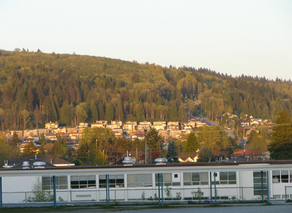 Burnaby MountainSummit · ~3 min drivePhoto: User:Flying Penguin, CC BY-SA 3.0 (via Wikimedia Commons)
 Sasamat HillSummit · ~3 min drivePhoto: Juraj Tatár, CC BY-SA 3.0 (via Wikimedia Commons)
 Dog MountainSummit · ~9 min drivePhoto: David Abercrombie, CC BY-SA 2.0 (via Wikimedia Commons)
 Mount ElsaySummit · ~12 min drivePhoto: Stephen Hui, CC BY-SA 4.0 (via Wikimedia Commons)
- Wickenden PeakSummit · ~3 min drive
- Sugar MountainSummit · ~5 min drive
- Cima Amanecer (Sunrise Hill)Summit · ~5 min drive
- Capitol HillSummit · ~6 min drive
- Percy KnobSummit · ~8 min drive
Also worth it near here
- Small Wheel Trail South LoopHiking · ~1 min drive
 Jug Island BeachBeach · ~3 min drivePhoto: Ruth Hartnup from Vancouver, Canada, CC BY 2.0 (via Wikimedia Commons)
 Cates Park boat rampBoat launch · ~3 min drivePhoto: BillB2000, CC BY-SA 3.0 (via Wikimedia Commons)
- North Twin CampgroundCamping · ~6 min drive
 Twin FallsWaterfall · ~9 min drivePhoto: PheobeLongneck, CC0 (via Wikimedia Commons)
Best time to visit Belcarra Mountain
Best months: May–September. Best months have typical highs of 55–85 °F, lows of 30 °F or warmer (32 °F where the station doesn't record snow), at most one snowy day and no more than 12 wet days.
Jan
45° / 34°
18 wet
Feb
48° / 35°
16 wet
Mar
52° / 38°
17 wet
Apr
58° / 42°
14 wet
May
64° / 47°
11 wet
Jun
69° / 52°
10 wet
Jul
73° / 55°
6 wet
Aug
73° / 55°
6 wet
Sep
67° / 50°
9 wet
Oct
57° / 44°
15 wet
Nov
50° / 38°
19 wet
Dec
44° / 34°
19 wet
Typical high / low (°F) and days with rain or snow, 1991–2020. Measured at Blaine, WA, 23.2 mi away at 60 ft. The station sits about 900 ft lower than this place, so expect it a little cooler here. This station doesn't record snowfall. Source: NOAA NCEI U.S. Climate Normals 1991–2020.
Map and trail data © OpenStreetMap contributors
