Winom Creek Cg/Th
Oregon
Free — you'll pick up right here.
No verdict for this campground
We won't guess. Here is exactly what we do and don't know.
What we do know
Inside Umatilla National Forest
2 managing-area boundaries mapped — agency alerts for them feed this page automatically.
Boundary data
What's missing
No access route mapped
We don't yet know which road reaches this trailhead, so we can't tell you if it's gated.
Nobody's filed a report here yet — be the first.
Here's your stay, mapped
Winom Creek Cg/Th
Suggested plan · check conditions before you go
Gear for the day
Meals
Photos
About this campground
This campground is located along the paved; Blue Mountain Scenic Byway southeast of Ukiah, OR. There are 10 campsites (3 of which are group sites) and 2 accessible toilets. Sites 3 and 4 have log picnic shelters. There is an interpretive sign near the information board and OHV loading dock. There is no water or garbage service, so please pack your garbage home.2018 Winom-Frazier OHV Complex and Desolation OHV Trail System Map ; - June; 3, 2019; (pdf file - 466kb)Trail access: The Tower Loop Trail #3040 connects with the; campground providing; access to; the southern end of the Winom-Frazier OHV Complex with over 100 miles of trail to enjoy. Nearby is the North Fork John Day Wilderness which is accessed via the; North Winom Creek Trail #3160; and; South Winom Creek Trail #3153; which are located across Winom Creek off Forest Service Road; 52-440 just beyond the campground.Available; activities nearby also include hunting, sight-seeing, mushroom picking, huckleberry picking, photography and the Ukiah-Granite Roadside Geology tour.For information about accessible recreation opportunities in Pacific Northwest National Forests, visit http://www.fs.usda.gov/goto/r6/accessiblerecreation
Campsite info
Directions & GPX
Facts about this campground
Where it is
- North Fork John Day Ranger District · Ranger district
- Umatilla National Forest · National forest
- Managed by
- Forest Service
Conditions
Active alerts for North Fork John Day Ranger District as of Oct 9, 2026:
Wake and Personal Watercraft Prohibition on Olive Lake
information · posted Aug 24, 2026
Source: USFS forest alerts
Nearby
- Tower Loop TrailHiking0.2 mi
- Big CreekCanoeing0.9 mi
- Big Creek Mdws Cg/ThCamping1 mi
- Oriental Cg/ThCamping5.1 mi
- Umapine CampgroundCamping8 mi
- Gold Dredge CgCamping8.8 mi
- Lehman Trail (No. 3188)Hiking9.9 mi
Source: Roamze catalog (indexable pages within 10 miles, PostGIS distance)
Add to a trip & share
Keep exploring — more campsites worth the drive
Peavy Cabin
~34 min drive
A worthwhile stop near Oregon.
Anthony Lake
~35 min drive
A worthwhile stop near Oregon.
Mud Lake Campground
~35 min drive
A worthwhile stop near Oregon.
Welch Creek Cg/Th
~20 min drive
A worthwhile stop near Oregon.
North Fork John Day Campground
~23 min drive
North Fork John Day Campground is a campground in Oregon at about 5,190 feet. It is managed by the U.S. Forest Service.
Frog Heaven Forest Camp
~24 min drive
A worthwhile stop near Oregon.
Tollbridge Cg
~25 min drive
A worthwhile stop near Oregon.
Caretakers Cabin
~28 min drive
A worthwhile stop near Oregon.
Congo Gulch
~28 min drive
A worthwhile stop near Oregon.
Spool Cart Campground
~30 min drive
A worthwhile stop near Oregon.
Also worth it near here
Warm Mineral Spring
~16 min drive
 Photo: Finetooth, CC BY-SA 3.0 (via Wikimedia Commons)
Sheep Rock
~27 min drive
Meadow Brooks Falls
~27 min drive
 Photo: Forest Service Pacific Northwest Region, Public Domain Mark (via Flickr)
Saddle Camp Trail
~28 min drive
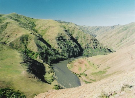 Photo: Dsdugan, Public domain (via Wikimedia Commons)
Grande Ronde River
~32 min drive
