
Esmerelda RV Park & Cabins
Campground
11 mi from the trail
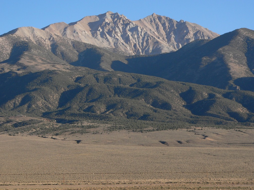
 Photo: JonathanLamb (talk · contribs), CC BY 3.0 (via Wikimedia Commons)
White Mountain Peak is a summit in the White Mountain Ranger District of Inyo National Forest in eastern California, managed by the Forest Service. The nearest town is Chalfant, about 12 miles away. Several hikes lie within a few miles of the summit. Jeffrey Mine Upper Trail is about 4 miles away and Jeffrey Mine about 5. West Ridge Route and Leidy Creek are both a little over 5 miles off.
Where it is: White Mountain Ranger District · Inyo National Forest
Near: Bishop
Been here? Tell people how it was.
| White Mountain Peak | West Ridge Route | |
|---|---|---|
| Starts at | Locked gate below Barcroft Station | — |
| Climbing | About 3,385 ft | — |
| Round trip | 14.2 mi | 11.7 mi |
| Difficulty | Expert | Hard |
| Terrain | Hike | Hike |


 Cottonwood Basin Overlook LoopHikingPhoto: RuggyBearLA, CC BY 2.0 (via Flickr)8 miPatriarch/ancients Vis LoopHikingPhoto: RuggyBearLA, CC BY 2.0 (via Flickr)8 mi
 Mount DuboisSummitPhoto: Martin Stiburek, CC BY-SA 4.0 (via Wikimedia Commons)~19 min driveBoundary PeakSummitPhoto: An63ca (talk · contribs), Public domain (via Wikimedia Commons)~27 min drive
 Glass MountainSummitPhoto: Eeekster, CC BY 3.0 (via Wikimedia Commons)~46 min driveMount TomSummitPhoto: Eeekster, CC BY-SA 4.0 (via Wikimedia Commons)~51 min drive
 Basin MountainSummitPhoto: Justin, CC BY 2.0 (via Wikimedia Commons)~55 min drive
 Mount HopkinsSummitPhoto: Fred Hsu from San Jose, United States, CC BY 2.0 (via Wikimedia Commons)~56 min drive
 Mount BaldwinSummitPhoto: Channel City Camera Club from Santa Barbara, US, CC BY 2.0 (via Wikimedia Commons)~57 min drive
 Mount MorrisonSummitPhoto: The original uploader was Geographer at English Wikipedia., CC BY 1.0 (via Wikimedia Commons)~57 min drive
 Bear Creek SpireSummitPhoto: Adorabutton, CC BY-SA 4.0 (via Wikimedia Commons)~58 min drive
 Mount MillsSummitPhoto: Jonathan Fox from Carson City, United States, CC BY-SA 2.0 (via Wikimedia Commons)~58 min drive
Daily highs and lows, wind and the chance of precipitation at the summit and locked gate below barcroft station for the next 7 days, from the Open-Meteo model.
14,243 ft (4,341 m).
2: White Mountain Peak and West Ridge Route.
West Ridge Route, about 11.7 mi round trip.
White Mountain Peak starts at Locked gate below Barcroft Station.
Questions about White Mountain Peak: conditions, access, timing. Answers say when something isn't known.
Esmerelda RV Park & Cabins
Campground
Thai Thai Restaurant
Restaurant
Places © OpenStreetMap contributors
More in Bishop