Gem Lake Caribou
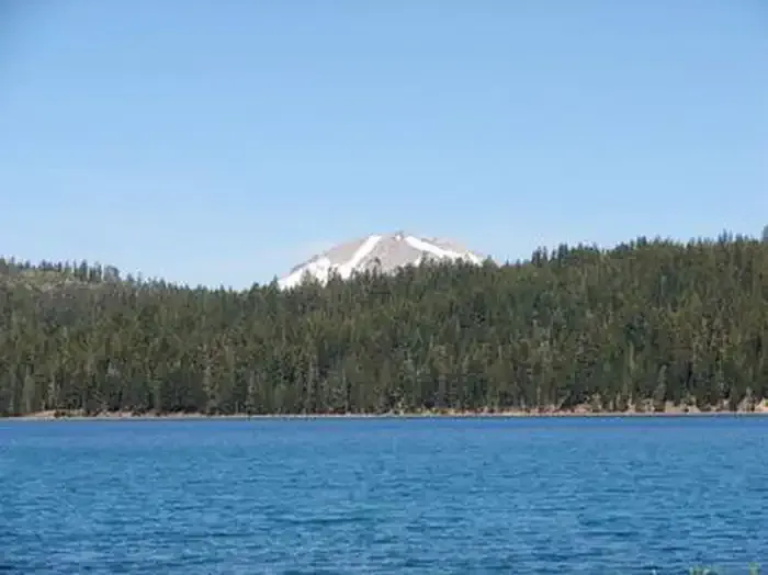
 Photo: Seth Tisue, CC BY-SA 2.0 (via Flickr)
At a glance
Gem Lake Caribou is a short, easy hike in the Caribou Wilderness, part of the Almanor Ranger District of Lassen National Forest in northern California. The Forest Service manages the land, and the trail sits within designated wilderness. The route is an out-and-back about 0.35 miles long, with a one-way gain of about 90 feet. The trail has a natural surface and is open to horses. Bikes are not allowed. Summer is the most comfortable time to go. Typical averages from a nearby weather station at Manzanita Lake put July highs around 79°F with lows near 46°F. That station sits well below the trail, so temperatures on the higher ground run cooler. Nearby options include Emerald-Cypress Caribou, about 0.4 miles away, and Jewel Lake, about 0.8 miles away. For camping, Silver Bowl Campground is about 1.4 miles away and Echo Lake Camping Area is about 4.9 miles away.
- round trip
- 0.4 mi
- climb
- 90 ft
- high point
- 6,992 ft
- route
- Out and back
- best months
- May–Oct
Where it is: Caribou Wilderness · Almanor Ranger District
Near: Susanville
Best time to visit Gem Lake Caribou
Best months: May–October. Best months have typical highs of 55–85 °F, lows of 30 °F or warmer (32 °F where the station doesn't record snow), at most one snowy day and no more than 12 wet days.
Jan
41°
22°
Feb
42°
22°
Mar
46°
24°
Apr
50°
27°
May
61°
35°
Jun
70°
41°
Jul
79°
46°
Aug
78°
45°
Sep
72°
41°
Oct
59°
33°
Nov
47°
26°
Dec
39°
22°
Typical high / low (°F) and days with rain or snow, 1991–2020. Measured at Manzanita Lake, CA, 20.5 mi away at 5,750 ft. The station sits about 1,200 ft lower than this place, so expect it a little cooler here. This station doesn't record snowfall. Source: NOAA NCEI U.S. Climate Normals 1991–2020.
Been here? Tell people how it was.
- Emerald-Cypress CaribouHikingPhoto: Seth Tisue, CC BY-SA 2.0 (via Flickr)0.4 mi
- Jewel LakeHikingPhoto: Seth Tisue, CC BY-SA 2.0 (via Flickr)0.8 mi
- Turnaround Lake TrailHiking1.3 mi
- Silver Bowl CampgroundCamping1.4 mi
- Echo Lake Camping AreaCamping4.9 mi
 Juniper Lake GroupCampingPhoto: Recreation.gov (RIDB) / public domain6.5 mi
 The Fallout ZoneRock climbingPhoto: Ken Lund, CC BY-SA 2.0 (via Flickr)9.5 mi
- The Loading ZoneRock climbing9.6 mi
 Caribou-N. Divide CaribouHikingPhoto: Seth Tisue, CC BY-SA 2.0 (via Flickr)~2 min drive
 Crystal Lake TrailHikingPhoto: ray_explores, CC BY 2.0 (via Flickr)~11 min drive
 Butte Lake To Snag Lake TrailHikingPhoto: Vlad & Marina Butsky on Flickr, CC BY 2.0 (via Wikimedia Commons)~10 min drive
- BUTTE LAKEHiking~8 min drive
 Rainbow Lake To Nobles TrailHikingPhoto: inkknife_2000 (7.5 million views +), CC BY-SA 2.0 (via Wikimedia Commons)~14 min drive
- Bathtub Lake TrailHikingPhoto: Vlad & Marina Butsky on Flickr, CC BY 2.0 (via Wikimedia Commons)~12 min drive
- Cone-Hay Mdws CaribouHiking~5 min drive
- Emerald-Cypress CaribouHikingPhoto: Seth Tisue, CC BY-SA 2.0 (via Flickr)Next door
- Cinder Cone TrailHiking~13 min drive
- Red Cinder Cone TrailHiking~6 min drive
Conditions and forecast
Caution todayAgency alerts are in effect for this areaUSFS · checked just nowDaily highs and lows, wind and the chance of precipitation at Start for the next 7 days, from the Open-Meteo model.
Ask about this place
Questions about Gem Lake Caribou: conditions, access, timing. Answers say when something isn't known.
