Cinder Cone Trail
- 0.6 mi
- loop
- 53 ft
- climb
- 6,909 ft
- high point
- Loop
- route
- May–Oct
- best months
Is Cinder Cone Trail open right now?
Closure in the area
There's a closure order in Lassen Volcanic National Park. It doesn't name Cinder Cone Trail, so check the source for the area it covers.
Lassen National Park Highway Closed to Vehicle Traffic
Park closure covering Lassen Volcanic National Park · NPS · Lassen Volcanic National Park
As of · Source: NPS · Lassen Volcanic National Park. Agencies don't list every closure — check before you go.
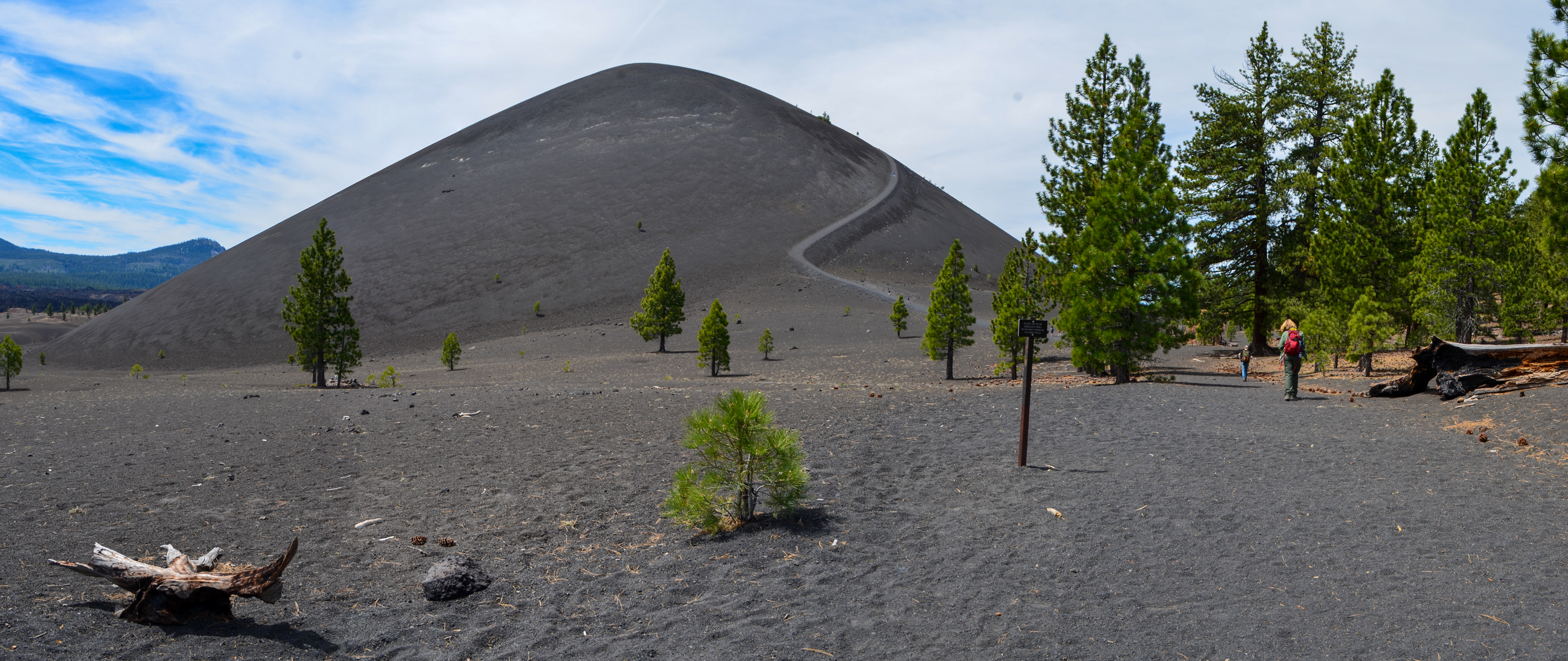
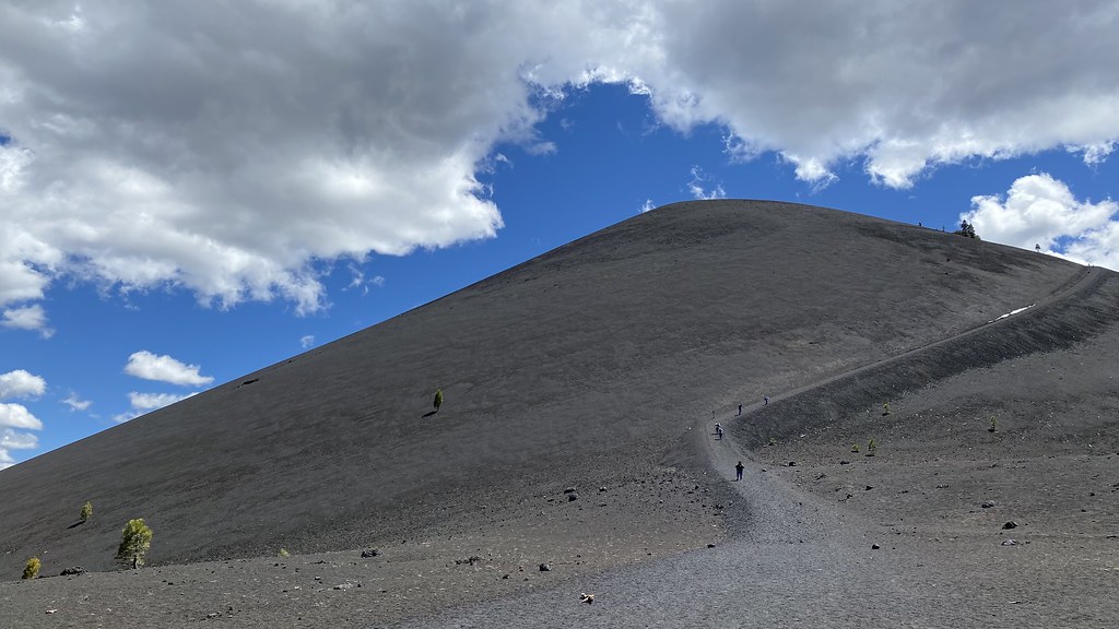
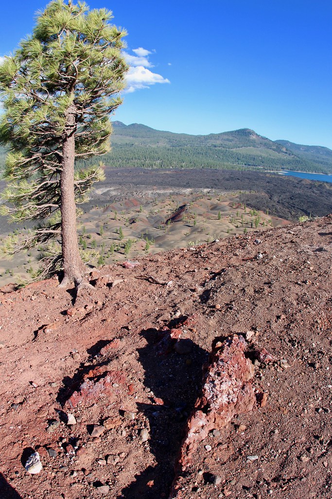
Start: Butte Lake parking area Round-Trip Distance to Base: 2.4 miles Round Trip Distance to Summit: 4 miles Round-Trip Time: 3 hours Elevation Change: 846 ft Elevation: 6,061 - 6,907 feet Trail Surface: Cinders (similar to course sand) Season: Approximately June through November Hike to the base or summit of the dramatic Cinder Cone volcano via this popular trail in the Butte Lake Area. The sand-like cinders on this trail make the hike challenging, especially when climbing the steep 200-foot ascent to the summit. However, hikers are afforded with fantastic views of the dramatic cinder cone, its lava flow called the Fantastic Lava Beds, and the colorful Painted Dunes. A handout is available at the park visitor centers and the trailhead with stops that correspond to numbered posts highlighting various features along the trail. At 1.2 miles, the trail reaches a fork at the base of Cinder Cone. Look to your left (south) here for the first views of the colorful Painted Dunes. Please stay on the trail to avoid scarring the landscape with footprints. Be sure to take a break in the shade of the surrounding Jeffrey pines before beginning the heart-pumping climb to the top of the cone. Lassen Peak comes into view as the trail slowly circles around to the south side of the cone. The summit affords panoramic views in all directions. Prospect Peak, Lassen Peak, Snag Lake, the Fantastic Lava Beds and the Painted Dunes are all clearly visible. An additional trail continues down into the crater of Cinder Cone. Cinder Cone Trail follows a portion of the Nobles Emigrant Trail, which is part of the California National Historic Trail. The Nobles Emigrant Trail was one two routes used by emigrants to travel across what is now Lassen Volcanic National Park. Getting There Cinder Cone Trailhead is located near the boat ramp in the Butte Lake Day Use Area in the northeast corner of the park. This remote area is accessed via a 6-mile dirt road off of Highway 44, approximately 24 miles east of the park's Northwest Entrance. View directions to Butte Lake. Drinking water is available when the Butte Lake Campground is open. There are no other services in this area.
 Butte LakeCampingPhoto: Recreation.gov (RIDB) / public domain0.2 mi
 Butte Lake GroupCampingPhoto: Recreation.gov (RIDB) / public domain0.2 mi
 Butte Lake Stock CorralCampingPhoto: Recreation.gov (RIDB) / public domain0.2 mi
 Bathtub Lake TrailHikingPhoto: Vlad & Marina Butsky on Flickr, CC BY 2.0 (via Wikimedia Commons)0.7 mi
- Butte Lake TrailHikingPhoto: Vlad & Marina Butsky on Flickr, CC BY 2.0 (via Wikimedia Commons)0.7 mi
- Butte Lake To Snag Lake TrailHikingPhoto: Vlad & Marina Butsky on Flickr, CC BY 2.0 (via Wikimedia Commons)1.5 mi
 Roadside Distraction AreaRock climbingPhoto: randomduck, CC BY-SA 2.0 (via Flickr)9.4 mi
- Roadside DistractionRock climbingPhoto: randomduck, CC BY-SA 2.0 (via Flickr)9.5 mi
Source: Roamze catalog (indexable pages within 10 miles, PostGIS distance)
- Bathtub Lake TrailHiking · ~1 min drivePhoto: Vlad & Marina Butsky on Flickr, CC BY 2.0 (via Wikimedia Commons)
- Butte Lake TrailHiking · ~1 min drivePhoto: Vlad & Marina Butsky on Flickr, CC BY 2.0 (via Wikimedia Commons)
- Butte Lake To Snag Lake TrailHiking · ~3 min drivePhoto: Vlad & Marina Butsky on Flickr, CC BY 2.0 (via Wikimedia Commons)
- BUTTE LAKEHiking · ~7 min drive
 Cinder Cone TrailHiking · ~2 min drivePhoto: lamblukas, CC BY 2.0 (via Flickr)
 Rainbow Lake To Nobles TrailHiking · ~7 min drivePhoto: inkknife_2000 (7.5 million views +), CC BY-SA 2.0 (via Wikimedia Commons)
 Bear Lakes TrailHiking · ~12 min drivePhoto: inkknife_2000 (7.5 million views +), CC BY-SA 2.0 (via Wikimedia Commons)
 Cinder Cone TrailHiking · ~2 min drivePhoto: daveynin, CC BY 2.0 (via Flickr)
- Rainbow Lake TrailHiking · ~7 min drivePhoto: inkknife_2000 (7.5 million views +), CC BY-SA 2.0 (via Wikimedia Commons)
- Prospect Peak TrailHiking · ~4 min drive
Best time to visit Cinder Cone Trail
Best months: May–October. Best months have typical highs of 55–85 °F, lows of 30 °F or warmer (32 °F where the station doesn't record snow), at most one snowy day and no more than 12 wet days.
Jan
41° / 22°
Feb
42° / 22°
Mar
46° / 24°
Apr
50° / 27°
May
61° / 35°
Jun
70° / 41°
Jul
79° / 46°
Aug
78° / 45°
Sep
72° / 41°
Oct
59° / 33°
Nov
47° / 26°
Dec
39° / 22°
Typical high / low (°F) and days with rain or snow, 1991–2020. Measured at Manzanita Lake, CA, 14.5 mi away at 5,750 ft. The station sits about 1,200 ft lower than this place, so expect it a little cooler here. This station doesn't record snowfall. Source: NOAA NCEI U.S. Climate Normals 1991–2020.

Route details
- Distance
- 0.6 mi
- Climbing
- About 53 ft
- Starts at
- Cinder Cone Trailhead (about 6,052 ft)
- Summit
- 6,909 ft
- Difficulty
- Easy
Other routes up Cinder Cone
Questions about this route
How long is the Cinder Cone Trail on Cinder Cone?
About 0.6 mi from Cinder Cone Trailhead (about 6,052 ft).
How much elevation gain is on the Cinder Cone Trail?
About 53 ft of climbing round trip.
How hard is the Cinder Cone Trail?
It is rated easy.
Where does the Cinder Cone Trail start?
Cinder Cone Trailhead (about 6,052 ft).
How many routes go up Cinder Cone?
3: Cinder Cone Trail, Cinder Cone Trail and Cinder Cone Trail.
Conditions and forecast on Cinder Cone
Daily highs and lows, wind and the chance of precipitation at the summit and route start for the next 7 days, from the Open-Meteo model.
