
Canoe-W. Branch Presque Isle
Michigan
Free — you'll pick up right here.
8.0 mi
Distance
388 ft
Gain
2h 49m
Time
No verdict for this trail
We won't guess. Here is exactly what we do and don't know.
What we do know
Inside Ottawa National Forest
2 managing-area boundaries mapped — agency alerts for them feed this page automatically.
Boundary data
What's missing
No access route mapped
We don't yet know which road reaches this trailhead, so we can't tell you if it's gated.
Nobody's filed a report here yet — be the first.
Why you'll love it
Here's your day, mapped
Canoe-W. Branch Presque Isle
Suggested plan · check conditions before you go
Meals
Gear for the day
Elevation & route
- Distance
- 8.0 mi
- Elevation gain
- 388 ft
- Elevation loss
- 388 ft
- Highest point
- 1,559 ft
- Lowest point
- 1,510 ft
Photos
Directions & GPX
Permits & access
- Managing agency
- Forest Service
About this trail
Canoe-W. Branch Presque Isle is an 16-mile out-and-back trail in Michigan with 293 feet of elevation gain and 347 feet of elevation loss. The trail is managed by the Forest Service.
Facts about this trail
The climb
- High point
- 1,559 ft
- Steepest stretch
- 6% grade around mile 3.3 on the way out
- Length (round trip)
- 16 mi
- Shape
- Out and back
Source: Roamze elevation profile and trail geometry (DEM samples along the mapped route)
When to go
Typical monthly averages (not a forecast) from the Rest Lake, WI weather station, 15 mi away. High / low in °F, and days with snow.
- Jan20° high0° low8 days with snow
- Feb25° high3° low6 days with snow
- Mar37° high13° low5 days with snow
- Apr50° high27° low2 days with snow
- May65° high41° low
- Jun74° high51° low
- Jul78° high54° low
- Aug76° high53° low
- Sep67° high45° low
- Oct53° high33° low1 days with snow
- Nov37° high21° low5 days with snow
- Dec25° high9° low8 days with snow
Where it is
- Bessemer Ranger District · Ranger district
- Ottawa National Forest · National forest
- Managed by
- Forest Service
Conditions
Active alerts for Ottawa National Forest as of Oct 9, 2026:
critical · posted Sep 17, 2026
Black River Waterfall Platforms and Trails Undergoing Major Repairs
information · posted Sep 17, 2026
Occupancy and Use - Forest Order 5300-09-07-01-07
information · posted Aug 24, 2026
Alcohol and Drugs Within the Ottawa National Forest - Forest Order 09-07-21-01
information · posted Aug 24, 2026
Wilderness Order - Forest Order 09-07-21-07
information · posted Aug 24, 2026
Sylvania Perimeter Area - Forest Order 09-07-21-06
information · posted Aug 24, 2026
Fire, Operating Internal and External Combustion Engines, and Fireworks - Forest Order 09-07-21-02
information · posted Aug 24, 2026
Off-Highway Vehicles and Over-Snow Vehicles - Forest Order 09-07-21-05
information · posted Aug 24, 2026
Occupancy and Use - Forest Order 09-07-21-04
information · posted Aug 24, 2026
National Forest System Roads and Trails Order - Forest Order 09-07-21-03
information · posted Aug 24, 2026
Source: USFS forest alerts
Nearby
- Henry Lake CampgroundCamping0.5 mi
- Mishike LakeHiking3 mi
- Moraine Lake HunterHiking3.7 mi
- Harris Creek HunterHiking4.5 mi
- Bessemer Ranger DistrictRiver fishing5.5 mi
- Bobcat Lake CampgroundCamping6.2 mi
- Wolf MountainHiking7.6 mi
- Presque Isle RiverCanoeing8.9 mi
Source: Roamze catalog (indexable pages within 10 miles, PostGIS distance)
Add to a trip & share
Keep exploring — more trails worth the drive
 Photo: chumlee10, CC BY-SA 2.0 (via Flickr)
Harris Creek Hunter
~8 min drive
Moderate 5-mile out-and-back creek-side hike in Michigan.
 Photo: Ian Shackleford, CC BY 3.0 (via Wikimedia Commons)
Yondota Falls
~15 min drive
Yondota Falls is a 0.71-mile out-and-back trail in Michigan with 15 ft of gain.
 Photo: usfs_Eastern_Region, Public Domain Mark (via Flickr)
Whitefish Lake (West)
~38 min drive
1.60-mile out-and-back trail at Whitefish Lake (West) in Michigan
Wolf Mountain
~13 min drive
0.7-mile out-and-back trail at Wolf Mountain in Michigan with 239 ft of elevation gain.
Moraine Lake Hunter
~6 min drive
4.42-mile out-and-back trail in Michigan with 334 ft elevation gain.
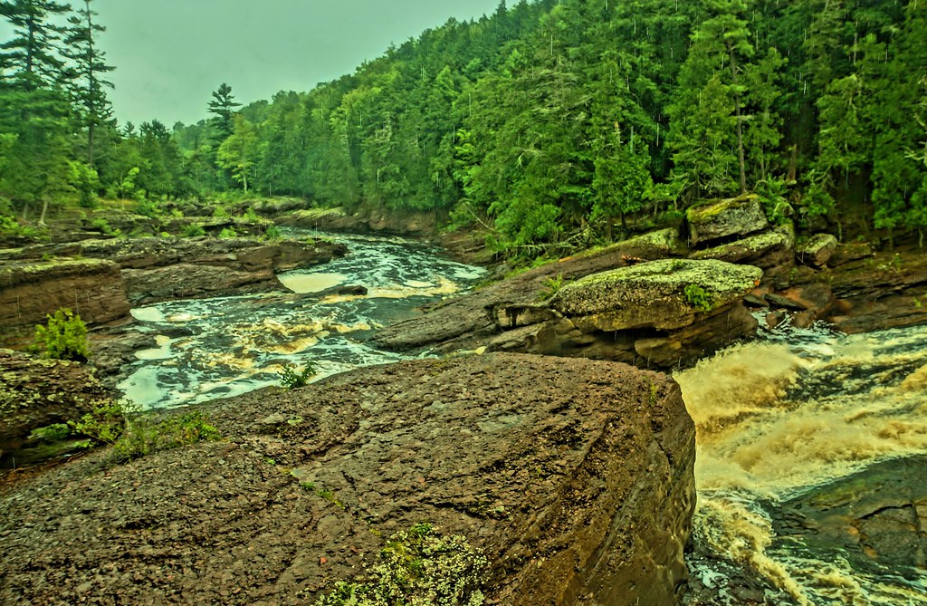 Photo: chumlee10, CC BY-SA 2.0 (via Flickr)
Potowatomi Falls
~41 min drive
Easy out-and-back trail to a scenic waterfall in Michigan's UP.
 Photo: usfs_Eastern_Region, Public Domain Mark (via Flickr)
Thompson Lodge
~42 min drive
5-mile out-and-back woodland hike to a historic lodge in Michigan.
Alligator Eye
~23 min drive
0.62-mile out-and-back trail in Michigan with 222 ft of elevation gain.
Whitefish Lake Bike Trail
~38 min drive
4.50-mile out-and-back bike trail in Michigan with 261 ft elevation gain.
Photo: chumlee10, CC BY-SA 2.0 (via Flickr)Sandstone Falls
~43 min drive
0.37-mile out-and-back trail to Sandstone Falls in Michigan.

