
Clear Creek Campground
Campground
6.3 mi from the trail
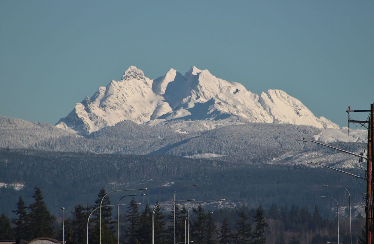 Photo: SounderBruce from Seattle, United States, CC BY-SA 2.0 (via Wikimedia Commons)
Three Fingers is a summit of about 6,852 feet in Snohomish County, Washington, inside the Boulder River Wilderness. The peak lies within the Darrington Ranger District of Mt. Baker-Snoqualmie National Forest, which the Forest Service manages, and the nearest town is Verlot, about 6 miles away. The Three Fingers summit trail starts less than a mile from the peak, and the Waterfall Basin climbing area is about 0.7 miles away. Farther out, the Eight-Mile Creek Trail is about 2 miles off, and Clear Creek Campground offers a place to stay roughly 6 miles away.
Where it is: Boulder River Wilderness · Darrington Ranger District
Near: Marysville
Been here? Tell people how it was.
We don't know of a mapped trail or route to the summit of Three Fingers. Plan the approach with local maps, a guidebook or a local guide, and check conditions before you go.


 Big Bear MountainSummitPhoto: Ron Clausen, CC BY-SA 4.0 (via Wikimedia Commons)~2 min drive
 Mount BullenSummitPhoto: Eggbones, CC BY-SA 4.0 (via Wikimedia Commons)~3 min drive
 Liberty MountainSummitPhoto: Ron Clausen, CC BY-SA 4.0 (via Wikimedia Commons)~5 min drive
 Whitehorse MountainSummitPhoto: Walter Siegmund (talk), CC BY-SA 3.0 (via Wikimedia Commons)~5 min drive
 Devils ThumbSummitPhoto: Ron Clausen, CC BY-SA 4.0 (via Wikimedia Commons)~12 min driveMount PilchuckSummitPhoto: Josh Lewis, CC BY-SA 3.0 (via Wikimedia Commons)~16 min drive
 Mount HigginsSummitPhoto: Ron Clausen, CC BY-SA 4.0 (via Wikimedia Commons)~18 min drive
 Stillaguamish PeakSummitPhoto: Walter Siegmund (talk), CC BY-SA 3.0 (via Wikimedia Commons)~18 min drive
 Big Four MountainSummitPhoto: Generalnonsensecomic at English Wikipedia, Public domain (via Wikimedia Commons)~20 min driveMount DickermanSummitPhoto: Danust, CC BY-SA 4.0 (via Wikimedia Commons)~21 min drive
Also worth it near here
 SQUIRE CREEKHikingPhoto: U.S. Forest Service- Pacific Northwest Region, Public domain (via Wikimedia Commons)~5 min drive
 Three O'clock RockRock climbingPhoto: Wilderness trespasser, CC BY-SA 4.0 (via Wikimedia Commons)~6 min drive
 Boulder RiverCanoeingPhoto: BlueCanoe, CC BY-SA 3.0 (via Wikimedia Commons)~10 min drive
Daily highs and lows, wind and the chance of precipitation at the summit for the next 7 days, from the Open-Meteo model.
6,852 ft (2,088 m).
We don't know of a mapped trail or route to the summit. Plan the approach with local maps, a guidebook or a local guide.
Questions about Three Fingers: conditions, access, timing. Answers say when something isn't known.
Clear Creek Campground
Campground
Upper Olney Falls View
Viewpoint
Places © OpenStreetMap contributors, Places © Overture Maps Foundation
More in Gold Bar