San Antonio
At a glance
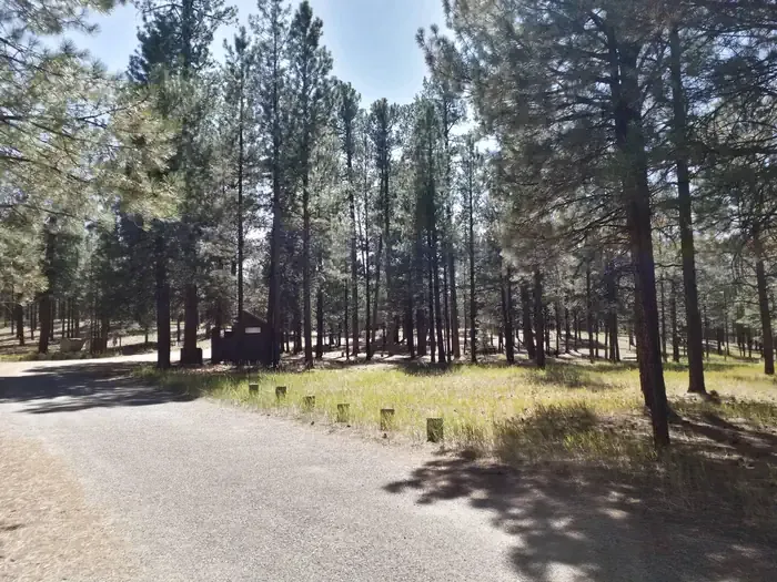
San Antonio is a Forest Service campground in the Jemez Ranger District of the Santa Fe National Forest in New Mexico. Its group area sits within the larger San Antonio Campground, among towering ponderosa pines and open forest meadows, with the San Antonio River running alongside. A paved walking trail winds through the campground. The group site holds nine walk-in campsites served by 11 parking spaces, plus a pavilion that accommodates up to 100 people. Vault toilets and drinking water spigots are on hand, but there is no dump station. A fee is charged, and none of the campsites are listed as accessible. June through September is the most comfortable stretch. A nearby weather station records typical July highs around 77°F with lows in the mid-40s, though July and August bring the most wet days of the year. Horseshoe Springs Trail starts about 0.7 mile away, and Twin Cabins Trail (506) is roughly a mile off. Redondo campground lies about 2 miles away, and Jemez Falls Campground is about 5 miles away.
- sites
- 30
- fee
- from $150
- best months
- May–Jul, Sep
Where it is: Jemez Ranger District · Santa Fe National Forest
Near: Los Alamos
Reserve a site
30 sites
You book with Recreation.gov. Roamze doesn't take a cut.
San Antonio cancellation alert
Sites open up when people cancel. We check Recreation.gov and email you when a site opens for your dates.
Best time to visit San Antonio
Best months: May–July and September. Best months have typical highs of 55–85 °F, lows of 30 °F or warmer (32 °F where the station doesn't record snow), at most one snowy day and no more than 12 wet days.
Jan
38°
9°
7 wet · 7 snow
Feb
40°
13°
6 wet · 6 snow
Mar
48°
19°
6 wet · 5 snow
Apr
56°
24°
5 wet · 3 snow
May
65°
30°
5 wet · 1 snow
Jun
75°
37°
5 wet
Jul
77°
44°
12 wet
Aug
75°
43°
13 wet
Sep
69°
36°
8 wet
Oct
59°
27°
6 wet · 1 snow
Nov
47°
18°
5 wet · 4 snow
Dec
38°
10°
7 wet · 7 snow
Typical high / low (°F) and days with rain or snow, 1991–2020. Measured at Wolf Canyon, NM, 7 mi away at 8,220 ft. Source: NOAA NCEI U.S. Climate Normals 1991–2020.
Been here? Tell people how it was.
 Horseshoe Springs TrailHikingPhoto: cogdogblog, CC0 (via Wikimedia Commons)0.7 mi
- Twin Cabins Trail (506)HikingPhoto: cogdogblog, CC0 (via Wikimedia Commons)1.1 mi
- RedondoCamping2.1 mi
- LAKE FORK MESA LOOPHikingPhoto: cogdogblog, CC0 (via Wikimedia Commons)2.2 mi
- Jemez Mountains and Jemez ValleyRock climbing5.4 mi
 Jemez Falls CampgroundCampingPhoto: Recreation.gov (RIDB) / public domain5.4 mi
 Jemez Cave (a.k.a. Crystal Cave) - CLOSEDRock climbingPhoto: RuggyBearLA, CC BY 2.0 (via Flickr)7 mi
- Rio de las VacasCanoeing9.8 mi
- Clear Creek Campground (nm)Camping~20 min drive
- Tetilla PeakCamping~43 min drive
 Fenton Lake CampgroundCampingPhoto: cogdogblog, CC0 (via Wikimedia Commons)~7 min drive
- Jemez Falls CampgroundCamping~9 min drive
- Banco Bonito Campground (Special Use Permit Required)Camping~6 min drive
- Seven Springs Camp GroundCamping~7 min drive
- Calaveras CampgroundCamping~8 min drive
- Rio De Las Vacas CampgroundCamping~20 min drive
- Vista LindaCamping~21 min drive
- Clear Creek Campground Group AreaCamping~22 min drive
Conditions and forecast
Caution todayAgency alerts are in effect for this areaUSFS · checked 11 min agoDaily highs and lows, wind and the chance of precipitation at San Antonio for the next 7 days, from the Open-Meteo model.
Ask about this place
Questions about San Antonio: conditions, access, timing. Answers say when something isn't known.
- 30 sitesReservable on Recreation.gov
- At 7,765 ft
- Jemez Ranger DistrictSanta Fe National Forest
Local outfitters
- Santa Fe Skies RV Park40 mi away
- Cooper's El Vado Ranch48 mi away
Not on Roamze yet. Their page has how to reach them.
San Antonio
30 sites
