Red Bridge Lake
- Jun–Sep
- best months
Near: Keremeos
- At 5,233 ft
Red Bridge Lake is an informal camping spot in British Columbia, Canada, at about 5,230 ft above sea level. It is inside Red Bridge Lake Recreation Reserve. Camping here is mapped as free. The nearest town is Keremeos, about 10 miles west of the campground. Peaks within about 3 miles include Crater Mountain. For camping, Tunnel - Recreation Site and Snaʕsnulax̌tn Campground (Pow-wow Grounds) are within about 6 miles. The location and elevation come from OpenStreetMap and the Copernicus 90 m elevation model. Check local access rules and conditions before you go.
Local outfitters
- Stateside 97 RV Park33 mi away
Not on Roamze yet. Their page has how to reach them.
Conditions and forecast
Daily highs and lows, wind and the chance of precipitation at Red Bridge Lake for the next 7 days, from the Open-Meteo model.
Been here? Tell people how it was.
 Stemwinder Provincial Park CampgroundCampingPhoto: Kiwibirdman, CC BY 3.0 (via Wikimedia Commons)~22 min drive
- Placer Mountain Emergency ShelterHut camping~29 min drive
- Tunnel - Recreation SiteCamping~5 min drive
- Similkameen Cabin Emergency ShelterHut camping~33 min drive
- Snaʕsnulax̌tn Campground (Pow-wow Grounds)Camping~6 min drive
- Horseshoe Canyon - Recreation SiteCamping~6 min drive
- Lakeview CampgroundCamping~8 min drive
- Buckhorn CampgroundCamping~9 min drive
- Rustic CampingCamping~12 min drive
- Eagle campground & RV ParkCamping~15 min drive
Also worth it near here
- Keremeos Village PromenadeMountain biking~17 min drive
- MascotCross-country skiing~21 min drive
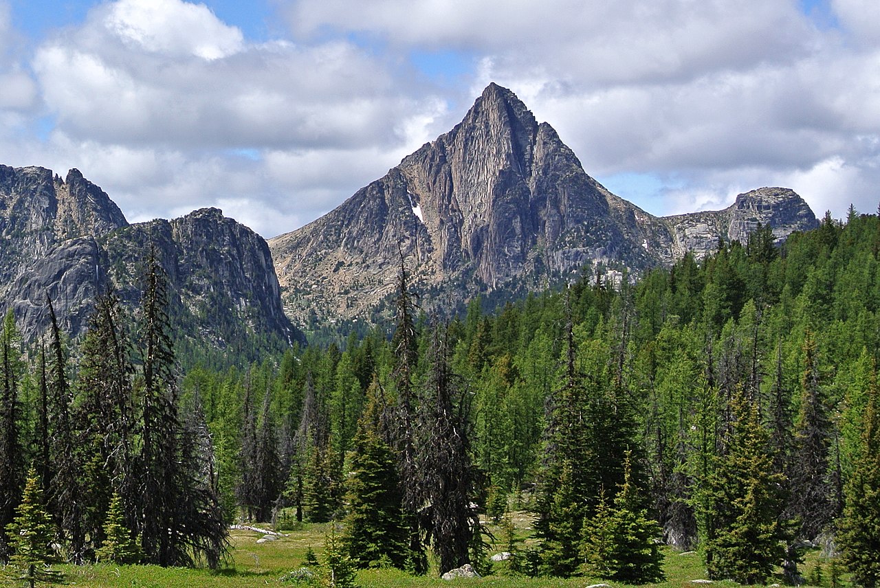 Cathedral PeakSummitPhoto: Maurice King, CC BY 2.0 (via Wikimedia Commons)~27 min drive
 SMITH LAKEHikingPhoto: Nwcamera1, CC BY-SA 4.0 (via Wikimedia Commons)~27 min drive
 Amphitheatre MountainRock climbingPhoto: caffeinated_zeitgeist, CC BY 2.0 (via Flickr)~28 min drive
Best time to visit Red Bridge Lake
Best months: June–September. Best months have typical highs of 55–85 °F, lows of 30 °F or warmer (32 °F where there's no snowfall data), at most one snowy day and no more than 12 wet days.
Jan
26°
12°
15 wet
Feb
30°
14°
12 wet
Mar
36°
18°
14 wet
Apr
42°
23°
11 wet
May
52°
29°
11 wet
Jun
61°
37°
11 wet
Jul
69°
43°
8 wet
Aug
69°
43°
9 wet
Sep
61°
37°
8 wet
Oct
46°
27°
11 wet
Nov
31°
15°
16 wet
Dec
23°
9°
15 wet
Typical high / low (°F) and days with rain or snow, 1981–2010. Modelled for the 1 km square this place sits in (average height 5,299 ft), not measured at a weather station. Snowfall days aren't in this data. Source: CHELSA 1 km climate model (1981–2010) and CRU TS 4.09 wet days. Data: CHELSA V2.1 climatologies (Karger et al. 2017), WSL (CC0 1.0); CRU TS 4.09 (Harris et al. 2020), University of East Anglia Climatic Research Unit. Contains public sector information licensed under the Open Government Licence v3.0. (Open Government Licence v3.0).
Map and trail data © OpenStreetMap contributors
