Sugarland Mountain Trail
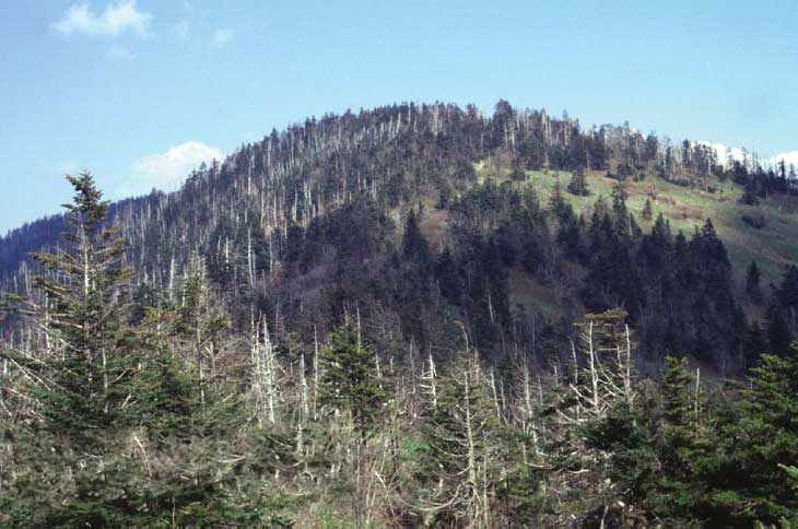
 Photo: Michael Pellegrino, CC BY-SA 4.0 (via Wikimedia Commons)
At a glance
Sugarland Mountain Trail is a hard hike of about 11.7 miles in Great Smoky Mountains National Park, on land managed by the National Park Service. It crosses the Appalachian National Scenic Trail and runs from a low point of about 2,290 feet to a high of nearly 6,000 feet, with a total climb of 3,497 feet. Summer is the most comfortable time to go. Typical averages from a nearby weather station at Mt Leconte show July highs around 66°F with lows near 50°F, while winter highs stay in the low 30s. The trail sits close to the Appalachian Trail and the Mountains-To-Sea Trail: Segment 1, both about 0.3 miles away. The Spruce Fir Nature Trail is about 0.9 miles off, and the Road Prong Trail is about 2 miles away.
- one way
- 11.7 mi
- climb
- 3,497 ft
- high point
- 5,959 ft
- route
- Point to point
- time
- About 5 hours
- best months
- Sep
Where it is: Appalachian National Scenic Trail · Great Smoky Mountains National Park
Near: Gatlinburg
Best time to visit Sugarland Mountain Trail
Best months: September. Best months have typical highs of 55–85 °F, lows of 30 °F or warmer (32 °F where the station doesn't record snow), at most one snowy day and no more than 12 wet days.
Jan
33°
17°
13 wet
Feb
35°
20°
12 wet
Mar
41°
24°
13 wet
Apr
50°
32°
14 wet
May
56°
40°
16 wet
Jun
63°
47°
17 wet
Jul
66°
50°
17 wet
Aug
65°
49°
16 wet
Sep
61°
44°
12 wet
Oct
53°
36°
11 wet
Nov
44°
27°
11 wet
Dec
37°
21°
13 wet
Typical high / low (°F) and days with rain or snow, 1991–2020. Measured at Mt Leconte, TN, 4.8 mi away at 6,493 ft. The station sits about 500 ft higher than this place, so expect it a little warmer here. This station doesn't record snowfall. Source: NOAA NCEI U.S. Climate Normals 1991–2020.
Been here? Tell people how it was.
- Appalachian TrailHikingPhoto: Michael Pellegrino, CC BY-SA 4.0 (via Wikimedia Commons)0.3 mi
- Mountains-To-Sea Trail: Segment 1HikingPhoto: Michael Pellegrino, CC BY-SA 4.0 (via Wikimedia Commons)0.3 mi
- Spruce Fir Nature TrailHiking0.9 mi
- Road Prong TrailHiking2 mi
- Twin Creeks Picnic PavilionCamping6.8 mi
- Spence CabinCamping7.2 mi
- Little RiverRiver fishing7.4 mi
- Appalachian ClubhouseCamping7.4 mi
- Mountains-To-Sea Trail: Segment 1HikingPhoto: Michael Pellegrino, CC BY-SA 4.0 (via Wikimedia Commons)Next door
- Appalachian TrailHikingPhoto: Michael Pellegrino, CC BY-SA 4.0 (via Wikimedia Commons)Next door
 Swinging Bridge Quiet WalkwayHikingPhoto: lns1122, CC BY 2.0 (via Flickr)~6 min drive
 Appalachian TrailHikingPhoto: bogdanstepniak, CC BY 3.0 (via Wikimedia Commons)~9 min drive
 Chimney Tops TrailHikingPhoto: Bas van Oorschot, CC BY-SA 3.0 (via Wikimedia Commons)~4 min drive
 Rough Creek TrailHikingPhoto: Charles Skip Martin, CC BY 3.0 (via Wikimedia Commons)~6 min drive
- Jump Off TrailHikingPhoto: bogdanstepniak, CC BY 3.0 (via Wikimedia Commons)~9 min drive
- Deep Creek TrailHiking~6 min drive
 Appalachian TrailHikingPhoto: w_lemay, CC BY-SA 2.0 (via Flickr)~4 min drive
 Forney Ridge TrailHikingPhoto: Bas van Oorschot, CC BY-SA 3.0 (via Wikimedia Commons)~6 min drive
Conditions and forecast on Sugarland Mountain
Daily highs and lows, wind and the chance of precipitation at the summit and route start for the next 7 days, from the Open-Meteo model.

Ask about this place
Questions about Sugarland Mountain Trail: conditions, access, timing. Answers say when something isn't known.
Local outfitters
- GSM Outfitters13 mi away
- Hurshel's Outfitters16 mi away
Not on Roamze yet. Their page has how to reach them.
Questions about this route
How long is the Sugarland Mountain Trail on Sugarland Mountain?
About 11.7 mi.
How much elevation gain is on the Sugarland Mountain Trail?
About 3,497 ft of climbing round trip.
How hard is the Sugarland Mountain Trail?
It is rated hard.
How long does the Sugarland Mountain Trail take?
About 5 hours round trip.
Map and trail data © OpenStreetMap contributors
