Elk Mountain Trail
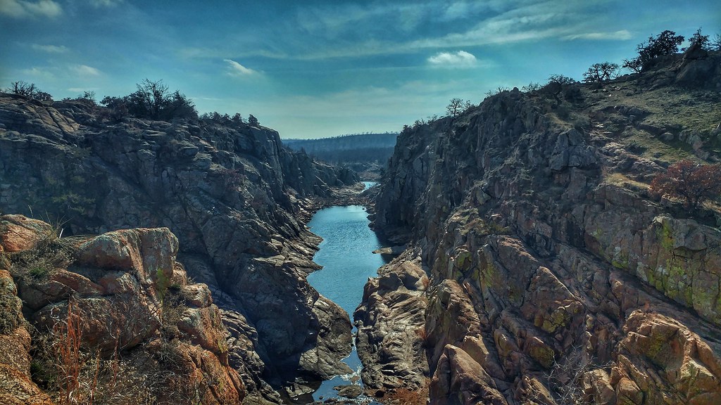
 Photo: jonathan c. wheeler, CC BY-SA 3.0 (via Wikimedia Commons)
At a glance
Elk Mountain Trail is a moderate hike of about 1.4 miles on the Wichita Mountains Wildlife Refuge in Oklahoma, managed by the U.S. Fish and Wildlife Service. The route rises from a starting point near 1,680 feet to a high of about 2,230 feet, with a total climb of 574 feet. The steepest stretch comes around 0.7 miles in, where the grade reaches about 20%. Spring and fall are the most comfortable times to go. Typical averages from a nearby weather station show October highs around 75°F with lows near 51°F, and April highs around 73°F. That station sits about 570 feet lower than the trail's high point, so temperatures on the summit run cooler. Climbers will find Dick Boulder and Hidden Leaf Boulders about half a mile away, and Charon's Garden Trail is about 1.3 miles off. Bison Trail is roughly 1.4 miles away.
- one way
- 1.4 mi
- climb
- 574 ft
- high point
- 2,232 ft
- route
- Point to point
- time
- About 45 minutes
- best months
- Late Jan–mid-May, early Oct–late Dec
Where it is: Wichita Mountains Wildlife Refuge
Near: Lawton
Best weeks to go
Late January to mid-May and early October to late December are usually best for hiking here.
Typical highs of 52–79°F and lows of 30°F or warmer in those weeks.
Typical weather: NOAA 1991–2020 normals at Wichita Mtn Wr, OK, 1 mi away. Not a forecast.
Typical weather by monthBest time to visit Elk Mountain Trail
Best months: February–April and October–December. Best months are the ones mostly made of the best weeks for hiking: typical temperatures in its comfortable range, few snowy days and not usually wet, judged with the same limits as our good-day forecasts.
Jan
52°
29°
4 wet
Feb
55°
33°
4 wet
Mar
65°
42°
5 wet
Apr
73°
50°
6 wet
May
81°
59°
7 wet
Jun
89°
68°
6 wet
Jul
95°
73°
5 wet
Aug
94°
71°
5 wet
Sep
86°
63°
6 wet
Oct
75°
51°
5 wet
Nov
63°
40°
4 wet
Dec
53°
31°
4 wet
Typical high / low (°F) and days with rain or snow, 1991–2020. Measured at Wichita Mtn Wr, OK, 0.6 mi away at 1,665 ft. The station sits about 600 ft lower than this place, so expect it a little cooler here. Source: NOAA NCEI U.S. Climate Normals 1991–2020.
Been here? Tell people how it was.
- Dick BoulderRock climbing0.5 mi
- Hidden Leaf BouldersRock climbing0.5 mi
- Pear and Apple (Bouldering)Rock climbing0.7 mi
- Blackout BoulderRock climbing0.7 mi
 Charon's Garden TrailHikingPhoto: Larry Smith from Lawton, Ok, USA, CC BY 2.0 (via Wikimedia Commons)1.3 mi
 Elk TrailHikingPhoto: Larry Smith, CC BY 2.0 (via Wikimedia Commons)1.4 mi
- Bison TrailHikingPhoto: Larry Smith, CC BY 2.0 (via Wikimedia Commons)1.4 mi
 Longhorn TrailHikingPhoto: ToddMorris, CC BY-SA 2.0 (via Flickr)1.9 mi
- Charon's Garden TrailHikingPhoto: Larry Smith from Lawton, Ok, USA, CC BY 2.0 (via Wikimedia Commons)~2 min drive
- Elk TrailHikingPhoto: Larry Smith, CC BY 2.0 (via Wikimedia Commons)~2 min drive
- Bison TrailHikingPhoto: Larry Smith, CC BY 2.0 (via Wikimedia Commons)~2 min drive
- Longhorn TrailHikingPhoto: ToddMorris, CC BY-SA 2.0 (via Flickr)~3 min drive
 Burford Lake TrailHikingPhoto: jonathan c. wheeler, CC BY-SA 3.0 (via Wikimedia Commons)~5 min drive
 Kite TrailHikingPhoto: jonathan c. wheeler, CC BY-SA 3.0 (via Wikimedia Commons)~6 min drive
- The Narrows TrailHikingPhoto: jonathan c. wheeler, CC BY-SA 3.0 (via Wikimedia Commons)~6 min drive
 Jed Johnson Tower TrailHikingPhoto: duggar11, CC BY 2.0 (via Wikimedia Commons)~12 min drive
 Cedar Planting TrailHikingPhoto: jonathan c. wheeler, CC BY-SA 3.0 (via Wikimedia Commons)~14 min drive
 LETRA TrailHikingPhoto: anyjazz65, CC BY 2.0 (via Flickr)~20 min drive
Conditions and forecast
Daily highs and lows, wind and the chance of precipitation at Start for the next 7 days, from the Open-Meteo model.

Ask about this place
Questions about Elk Mountain Trail: conditions, access, timing. Answers say when something isn't known.
Map and trail data © OpenStreetMap contributors
