
Guanella Pass Scenic Byway
Campground
3.9 mi from the trail
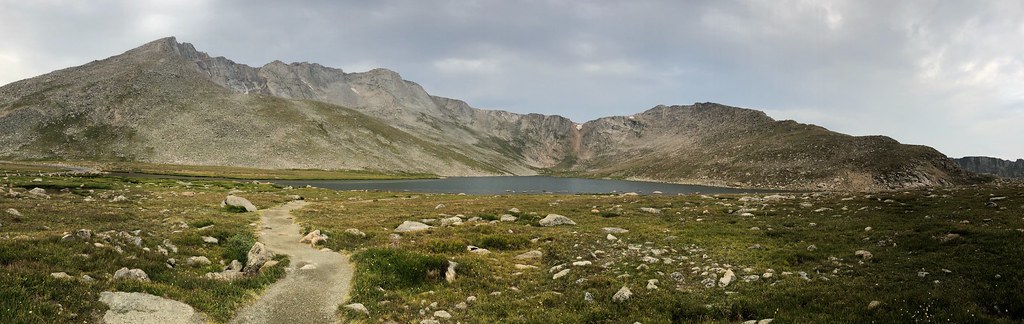
 Photo: gregor_y, CC BY-SA 2.0 (via Flickr)
Mt. Evans is a climbing area in Colorado's Mount Evans Wilderness, within the Clear Creek Ranger District of the Arapaho and Roosevelt National Forests. The Forest Service manages the land, and the area sits among a cluster of climbing and hiking destinations, with Mount Blue Sky and the Mt. Evans - mixed, couloirs climbing area both about 0.4 miles away. The climbing here is alpine, with 11 routes in total, and one route is listed as ice. The YDS grades run from 5.5 to 5.12c, with BaDaBing at 5.10a and Rock Hard at 5.12c as two of the more notable ones. The Aprons climbing area is about 0.7 miles away. For an overnight base, Guanella Pass Campground is about 4.5 miles off and Echo Lake Campground about 5 miles. Geneva Creek, a canoeing spot, is roughly 6.9 miles away.
11 routes · 5.5 – 5.12c · Alpine
Where it is: Mount Evans Wilderness · Clear Creek Ranger District
Near: Lakewood
Blocked at last check
A road serving this area is closed; agency alerts are in effect for this area; weather is good · USFS, State DOT 511, OpenWeather · checked 18 h ago
Road closed
CO 5/Mount Blue Sky Road: road closure is listed as closed by CDOT 511.
CO 5/Mount Blue Sky Road: road closure
Closed · ~0.2 km from Mt. Evans · CDOT 511
Fire Restrictions
Agency alert covering Arapaho and Roosevelt National Forests · USFS · Arapaho and Roosevelt National Forests
Slater Lake Area Closure
Agency alert covering Clear Creek Ranger District · Order 02-10-07-26-03 · USFS · Clear Creek Ranger District
Area Closure Surrounding the Devils Nose Target Range
Agency alert covering Clear Creek Ranger District · Order 02-10-07-26-01 · USFS · Clear Creek Ranger District
As of · Source: CDOT 511. Agencies don't list every closure — check before you go.
Been here? Tell people how it was.
 Mt. Evans - mixed, couloirsRock climbingPhoto: regexman, CC BY 2.0 (via Flickr)0.4 mi
 Mount Blue SkyHikingPhoto: regexman, CC BY 2.0 (via Flickr)0.4 miMount WarrenHikingPhoto: regexman, CC BY 2.0 (via Flickr)0.5 mi
 The ApronsRock climbingPhoto: brewbooks, CC BY-SA 2.0 (via Flickr)0.7 mi
 Echo Lake CampgroundCampingPhoto: squeaks2569 — CC BY-SA 2.0 (via Flickr)5 mi
 Geneva CreekCanoeingPhoto: Plazak, CC BY-SA 3.0 (via Wikimedia Commons)6.9 mi
 East JuniRock climbingPhoto: Chris_Short, CC BY-SA 2.0 (via Flickr)~11 min driveMt. Evans - mixed, couloirsRock climbingPhoto: regexman, CC BY 2.0 (via Flickr)Next doorThe ApronsRock climbingPhoto: brewbooks, CC BY-SA 2.0 (via Flickr)~1 min drive
 Easter IslandRock climbingPhoto: William Henry Jackson, Public domain (via Wikimedia Commons)~2 min drive
Daily highs and lows, wind and the chance of precipitation at Mt. Evans for the next 7 days, from the Open-Meteo model.
Questions about Mt. Evans: conditions, access, timing. Answers say when something isn't known.
Guanella Pass Scenic Byway
Campground
 If it rainsUser:Magicpiano, CC BY-SA 4.0 · Wikimedia Commons
Historic house-museum in Georgetown, Colorado, United States
Places © OpenStreetMap contributors · Photos: User:Magicpiano, CC BY-SA 4.0 (commons)
More in Idaho Springs