Mount Queets
 Photo: National Park Service, Public domain (via Wikimedia Commons)
At a glance
Mount Queets is a summit of about 6,458 feet in Jefferson County, Washington, inside Olympic National Park and the Daniel J. Evans Wilderness. The National Park Service manages the land, and the nearest town is Whiskey Bend, about 14 miles away. The closest trails are Elwha Basin Way Trail, about 1.4 miles away, and Happy Hollow Trail, about 1.8 miles away. Skyline Primitive Trail and Lake Beauty Primitive Trail are both within about 4 miles.
- summit
- 6,458 ft
- managed by
- National Park Service
Where it is: Daniel J. Evans Wilderness · Olympic National Park
Near: Port Angeles
Been here? Tell people how it was.
We don't know of a mapped trail or route to the summit of Mount Queets. Plan the approach with local maps, a guidebook or a local guide, and check conditions before you go.
- Dodger Point5,732 ft · Washington1 route8.7 mi away
 Bogachiel Peak5,468 ft · Washington2 routes13 mi awayPhoto: Eggbones, CC BY-SA 4.0 (via Wikimedia Commons)
 Eagle Point6,257 ft · Washington1 route15 mi awayPhoto: Ron Clausen, CC BY-SA 4.0 (via Wikimedia Commons)
 Elk Mountain6,781 ft · Washington2 routes16 mi awayPhoto: Ron Clausen, CC BY-SA 4.0 (via Wikimedia Commons)
- Hurricane Hill5,768 ft · Washington2 routes16 mi away
- Slide Peak4,338 ft · Washington1 route19 mi away
 Mount MeanySummitPhoto: Parratt, Smitty National Park Service, Public domain (via Wikimedia Commons)~1 min drive
 Mount ChristieSummitPhoto: Ron Clausen, CC BY-SA 4.0 (via Wikimedia Commons)~9 min drive
 Mount DanaSummitPhoto: Ron Clausen, CC BY-SA 4.0 (via Wikimedia Commons)~9 min drive
 Mount OlympusSummitPhoto: R6, State & Private Forestry, Forest Health Protection, Public domain (via Wikimedia Commons)~10 min drive
 Mount TomSummitPhoto: rnjacobs, CC BY 2.0 (via Wikimedia Commons)~14 min drive
 Mount NortonSummitPhoto: Terri Stewart, CC BY-SA 2.0 (via Wikimedia Commons)~14 min drive
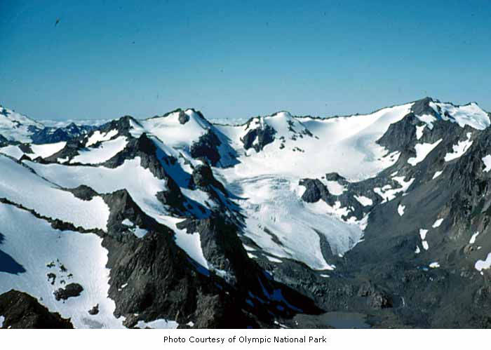 Mount CarrieSummitPhoto: National Park Service, Public domain (via Wikimedia Commons)~16 min drive
 Mount FairchildSummitPhoto: Martin Bravenboer, CC BY 3.0 (via Wikimedia Commons)~17 min drive
 Cat PeakSummitPhoto: brewbooks, CC BY-SA 2.0 (via Wikimedia Commons)~18 min drive
 Mount ClaywoodSummitPhoto: National Park Service, Public domain (via Wikimedia Commons)~19 min drive
Conditions and forecast
Daily highs and lows, wind and the chance of precipitation at the summit for the next 7 days, from the Open-Meteo model.
Questions about Mount Queets
How tall is Mount Queets?
6,458 ft (1,968 m).
Is there a trail to the top of Mount Queets?
We don't know of a mapped trail or route to the summit. Plan the approach with local maps, a guidebook or a local guide.

Ask about this place
Questions about Mount Queets: conditions, access, timing. Answers say when something isn't known.
