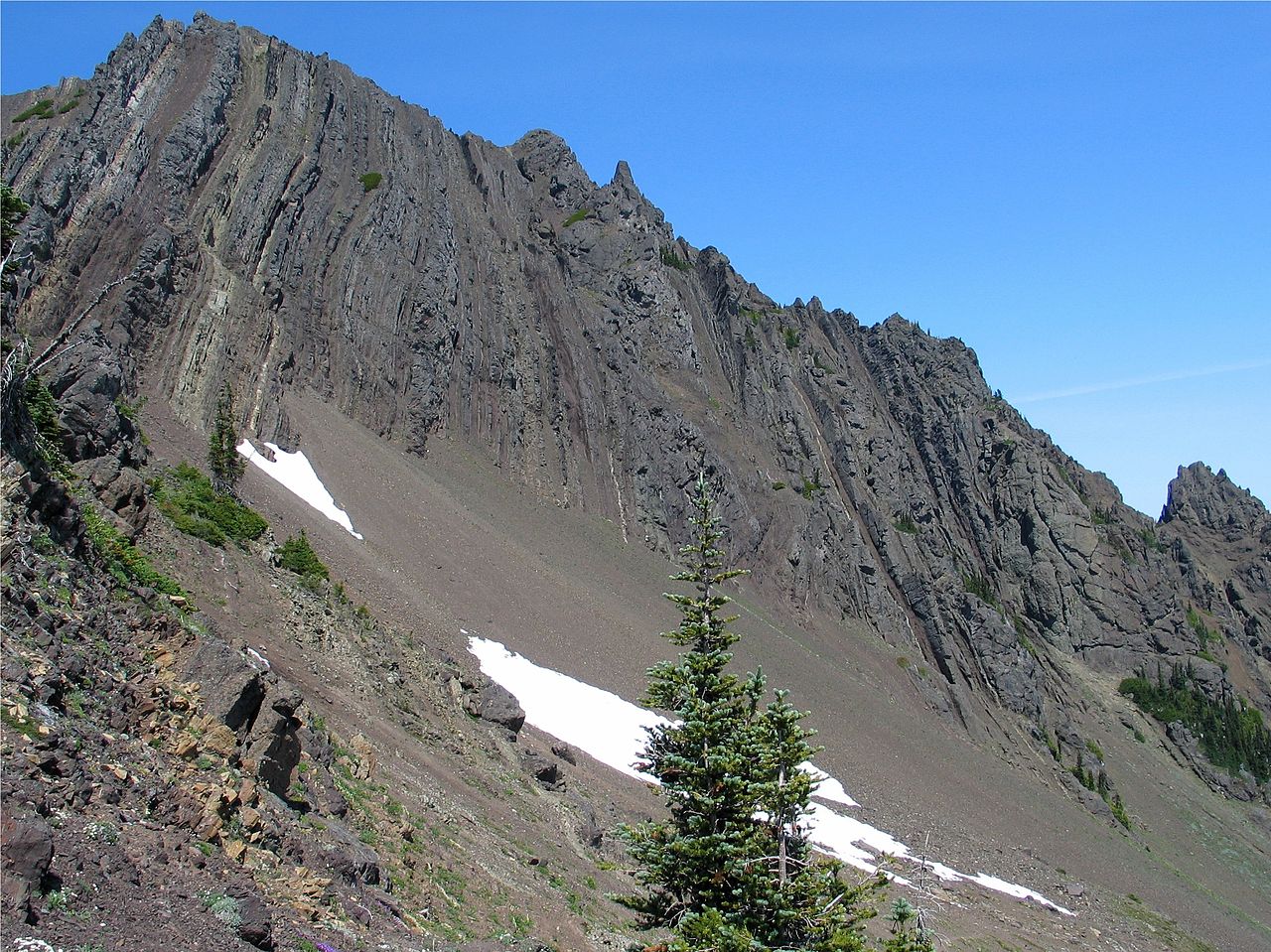
Eagle Point
 Photo: Ron Clausen, CC BY-SA 4.0 (via Wikimedia Commons)
- 6,257 ft
- summit
- 1
- way up
- National Park Service
- managed by
Is Eagle Point open right now?
Closure in the area
There's a closure order in Olympic National Park. It doesn't name Eagle Point, so check the source for the area it covers.
Hurricane Ridge Road Closed, Tuesday 11/17, 8:45am
Park closure covering Olympic National Park · NPS · Olympic National Park
Visitors to Rialto, Ruby Beach & Coastal Areas Cautioned Due to High Tides
Park alert covering Olympic National Park · NPS · Olympic National Park
Bat Tests Positive for Rabies, Visitors Urged to Report Potential Contact
Park alert covering Olympic National Park · NPS · Olympic National Park
Full Burn Ban Begins August 7
Park alert covering Olympic National Park · NPS · Olympic National Park
Staircase Developed Area is Open, Use Caution in Burned Areas
Park alert covering Olympic National Park · NPS · Olympic National Park
As of · Source: NPS · Olympic National Park. Agencies don't list every closure — check before you go.
Eagle Point is a summit in Washington's Olympic National Park, inside the Daniel J. Evans Wilderness. The National Park Service manages the land, and the nearest town is Port Angeles East, about 12 miles away. One reports that a bat tested positive for rabies and asks visitors to report any potential contact. The other is a full burn ban that began August 7. The Eagle Point Trail starts about half a mile away. Pj Lake Primitive Trail is just under a mile off, and Badger Valley Trail is about 2.5 miles away. Obstruction Point-Deer Park Trail is about 3.1 miles out and offers more options for longer outings.
Conditions and forecast
Daily highs and lows, wind and the chance of precipitation at the summit and route start for the next 7 days, from the Open-Meteo model.
- Summit elevation
- 6,257 ft
- Land manager
- National Park Service
Elevation from USGS 3D Elevation Program terrain data (about 10 m resolution).
Map © Mapbox © OpenStreetMap contributors Questions about Eagle Point
How tall is Eagle Point?
6,257 ft (1,907 m).
How many routes go to the summit of Eagle Point?
One: Eagle Point Trail.
 Elk Mountain6,781 ft · Washington2 routes2.9 mi awayPhoto: Ron Clausen, CC BY-SA 4.0 (via Wikimedia Commons)
- Dodger Point5,732 ft · Washington1 route6.5 mi away
- Hurricane Hill5,768 ft · Washington2 routes6.6 mi away
 Blue Mountain6,008 ft · Washington1 route7.0 mi awayPhoto: Chase N., CC BY-SA 2.0 (via Wikimedia Commons)
- Baldy6,800 ft · Washington1 route11 mi away
- Ned Hill3,468 ft · Washington1 route11 mi away
- Eagle Point TrailHiking0.5 mi
- Pj Lake Primitive TrailHiking0.9 mi
- Badger Valley TrailHiking2.5 mi
 Obstruction Point-Deer Park TrailHikingPhoto: Jason Hollinger, CC BY 2.0 (via Wikimedia Commons)3.1 mi
- Elk Mountain TrailHikingPhoto: Jason Hollinger, CC BY 2.0 (via Wikimedia Commons)3.1 mi
- Maiden CreekCanoeing4.7 mi
 Morse CreekCanoeingPhoto: Evvekk, CC0 (via Wikimedia Commons)5.3 mi
- Gray Wolf RiverCanoeing9 mi
Source: Roamze catalog (indexable pages within 10 miles, PostGIS distance)
 Obstruction PeakSummit · ~3 min drivePhoto: Ron Clausen, CC BY-SA 4.0 (via Wikimedia Commons)
- Elk MountainSummit · ~5 min drivePhoto: Ron Clausen, CC BY-SA 4.0 (via Wikimedia Commons)
 Maiden PeakSummit · ~7 min drivePhoto: Walter Siegmund (talk), CC BY-SA 3.0 (via Wikimedia Commons)
 Mount AngelesSummit · ~8 min drivePhoto: Jeff Taylor, Public domain (via Wikimedia Commons)
- Blue MountainSummit · ~12 min drivePhoto: Chase N., CC BY-SA 2.0 (via Wikimedia Commons)
 Mount ClaywoodSummit · ~17 min drivePhoto: National Park Service, Public domain (via Wikimedia Commons)
 Mount FitzhenrySummit · ~18 min drivePhoto: Martin Bravenboer, CC BY 3.0 (via Wikimedia Commons)
 Mount FairchildSummit · ~18 min drivePhoto: Martin Bravenboer, CC BY 3.0 (via Wikimedia Commons)
 Mount DanaSummit · ~19 min drivePhoto: Ron Clausen, CC BY-SA 4.0 (via Wikimedia Commons)
 Mount ClarkSummit · ~19 min drivePhoto: Garland, M. National Park Service., Public domain (via Wikimedia Commons)
Also worth it near here
