Mina Sauk Falls
At a glance
Mina Sauk Falls is a waterfall in Missouri, sitting at about 1,274 feet in elevation roughly 6 miles from the town of Arcadia. The Mina Sauk Falls Trail lies about a mile away and is the natural way to reach the falls. For comfortable weather, aim for late spring or early fall. Typical averages from a nearby weather station show May highs around 74°F and September highs around 78°F, with July the warmest month at about 86°F. Paddlers can head to the East Fork Black River, about 4 miles off, or Stouts Creek, about 5 miles away. Hikers will find the Scour Trail about 5 miles out, and the Black River Trail System is just under 6 miles away.
- elevation
- 1,274 ft
- best months
- Mar–Jun, Aug–Oct
Near: Ironton
Best time to visit Mina Sauk Falls
Best months: March–June and August–October. Best months have typical highs of 55–85 °F, lows of 30 °F or warmer (32 °F where the station doesn't record snow), at most one snowy day and no more than 12 wet days.
Jan
40°
21°
8 wet
Feb
45°
25°
8 wet
Mar
55°
33°
10 wet
Apr
66°
44°
11 wet
May
74°
54°
12 wet
Jun
82°
63°
10 wet
Jul
86°
67°
9 wet
Aug
85°
65°
8 wet
Sep
78°
57°
7 wet
Oct
68°
46°
9 wet
Nov
54°
35°
8 wet
Dec
43°
26°
8 wet
Typical high / low (°F) and days with rain or snow, 1991–2020. Measured at Potosi 4 Sw, MO, 23.6 mi away at 1,105 ft. This station doesn't record snowfall. Source: NOAA NCEI U.S. Climate Normals 1991–2020.
Been here? Tell people how it was.
- Mina Sauk Falls TrailHiking1 mi
- East Fork Black RiverCanoeing3.8 mi
 Stouts CreekCanoeingPhoto: Adam Moss from Macomb, IL, United States, CC BY-SA 2.0 (via Wikimedia Commons)5.1 mi
 Scour TrailHikingPhoto: CC BY-SA 3.0 (via Wikimedia Commons)5.4 mi
 Upper CliffRock climbingPhoto: Wikipedian Kbh3rd, CC BY-SA 3.0 (via Wikimedia Commons)5.6 mi
 EM: Johnson Shut-InsRock climbingPhoto: Kbh3rd, CC BY 4.0 (via Wikimedia Commons)5.6 mi
 Black River Trail SystemHikingPhoto: SymphonicPoet, CC BY 2.0 (via Flickr)5.9 mi
 A: Picnic AreaRock climbingPhoto: Fredlyfish4, CC BY-SA 3.0 (via Wikimedia Commons)6.8 mi
Also worth it near here
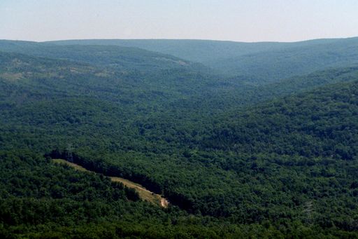 Taum Sauk MountainSummitPhoto: Kbh3rd, CC BY-SA 3.0 (via Wikimedia Commons)~2 min drive
- Stouts CreekCanoeingPhoto: Adam Moss from Macomb, IL, United States, CC BY-SA 2.0 (via Wikimedia Commons)~9 min drive
- Scour TrailHikingPhoto: CC BY-SA 3.0 (via Wikimedia Commons)~9 min drive
- A: Picnic AreaRock climbingPhoto: Fredlyfish4, CC BY-SA 3.0 (via Wikimedia Commons)~12 min drive
Conditions and forecast
Daily highs and lows, wind and the chance of precipitation at Mina Sauk Falls for the next 7 days, from the Open-Meteo model.
Ask about this place
Questions about Mina Sauk Falls: conditions, access, timing. Answers say when something isn't known.
