Lake Fork Boat Launch
At a glance
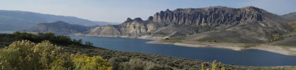
Lake Fork Boat Launch is a boat launch in Curecanti National Recreation Area in western Colorado, managed by the National Park Service. The nearest town is Gunnison, about 22 miles away. Summer is the most comfortable time to visit. Typical averages from the nearby Blue Mesa Lake weather station show July highs around 83°F with lows near 46°F, while winter highs stay in the 20s and 30s. The launch sits close to several other spots. Lake Fork Campground is about half a mile away, and the Denver & Rio Grande Western Abandoned Railroad and the Lake City Branch Abandoned Railway are both within about half a mile. Pine Creek Trail is roughly 2.3 miles off.
- best months
- May–Sep
Where it is: Curecanti National Recreation Area
Near: Montrose
Best time to visit Lake Fork Boat Launch
Best months: May–September. Best months have typical highs of 55–85 °F, lows of 30 °F or warmer (32 °F where the station doesn't record snow), at most one snowy day and no more than 12 wet days.
Jan
25°
-1°
8 wet
Feb
30°
3°
6 wet
Mar
43°
15°
5 wet
Apr
56°
24°
5 wet
May
66°
32°
5 wet
Jun
77°
39°
4 wet
Jul
83°
46°
7 wet
Aug
80°
45°
8 wet
Sep
73°
37°
7 wet
Oct
60°
27°
5 wet
Nov
44°
15°
5 wet
Dec
29°
3°
7 wet
Typical high / low (°F) and days with rain or snow, 1991–2020. Measured at Blue Mesa Lake, CO, 8.4 mi away at 7,568 ft. We don't have this place's elevation, so higher spots nearby can run cooler. This station doesn't record snowfall. Source: NOAA NCEI U.S. Climate Normals 1991–2020.
Been here? Tell people how it was.
- Denver & Rio Grande Western Abandoned RailroadCanoeing0.3 mi
- Lake City Branch Abandoned RailwayCanoeing0.5 mi
 Lake Fork CampgroundCampingPhoto: Recreation.gov (RIDB) / public domain0.5 mi
 Pine Creek TrailHikingPhoto: AndreyZharkikh, CC BY 2.0 (via Flickr)2.3 mi
- Lake Fork ArmCamping2.9 mi
- Old D&RGW Abandoned Rail TrailCanoeing3.1 mi
 Dillon Pinnacles TrailHikingPhoto: AndreyZharkikh, CC BY 2.0 (via Flickr)3.8 mi
- Curecanti National Recreation AreaRock climbing7.7 mi
 Blue CreekCanoeingPhoto: Jeffrey Beall, CC BY 4.0 (via Wikimedia Commons)~9 min drive
- Lake ForkBoat launchNext door
- Stevens Creek CampgroundTubing~21 min drive
 Cebolla CreekCanoeingPhoto: Jeffrey Beall, CC BY 4.0 (via Wikimedia Commons)~42 min drive
- Sapinero BeachBoat launch~2 min drive
 Smith ForkCanoeingPhoto: Jeffrey Beall, CC BY 3.0 (via Wikimedia Commons)~44 min drive
- Pine Creek Boat LaunchBoat launch~3 min drive
 Uncompahgre RiverCanoeingPhoto: Sally Pearce, Colorado Department of Transportation; brightened and color-corrected by Howcheng, Public domain (via Wikimedia Commons)~50 min drive
- Dillon PinnaclesBoat launch~6 min drive
 Henson CreekCanoeingPhoto: Jeffrey Beall, CC BY 4.0 (via Wikimedia Commons)~55 min drive
Conditions and forecast
Daily highs and lows, wind and the chance of precipitation at Lake Fork Boat Launch for the next 7 days, from the Open-Meteo model.
Ask about this place
Questions about Lake Fork Boat Launch: conditions, access, timing. Answers say when something isn't known.
