Campsite 5
Campground
1.1 mi from the trail
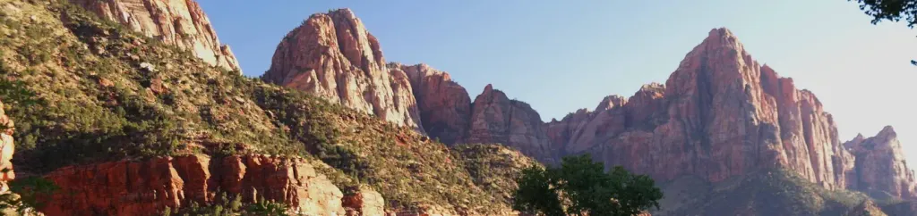
 Photo: Michael W, CC BY-SA 2.0 (via Wikimedia Commons)
Ivins Mountain is a summit of 7,023 feet in Utah's Zion Wilderness, within Zion National Park, which the National Park Service manages. The nearest town is Springdale, about 7 miles away. Spring and fall are the most comfortable times to go. Typical averages from a nearby weather station in Cedar City show May highs around 69°F and October highs around 65°F, with lows near 40°F in May and 36°F in October. That station sits about 550 feet below the summit, so temperatures on the mountain run a little cooler. Several other destinations lie within a few miles. Telephone Canyon Trail is about 1.6 miles away, and Angels Landing Trail is about 3 miles off. Climbers can head to the Grotto & Base of Great White Throne, about 2.6 miles away, and Watchman Campground is about 6 miles away.
Where it is: Zion Wilderness · Zion National Park
Near: Hurricane
Best months: April–October. Best months have typical highs of 55–85 °F, lows of 30 °F or warmer (32 °F where the station doesn't record snow), at most one snowy day and no more than 12 wet days.
Jan
43°
20°
6 wet
Feb
45°
22°
6 wet
Mar
53°
27°
7 wet
Apr
60°
32°
6 wet
May
69°
40°
5 wet
Jun
80°
48°
3 wet
Jul
85°
56°
5 wet
Aug
84°
55°
5 wet
Sep
77°
47°
4 wet
Oct
65°
36°
4 wet
Nov
51°
27°
4 wet
Dec
42°
19°
6 wet
Typical high / low (°F) and days with rain or snow, 1991–2020. Measured at Cedar City 5e, UT, 25.5 mi away at 6,465 ft. The station sits about 600 ft lower than this place, so expect it a little cooler here. This station doesn't record snowfall. Source: NOAA NCEI U.S. Climate Normals 1991–2020.
Been here? Tell people how it was.
We don't know of a mapped trail or route to the summit of Ivins Mountain. Plan the approach with local maps, a guidebook or a local guide, and check conditions before you go.


 Grotto & Base of Great White ThroneRock climbingPhoto: buzzard525, CC BY 3.0 (via Wikimedia Commons)2.6 mi
 Zion National ParkRock climbingPhoto: Don Graham from Redlands, CA, USA - God bless it!, CC BY-SA 2.0 (via Wikimedia Commons)2.9 mi
 Walter's WigglesHikingPhoto: Greg Willis from Denver, CO, usa, CC BY-SA 2.0 (via Wikimedia Commons)3.1 mi
 Temple of SinawavaRock climbingPhoto: Ken Lund from Reno, Nevada, USA, CC BY-SA 2.0 (via Wikimedia Commons)3.1 mi
 Angels Landing TrailHikingPhoto: Greg Willis from Denver, CO, usa, CC BY-SA 2.0 (via Wikimedia Commons)3.1 mi
 Watchman CampgroundCampingPhoto: Recreation.gov (RIDB) / public domain6.2 mi
 Mount MajesticSummitPhoto: Zion National Park, CC BY 2.0 (via Wikimedia Commons)~4 min drive
 South Guardian AngelSummitPhoto: Jerome Bon, CC BY 2.0 (via Wikimedia Commons)~5 min drive
 Lady MountainSummitPhoto: inkknife_2000, CC BY-SA 2.5 (via Wikimedia Commons)~5 min drive
 Three PatriarchsSummitPhoto: CC BY-SA 3.0 (via Wikimedia Commons)~5 min drive
 Mount ZionSummitPhoto: John A. Taylor, CC BY-SA 3.0 (via Wikimedia Commons)~6 min drive
 Jacob PeakSummitPhoto: James St. John, CC BY 2.0 (via Wikimedia Commons)~6 min driveAngels LandingSummitPhoto: Óðinn, CC BY-SA 2.5 ca (via Wikimedia Commons)~6 min drive
 North Guardian AngelSummitPhoto: Zion National Park, CC BY 2.0 (via Wikimedia Commons)~6 min driveObservation PointSummitPhoto: Aaron Zhu, CC BY-SA 3.0 (via Wikimedia Commons)~6 min drive
 Mount MoroniSummitPhoto: Cody Allison, CC BY-SA 2.0 (via Wikimedia Commons)~7 min drive
Also worth it near here
Zion National ParkRock climbingPhoto: Don Graham from Redlands, CA, USA - God bless it!, CC BY-SA 2.0 (via Wikimedia Commons)~5 min driveWalter's WigglesHikingPhoto: Greg Willis from Denver, CO, usa, CC BY-SA 2.0 (via Wikimedia Commons)~5 min driveDaily highs and lows, wind and the chance of precipitation at the summit for the next 7 days, from the Open-Meteo model.
7,023 ft (2,141 m).
We don't know of a mapped trail or route to the summit. Plan the approach with local maps, a guidebook or a local guide.
Questions about Ivins Mountain: conditions, access, timing. Answers say when something isn't known.
Campsite 5
Campground
 If it rainsDon Graham from Redlands, CA, USA - God bless it!, CC BY-SA 2.0 · Wikimedia Commons
Places © OpenStreetMap contributors, Places © Overture Maps Foundation · Photos: Don Graham from Redlands, CA, USA - God bless it!, CC BY-SA 2.0 (commons)
More in Hurricane