Hi Mountain
At a glance
Hi Mountain is a summit in the Santa Lucia Ranger District of Los Padres National Forest in California, about 11 miles from the town of Edna. It sits right alongside the Hi Mountain Trail, which passes about a tenth of a mile away, and the Rim Rock Trail is roughly 0.3 miles off. Beyond the trails at the summit, the Florence Hart Trail lies about 1.3 miles away and the McNeil Truck Trail about 2.4 miles out, while Santa Margarita Lake Recreation Area offers lake fishing roughly 6 miles from the peak.
- summit
- 3,200 ft
- way up
- 1
Where it is: Santa Lucia Ranger District · Los Padres National Forest
Near: San Luis Obispo
Been here? Tell people how it was.
Map © Mapbox © OpenStreetMap contributors - Caldwell Mesa2,497 ft · California1 route7.2 mi away
- Mount Lowe2,599 ft · California2 routes11 mi away
- Machesna Mountain4,062 ft · California1 route11 mi away
 Islay Hill780 ft · California1 route11 mi awayPhoto: Michael Pearson, Public domain (via Wikimedia Commons)
- Picacho919 ft · California1 route13 mi away
 Bishop Peak1,529 ft · California1 route16 mi awayPhoto: Leif Arne Storset, CC BY 2.5 (via Wikimedia Commons)
- Islay HillSummitPhoto: Michael Pearson, Public domain (via Wikimedia Commons)~19 min drive
- Bishop PeakSummitPhoto: Leif Arne Storset, CC BY 2.5 (via Wikimedia Commons)~27 min drive
 Chumash PeakSummitPhoto: Basar, CC BY-SA 3.0 (via Wikimedia Commons)~28 min drive
 Cerro RomualdoSummitPhoto: Basar at English Wikipedia, CC BY-SA 3.0 (via Wikimedia Commons)~30 min drive
- Hollister PeakSummitPhoto: Basar at English Wikipedia, CC BY-SA 3.0 (via Wikimedia Commons)~36 min drive
 Cerro CabrilloSummitPhoto: No machine-readable author provided. Kjkolb assumed (based on copyright claims)., CC BY 2.5 (via Wikimedia Commons)~39 min drive
 Black HillSummitPhoto: Basar, CC BY-SA 3.0 (via Wikimedia Commons)~41 min drive
 Morro RockSummitPhoto: No machine-readable author provided. Kjkolb assumed (based on copyright claims)., CC BY 2.5 (via Wikimedia Commons)~45 min drive
 Caliente MountainSummitPhoto: Antandrus at English Wikipedia, CC BY-SA 3.0 (via Wikimedia Commons)~1h 10m drive
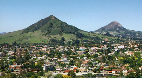 Cerro San Luis ObispoSummitPhoto: Ken Broomfield, CC BY-SA 3.0 (via Wikimedia Commons)~25 min drive
Conditions and forecast
Caution todayAgency alerts are in effect for this areaUSFS · checked 18 min agoDaily highs and lows, wind and the chance of precipitation at the summit and route start for the next 7 days, from the Open-Meteo model.
Questions about Hi Mountain
How tall is Hi Mountain?
3,200 ft (975 m).
How many routes go to the summit of Hi Mountain?
One: Hi Mountain Trail.

Ask about this place
Questions about Hi Mountain: conditions, access, timing. Answers say when something isn't known.
