

Crabtree Falls Campgound
Campground
0.9 mi from the trail
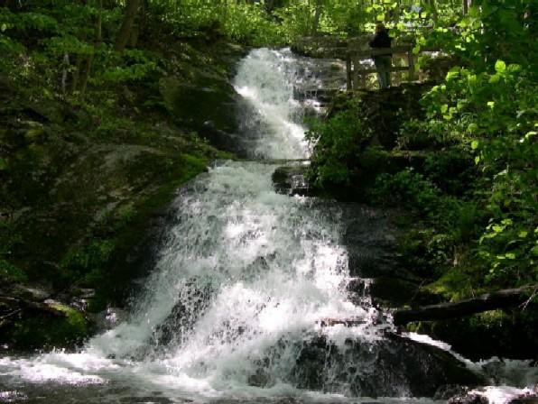 Photo: Public domain (via Wikimedia Commons)
Crabtree Falls is a waterfall in the Glenwood and Pedlar Ranger Districts of the George Washington and Jefferson National Forest in Virginia, about 9 miles from the town of Wintergreen. It sits at roughly 2,700 feet. Late spring and early fall are the most comfortable times to visit. Typical averages from a nearby weather station show May highs around 71°F and September highs around 75°F, with lows near 50°F in both months. Crabtree Meadows, a hike, starts just 0.1 mile away. Pinnacle Ridge and Pirate Crags, two climbing areas, are within a mile. For an overnight stay, Sherando Lake Group Campground is about 6 miles off.
Where it is: Glenwood and Pedlar Ranger Districts · George Washington and Jefferson National Forest
Near: Staunton
Best months: April–October. Best months have typical highs of 55–85 °F, lows of 30 °F or warmer (32 °F where the station doesn't record snow), at most one snowy day and no more than 12 wet days.
Jan
41°
19°
Feb
45°
20°
Mar
52°
25°
Apr
64°
36°
May
71°
46°
Jun
80°
56°
Jul
83°
60°
Aug
81°
58°
Sep
75°
51°
Oct
65°
39°
Nov
53°
29°
Dec
44°
24°
Typical high / low (°F) and days with rain or snow, 1991–2020. Measured at Montebello Fish Cultural Stn, VA, 3.1 mi away at 2,667 ft. This station doesn't record snowfall. Source: NOAA NCEI U.S. Climate Normals 1991–2020.
Been here? Tell people how it was.
 Sherando Lake Group CampgroundCampingPhoto: Idawriter, CC BY-SA 3.0 (via Wikimedia Commons)6.1 mi
 Sherando Lake Recreation Area Family CampingCampingPhoto: Recreation.gov (RIDB) / public domain6.3 mi
Daily highs and lows, wind and the chance of precipitation at Crabtree Falls for the next 7 days, from the Open-Meteo model.
Questions about Crabtree Falls: conditions, access, timing. Answers say when something isn't known.
Crabtree Falls Campgound
Campground
 If it rainsCarol M. Highsmith, Public domain · Wikimedia Commons
Stonewall Jackson House
Museum
Places © OpenStreetMap contributors, Places © Overture Maps Foundation · Photos: Carol M. Highsmith, Public domain (commons)
More in Staunton