Diamond Lake Resort
Hiking business nearby (~34 mi away) — hasn't claimed their Roamze page yet
Oregon
Free — you'll pick up right here.
1.6 mi
Distance
1,875 ft
Gain
35 min
Time
Agency alerts are in effect for this area; weather is good
2 factors · 2 sources
Newest 10 h ago · oldest 10 h
caution: Agency alerts
6 active alerts in Umpqua National Forest; most severe: Fall Prescribed Burning
USFSPosted Sep 29 · checked 10 h ago
clear: Weather
Clouds, high 66°F / low 45°F, 54% precip — 74/100 for hike
OpenWeather10 h ago
Been out here in the last few days? One report keeps this current for everyone.
Why you'll love it
Cougar Creek Trail
Suggested plan · check conditions before you go
Cougar Creek Trail is a 3.1-mile out-and-back hike in Oregon with 1,875 feet of elevation gain and loss. The trail reaches a maximum elevation of 4,181 feet.
It rolls up and down the whole way rather than holding one long climb.
Source: Roamze elevation profile and trail geometry (DEM samples along the mapped route)
Typical monthly averages (not a forecast) from the Lemolo Lake 3 Nnw, OR weather station, 29 mi away. High / low in °F, and days with snow.
Active alerts for Umpqua National Forest as of Oct 9, 2026:
caution · posted Sep 30, 2026
Poole Creek Campground Closed for the 2026 Season
caution · posted Sep 11, 2026
National Forest Service Road 28 Roadwork
caution · posted Aug 26, 2026
14-Day Stay Limit Across Umpqua National Forest
information · posted Aug 24, 2026
Forest-operated Developed Recreation Sites are No Longer Accepting Cash or Check
information · posted Aug 24, 2026
Blue-Green Algae Precaution for Diamond and Lemolo Lakes
caution · posted Aug 24, 2026
Source: USFS forest alerts
Source: Roamze catalog (indexable pages within 10 miles, PostGIS distance)
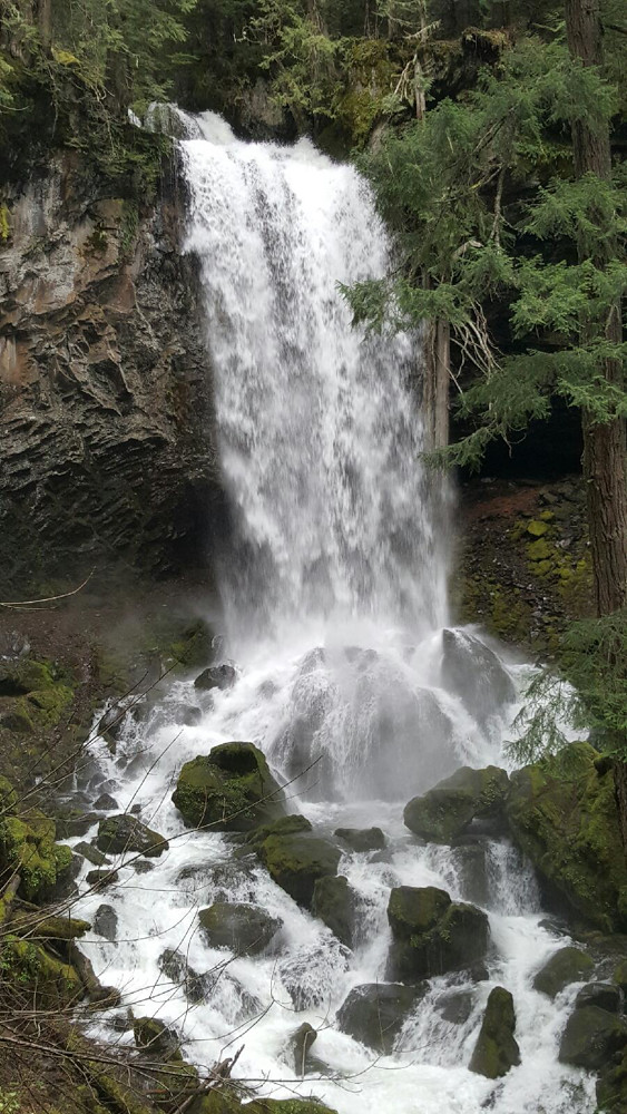 Photo: Forest Service Pacific Northwest Region, Public Domain Mark (via Flickr)
Grotto Falls
~6 min drive
Grotto Falls is a 0.60-mile lollipop trail in Oregon with 414 feet of elevation gain.
 Photo: Forest Service Pacific Northwest Region, Public Domain Mark (via Flickr)
North Umpqua Trail: Jessie Wright
~19 min drive
5.98-mile out-and-back trail in Oregon with 4,566 ft elevation gain
Cougar Creek Trail
~2 min drive
3.26-mile out-and-back hike in Oregon with 2,720 ft elevation gain
Hemlock Creek
~11 min drive
3.10-mile out-and-back trail in Oregon with 1,942 ft elevation gain
 Photo: lamblukas, CC BY 2.0 (via Flickr)
Emerald Trail
~11 min drive
Out-and-back Oregon trail featuring scenic natural landscapes.
 Photo: Bonnie Moreland (free images), Public Domain Mark (via Flickr)
North Umpqua Trail
~20 min drive
Riverside out-and-back trail following the North Umpqua River through Oregon's Cascades.
Mcdonald
~4 min drive
6.60-mile out-and-back trail in Oregon with 675 ft gain and 2,932 ft loss.
Snowbird
~16 min drive
3.46-mile out-and-back trail in Oregon with 1,214 ft elevation gain.
Photo: lamblukas, CC BY 2.0 (via Flickr)Susan Creek Falls Trail
~11 min drive
0.74-mile out-and-back to Susan Creek Falls in Oregon
 Photo: U.S. Forest Service- Pacific Northwest Region, Public domain (via Wikimedia Commons)
North Umpqua Trail: Mott
~4 min drive
9.9-mile out-and-back trail on the North Umpqua Trail with 4,818 ft gain/loss.
Map and trail data © OpenStreetMap contributors
Local operatorsoffering guided trips. You book directly with them — Roamze doesn’t take a cut.
Diamond Lake Resort
Hiking business nearby (~34 mi away) — hasn't claimed their Roamze page yet
Casey's Riverside RV Resort
Hiking business nearby (~35 mi away) — hasn't claimed their Roamze page yet
Shelter Cove Resort & Marina
Hiking business nearby (~42 mi away) — hasn't claimed their Roamze page yet
