Buzzard Peak
At a glance
Buzzard Peak is a summit of 1,377 feet in California's Walnut City Open Space Lands, about 1.4 miles from the town of Walnut. It sits among a cluster of trails, with the Schabarum-Skyline Trail just half a mile away and the Schabarum Grand Spur Trail under a mile off. Spring and fall are the most comfortable times to visit. Typical averages from a nearby weather station in Pomona show April highs around 76°F and October highs near 80°F, while July and August average in the low 90s. Several trails start close by. The Schabarum-Skyline Trail is 0.5 miles away, the Schabarum Grand Spur Trail is 0.8 miles away, and the Valley Loop is 1.3 miles away. Mountain bikers can find the Cobal Canyon Trail about 10 miles off.
- summit
- 1,377 ft
- way up
- 1
- best months
- Oct–Jun
Where it is: Walnut City Open Space Lands
Near: Walnut · 1.4 mi
Best time to visit Buzzard Peak
Best months: October–June. Best months have typical highs of 55–85 °F, lows of 30 °F or warmer (32 °F where the station doesn't record snow), at most one snowy day and no more than 12 wet days.
Jan
68°
43°
5 wet
Feb
67°
45°
6 wet
Mar
72°
47°
4 wet
Apr
76°
50°
2 wet
May
78°
54°
1 wet
Jun
84°
57°
0 wet
Jul
90°
62°
0 wet
Aug
92°
63°
0 wet
Sep
89°
60°
1 wet
Oct
80°
54°
3 wet
Nov
73°
47°
4 wet
Dec
67°
42°
5 wet
Typical high / low (°F) and days with rain or snow, 1991–2020. Measured at Pomona/Fairplex, CA, 5.2 mi away at 999 ft. Source: NOAA NCEI U.S. Climate Normals 1991–2020.
Been here? Tell people how it was.
Map © Mapbox © OpenStreetMap contributors - Johnstone Peak3,198 ft · California1 route7.8 mi away
- Indian Hill1,388 ft · California1 route8.8 mi away
 Workman Hill1,388 ft · California2 routes9.8 mi awayPhoto: Sergei Gussev, CC BY 2.0 (via Wikimedia Commons)
- Gilman Peak1,681 ft · California2 routes10 mi away
- San Juan Hill1,780 ft · California2 routes12 mi away
- Potato Mountain3,427 ft · California1 route12 mi away
- Workman HillSummitPhoto: Sergei Gussev, CC BY 2.0 (via Wikimedia Commons)~17 min drive
 Iron MountainSummitPhoto: Self, CC BY 3.0 (via Wikimedia Commons)~31 min drive
 Mount LoweSummitPhoto: The original uploader was Magi Media at English Wikipedia., CC BY-SA 3.0 (via Wikimedia Commons)~33 min drive
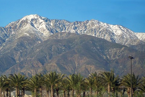 Cucamonga PeakSummitPhoto: Cliff Hutson; later cropping and color editing by Daniel Case., CC BY 2.0 (via Wikimedia Commons)~33 min drive
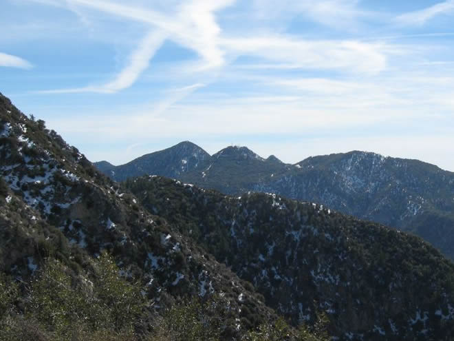 San Gabriel PeakSummitPhoto: Justin.Johnsen, CC BY 3.0 (via Wikimedia Commons)~33 min drive
 Mount DisappointmentSummitPhoto: Justin, CC BY-SA 2.0 (via Wikimedia Commons)~34 min drive
 Mount IslipSummitPhoto: Eeekster, CC BY 3.0 (via Wikimedia Commons)~34 min drive
 Mount WilsonSummitPhoto: The original uploader was Geographer at English Wikipedia., CC BY 1.0 (via Wikimedia Commons)~29 min drive
 Echo MountainSummitPhoto: Mike Manning, CC BY-SA 3.0 (via Wikimedia Commons)~32 min drive
 Timber MountainSummitPhoto: Mitch Barrie (simonov), CC BY-SA 2.0 (via Wikimedia Commons)~34 min drive
Conditions and forecast
Daily highs and lows, wind and the chance of precipitation at the summit and route start for the next 7 days, from the Open-Meteo model.
Questions about Buzzard Peak
How tall is Buzzard Peak?
1,377 ft (420 m).
How many routes go to the summit of Buzzard Peak?
One: Schabarum-Skyline Trail.

Ask about this place
Questions about Buzzard Peak: conditions, access, timing. Answers say when something isn't known.
