
Bread Loaves Group Camp
Campground
< 0.1 mi from the trail
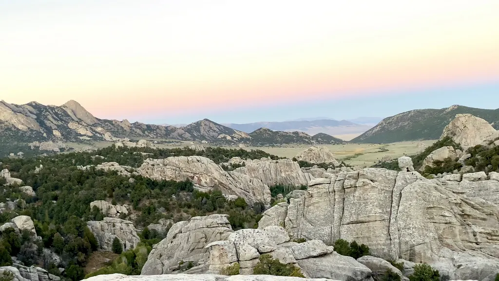
 Photo: cifraser1, CC BY 2.0 (via Flickr)
Breadloaves is a climbing area in Idaho's City of Rocks National Reserve, managed by the National Park Service. It sits among a cluster of other climbing spots, including Upper Breadloaves - West and Upper Breadloaves - East, and the Tea Kettle Trail lies about 0.1 mile away. The area is a traditional climbing destination. Four routes are listed, all rated between 5.6 and 5.7 on the YDS scale. They are Breezeway, Featured Face, Hough's Crack and Intruding Dike, and all are trad routes. Summer is the most comfortable time to visit. Typical averages from a nearby weather station in Rosette, Utah, show July highs around 86°F with lows near 59°F, while winter highs stay in the mid-30s. That station sits about 1,200 feet lower than the reserve, so temperatures at Breadloaves run cooler. Independence Lakes Campground is about 9.5 miles away for anyone planning an overnight stay.
4 routes · 5.6 – 5.7 · Trad
Where it is: City of Rocks National Reserve
Near: Albion
Best months: April–June and August–October. Best months have typical highs of 55–85 °F, lows of 30 °F or warmer (32 °F where the station doesn't record snow), at most one snowy day and no more than 12 wet days.
Jan
35°
16°
8 wet
Feb
39°
19°
7 wet
Mar
48°
27°
6 wet
Apr
55°
33°
7 wet
May
65°
41°
9 wet
Jun
75°
50°
6 wet
Jul
86°
59°
5 wet
Aug
85°
57°
6 wet
Sep
74°
48°
5 wet
Oct
60°
35°
5 wet
Nov
45°
24°
6 wet
Dec
35°
17°
8 wet
Typical high / low (°F) and days with rain or snow, 1991–2020. Measured at Rosette, UT, 24.7 mi away at 5,685 ft. The station sits about 1,200 ft lower than this place, so expect it a little cooler here. This station doesn't record snowfall. Source: NOAA NCEI U.S. Climate Normals 1991–2020.
Been here? Tell people how it was.
 Upper Breadloaves - WestRock climbingPhoto: cifraser1, CC BY 2.0 (via Flickr)0.1 mi
 Lower Decadent - Asian WallRock climbingPhoto: cifraser1, CC BY 2.0 (via Flickr)0.1 mi
 Tea Kettle TrailHikingPhoto: cifraser1, CC BY 2.0 (via Flickr)0.1 mi
 South Fork Circle Creek TrailHikingPhoto: cifraser1, CC BY 2.0 (via Flickr)0.5 mi
 California Trail HistoryHikingPhoto: NPS / public domain0.8 miUpper Breadloaves - WestRock climbingPhoto: cifraser1, CC BY 2.0 (via Flickr)Next doorLower Decadent - Asian WallRock climbingPhoto: cifraser1, CC BY 2.0 (via Flickr)Next doorUpper Broadloaves - NorthRock climbingPhoto: cifraser1, CC BY 2.0 (via Flickr)Next doorLower Breadloaves - Provo WallRock climbingPhoto: cifraser1, CC BY 2.0 (via Flickr)Next doorDecadent WallRock climbingPhoto: cifraser1, CC BY 2.0 (via Flickr)Next doorOwl Rock - WestRock climbingPhoto: cifraser1, CC BY 2.0 (via Flickr)Next doorKing on the Throne - EastRock climbingPhoto: cifraser1, CC BY 2.0 (via Flickr)Next doorKing on the Throne - WestRock climbingPhoto: cifraser1, CC BY 2.0 (via Flickr)Next door
 Window Rock - EastRock climbingPhoto: cifraser1, CC BY 2.0 (via Flickr)Next doorWindow Rock - WestRock climbingPhoto: cifraser1, CC BY 2.0 (via Flickr)Next door
Daily highs and lows, wind and the chance of precipitation at Breadloaves for the next 7 days, from the Open-Meteo model.
Questions about Breadloaves: conditions, access, timing. Answers say when something isn't known.
Bread Loaves Group Camp
Campground
Piggy Sue BBQ
Barbecue restaurant
Oakley Valley Historical Museum
Museum
Places © OpenStreetMap contributors, Places © Overture Maps Foundation
More in Oakley