Wilson Flowage B Hwt
- 2.3 mi
- round trip
- 69 ft
- climb
- 1,583 ft
- high point
- Out and back
- route
- May–Sep
- best months
Is Wilson Flowage B Hwt open right now?
Closure in the area
There's a closure order in Chequamegon-Nicolet National Forest. It doesn't name Wilson Flowage B Hwt, so check the source for the area it covers (2 listed).
Forest Lodge Occupancy and Use Prohibitions
Agency closure covering Chequamegon-Nicolet National Forest · Order 09-13-00-26-02 · USFS · Chequamegon-Nicolet National Forest
Forest Order 09-13-25-02 General Occupancy and Use Restrictions
Agency closure covering Chequamegon-Nicolet National Forest · Order 09-13-25-02 · USFS · Chequamegon-Nicolet National Forest
As of · Source: USFS · Chequamegon-Nicolet National Forest. Agencies don't list every closure — check before you go.
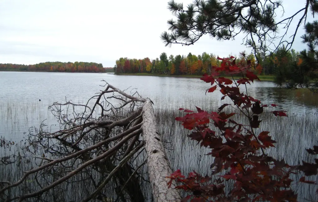
Wilson Flowage B Hwt is a short, easy hike in the Medford-Park Falls Ranger District of Wisconsin's Chequamegon-Nicolet National Forest, managed by the Forest Service. The trail is about 2.3 miles long and rises only about 10 feet, so it's a gentle out-and-back with a high point of 1,583 feet and a low of 1,561 feet. The steepest stretch comes at about 0.4 miles in, with a grade of about 3 percent. The trail is open from May 1 to November 30, and the trip takes about an hour. Summer is the most comfortable time to go. Typical averages from a nearby weather station in Park Falls run to highs around 78°F in July and 74°F in June, with lows in the low 50s. The route is natural-surface and allows horses and bikes. It is not an accessible trail. Several other Wilson Flowage trails sit close by, including Wilson Flowage A Hwt and Wilson Flowage C Hwt, and the Elk River offers canoeing about 4 miles away.
- Wilson Flowage a HwtHiking0.4 mi
- Wilson Flowage HwtHiking0.4 mi
- Wilson Flowage C HwtHiking0.8 mi
- Wilson Flowage F HwtHiking2.1 mi
- Elk RiverCanoeing4.2 mi
- Sailor LakeCamping4.9 mi
 Sailor Lake PavilionCampingPhoto: Recreation.gov (RIDB) / public domain5 mi
- Smith Rapids PavilionCamping8.4 mi
Source: Roamze catalog (indexable pages within 10 miles, PostGIS distance)
 Round Lake Loop CHiking · ~21 min drivePhoto: usfs_Eastern_Region, Public domain (via Wikimedia Commons)
- Wilson Flowage HwtHiking · Next door
- River SaddleHiking · ~14 min drive
- Wilson Flowage Aa HwtHiking · Next door
- Nichols Lake HwtHiking · ~10 min drive
- Wintergreen Loop BHiking · ~15 min drive
- Wilson Flowage a HwtHiking · Next door
- Upper Sq___ Creek HwtHiking · ~12 min drive
- Wilson Flowage C HwtHiking · ~1 min drive
- Riley Creek HwtHiking · ~13 min drive
Best time to visit Wilson Flowage B Hwt
Best months: May–September. Best months have typical highs of 55–85 °F, lows of 30 °F or warmer (32 °F where the station doesn't record snow), at most one snowy day and no more than 12 wet days.
Jan
20° / 2°
Feb
25° / 4°
Mar
37° / 16°
Apr
51° / 29°
May
65° / 43°
Jun
74° / 52°
Jul
78° / 56°
Aug
76° / 55°
Sep
67° / 46°
Oct
53° / 34°
Nov
38° / 22°
Dec
25° / 10°
Typical high / low (°F) and days with rain or snow, 1991–2020. Measured at Park Falls Dnr Hq, WI, 15.4 mi away at 1,525 ft. This station doesn't record snowfall. Source: NOAA NCEI U.S. Climate Normals 1991–2020.
